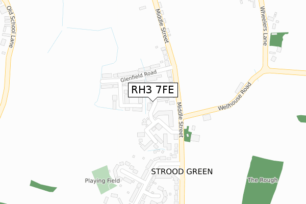
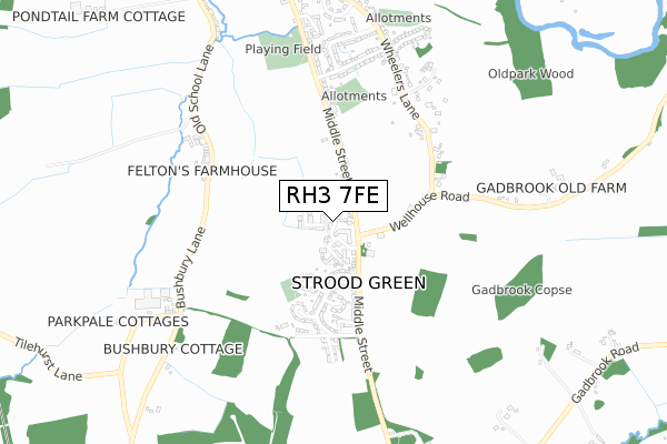
RH3 7FE is located in the Brockham, Betchworth, Buckland, Box Hill & Headley electoral ward, within the local authority district of Mole Valley and the English Parliamentary constituency of Mole Valley. The Sub Integrated Care Board (ICB) Location is NHS Surrey Heartlands ICB - 92A and the police force is Surrey. This postcode has been in use since June 2019.


GetTheData
Source: OS Open Zoomstack (Ordnance Survey)
Licence: Open Government Licence (requires attribution)
Attribution: Contains OS data © Crown copyright and database right 2025
Source: Open Postcode Geo
Licence: Open Government Licence (requires attribution)
Attribution: Contains OS data © Crown copyright and database right 2025; Contains Royal Mail data © Royal Mail copyright and database right 2025; Source: Office for National Statistics licensed under the Open Government Licence v.3.0
| Easting | 519990 |
| Northing | 148430 |
| Latitude | 51.222461 |
| Longitude | -0.283124 |
GetTheData
Source: Open Postcode Geo
Licence: Open Government Licence
| Country | England |
| Postcode District | RH3 |
➜ See where RH3 is on a map | |
GetTheData
Source: Land Registry Price Paid Data
Licence: Open Government Licence
| Ward | Brockham, Betchworth, Buckland, Box Hill & Headley |
| Constituency | Mole Valley |
GetTheData
Source: ONS Postcode Database
Licence: Open Government Licence
| Glenfield Road (Middle Street) | Strood Green | 119m |
| Glenfield Road (Middle Street) | Strood Green | 146m |
| Tynedale Road (Middle Street) | Strood Green | 207m |
| Tynedale Road (Middle Street) | Strood Green | 269m |
| Oakdene Road (Middle Street) | Brockham | 449m |
| Betchworth Station | 3.1km |
| Dorking Deepdene Station | 3.4km |
| Dorking Station | 3.5km |
GetTheData
Source: NaPTAN
Licence: Open Government Licence
GetTheData
Source: ONS Postcode Database
Licence: Open Government Licence


➜ Get more ratings from the Food Standards Agency
GetTheData
Source: Food Standards Agency
Licence: FSA terms & conditions
| Last Collection | |||
|---|---|---|---|
| Location | Mon-Fri | Sat | Distance |
| Strood Green Post Office | 16:15 | 09:15 | 246m |
| Wheelers Lane | 16:15 | 07:45 | 681m |
| Brockham Green | 16:30 | 09:00 | 1,055m |
GetTheData
Source: Dracos
Licence: Creative Commons Attribution-ShareAlike
The below table lists the International Territorial Level (ITL) codes (formerly Nomenclature of Territorial Units for Statistics (NUTS) codes) and Local Administrative Units (LAU) codes for RH3 7FE:
| ITL 1 Code | Name |
|---|---|
| TLJ | South East (England) |
| ITL 2 Code | Name |
| TLJ2 | Surrey, East and West Sussex |
| ITL 3 Code | Name |
| TLJ26 | East Surrey |
| LAU 1 Code | Name |
| E07000210 | Mole Valley |
GetTheData
Source: ONS Postcode Directory
Licence: Open Government Licence
The below table lists the Census Output Area (OA), Lower Layer Super Output Area (LSOA), and Middle Layer Super Output Area (MSOA) for RH3 7FE:
| Code | Name | |
|---|---|---|
| OA | E00155690 | |
| LSOA | E01030526 | Mole Valley 008C |
| MSOA | E02006369 | Mole Valley 008 |
GetTheData
Source: ONS Postcode Directory
Licence: Open Government Licence
| RH3 7NL | Brew House Road | 0m |
| RH3 7LN | Silverdale Close | 38m |
| RH3 7HS | Glenfield Close | 87m |
| RH3 7HR | Glenfield Road | 88m |
| RH3 7HW | Middle Street | 111m |
| RH3 7HP | Glenfield Road | 115m |
| RH3 7NH | Tanners Court | 134m |
| RH3 7NJ | Tanners Meadow | 157m |
| RH3 7HU | Middle Street | 174m |
| RH3 7HY | Boxhill Way | 229m |
GetTheData
Source: Open Postcode Geo; Land Registry Price Paid Data
Licence: Open Government Licence