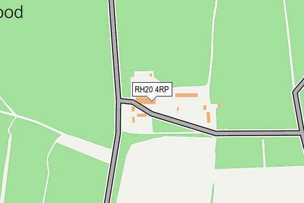
RH20 4RP is located in the Pulborough, Coldwaltham & Amberley electoral ward, within the local authority district of Horsham and the English Parliamentary constituency of Arundel and South Downs. The Sub Integrated Care Board (ICB) Location is NHS Sussex ICB - 70F and the police force is Sussex. This postcode has been in use since July 2017.


GetTheData
Source: OS OpenMap – Local (Ordnance Survey)
Source: OS VectorMap District (Ordnance Survey)
Licence: Open Government Licence (requires attribution)
| Easting | 506228 |
| Northing | 115211 |
| Latitude | 50.926576 |
| Longitude | -0.489866 |
GetTheData
Source: Open Postcode Geo
Licence: Open Government Licence
| Country | England |
| Postcode District | RH20 |
➜ See where RH20 is on a map | |
GetTheData
Source: Land Registry Price Paid Data
Licence: Open Government Licence
| Ward | Pulborough, Coldwaltham & Amberley |
| Constituency | Arundel And South Downs |
GetTheData
Source: ONS Postcode Database
Licence: Open Government Licence
| Pulborough Road | Cootham | 549m |
| Pulborough Road | Cootham | 560m |
| Bog Common (Pulborough Road) | Wiggonholt | 607m |
| Bog Common (Pulborough Road) | Wiggonholt | 614m |
| Pulborough Road | Wiggonholt | 956m |
| Pulborough Station | 3.9km |
| Amberley Station | 4.9km |
GetTheData
Source: NaPTAN
Licence: Open Government Licence
GetTheData
Source: ONS Postcode Database
Licence: Open Government Licence


➜ Get more ratings from the Food Standards Agency
GetTheData
Source: Food Standards Agency
Licence: FSA terms & conditions
| Last Collection | |||
|---|---|---|---|
| Location | Mon-Fri | Sat | Distance |
| Crossgates | 16:00 | 09:45 | 2,699m |
| Old Mill Drive | 17:00 | 09:30 | 2,815m |
| Ravenscroft | 16:00 | 10:00 | 3,010m |
GetTheData
Source: Dracos
Licence: Creative Commons Attribution-ShareAlike
The below table lists the International Territorial Level (ITL) codes (formerly Nomenclature of Territorial Units for Statistics (NUTS) codes) and Local Administrative Units (LAU) codes for RH20 4RP:
| ITL 1 Code | Name |
|---|---|
| TLJ | South East (England) |
| ITL 2 Code | Name |
| TLJ2 | Surrey, East and West Sussex |
| ITL 3 Code | Name |
| TLJ28 | West Sussex (North East) |
| LAU 1 Code | Name |
| E07000227 | Horsham |
GetTheData
Source: ONS Postcode Directory
Licence: Open Government Licence
The below table lists the Census Output Area (OA), Lower Layer Super Output Area (LSOA), and Middle Layer Super Output Area (MSOA) for RH20 4RP:
| Code | Name | |
|---|---|---|
| OA | E00161283 | |
| LSOA | E01031626 | Horsham 013A |
| MSOA | E02006600 | Horsham 013 |
GetTheData
Source: ONS Postcode Directory
Licence: Open Government Licence
| RH20 2ER | Bog Common | 887m |
| RH20 4HP | Pulborough Road | 1056m |
| RH20 2EP | Wiggonholt | 1119m |
| RH20 4JR | Dukes Row | 1325m |
| RH20 4JX | Chapel Lane | 1352m |
| RH20 4HL | Clay Lane | 1354m |
| RH20 4JT | Pulborough Road | 1360m |
| RH20 4JN | Pulborough Road | 1386m |
| RH20 4JU | The Crescent | 1447m |
| RH20 2EW | Hurston Lane | 1456m |
GetTheData
Source: Open Postcode Geo; Land Registry Price Paid Data
Licence: Open Government Licence