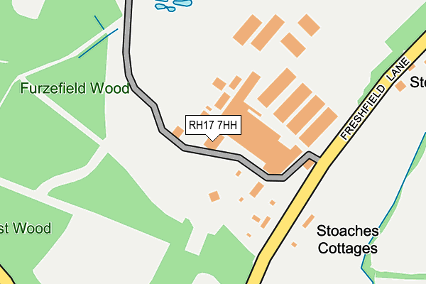
RH17 7HH is located in the Lindfield Rural & High Weald electoral ward, within the local authority district of Mid Sussex and the English Parliamentary constituency of Mid Sussex. The Sub Integrated Care Board (ICB) Location is NHS Sussex ICB - 70F and the police force is Sussex. This postcode has been in use since January 1980.


GetTheData
Source: OS OpenMap – Local (Ordnance Survey)
Source: OS VectorMap District (Ordnance Survey)
Licence: Open Government Licence (requires attribution)
| Easting | 538428 |
| Northing | 126179 |
| Latitude | 51.018332 |
| Longitude | -0.027811 |
GetTheData
Source: Open Postcode Geo
Licence: Open Government Licence
| Country | England |
| Postcode District | RH17 |
➜ See where RH17 is on a map | |
GetTheData
Source: Land Registry Price Paid Data
Licence: Open Government Licence
Elevation or altitude of RH17 7HH as distance above sea level:
| Metres | Feet | |
|---|---|---|
| Elevation | 60m | 197ft |
Elevation is measured from the approximate centre of the postcode, to the nearest point on an OS contour line from OS Terrain 50, which has contour spacing of ten vertical metres.
➜ How high above sea level am I? Find the elevation of your current position using your device's GPS.
GetTheData
Source: Open Postcode Elevation
Licence: Open Government Licence
| Ward | Lindfield Rural & High Weald |
| Constituency | Mid Sussex |
GetTheData
Source: ONS Postcode Database
Licence: Open Government Licence
GetTheData
Source: ONS Postcode Database
Licence: Open Government Licence


➜ Get more ratings from the Food Standards Agency
GetTheData
Source: Food Standards Agency
Licence: FSA terms & conditions
| Last Collection | |||
|---|---|---|---|
| Location | Mon-Fri | Sat | Distance |
| Freshfields Crossways | 16:45 | 09:15 | 623m |
| Hamsland | 16:45 | 07:15 | 1,726m |
| Horsted Keynes P O | 16:45 | 09:45 | 2,024m |
GetTheData
Source: Dracos
Licence: Creative Commons Attribution-ShareAlike
The below table lists the International Territorial Level (ITL) codes (formerly Nomenclature of Territorial Units for Statistics (NUTS) codes) and Local Administrative Units (LAU) codes for RH17 7HH:
| ITL 1 Code | Name |
|---|---|
| TLJ | South East (England) |
| ITL 2 Code | Name |
| TLJ2 | Surrey, East and West Sussex |
| ITL 3 Code | Name |
| TLJ28 | West Sussex (North East) |
| LAU 1 Code | Name |
| E07000228 | Mid Sussex |
GetTheData
Source: ONS Postcode Directory
Licence: Open Government Licence
The below table lists the Census Output Area (OA), Lower Layer Super Output Area (LSOA), and Middle Layer Super Output Area (MSOA) for RH17 7HH:
| Code | Name | |
|---|---|---|
| OA | E00161971 | |
| LSOA | E01031765 | Mid Sussex 006C |
| MSOA | E02006609 | Mid Sussex 006 |
GetTheData
Source: ONS Postcode Directory
Licence: Open Government Licence
| RH17 7HQ | Freshfield Lane | 496m |
| RH17 7NS | Monteswood Lane | 657m |
| RH17 7EA | Treemans Road | 1079m |
| RH16 2QP | Monteswood Lane | 1123m |
| TN22 3RX | Ketches Lane | 1270m |
| RH17 7NP | Sloop Lane | 1410m |
| RH17 7HG | Freshfield Lane | 1449m |
| RH17 7DY | Lewes Road | 1573m |
| RH16 2QR | Plummerden Lane | 1650m |
| RH17 7DX | Hamsland | 1681m |
GetTheData
Source: Open Postcode Geo; Land Registry Price Paid Data
Licence: Open Government Licence