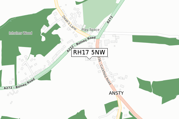
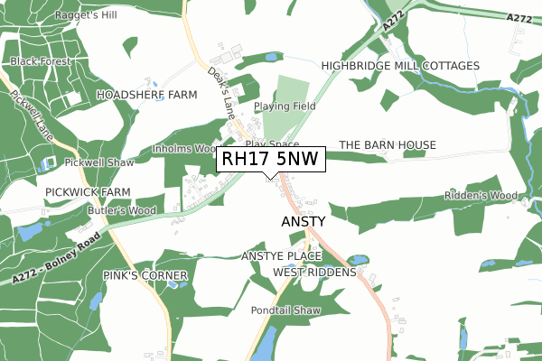
RH17 5NW is located in the Cuckfield, Bolney & Ansty electoral ward, within the local authority district of Mid Sussex and the English Parliamentary constituency of Mid Sussex. The Sub Integrated Care Board (ICB) Location is NHS Sussex ICB - 70F and the police force is Sussex. This postcode has been in use since June 2018.


GetTheData
Source: OS Open Zoomstack (Ordnance Survey)
Licence: Open Government Licence (requires attribution)
Attribution: Contains OS data © Crown copyright and database right 2025
Source: Open Postcode Geo
Licence: Open Government Licence (requires attribution)
Attribution: Contains OS data © Crown copyright and database right 2025; Contains Royal Mail data © Royal Mail copyright and database right 2025; Source: Office for National Statistics licensed under the Open Government Licence v.3.0
| Easting | 529085 |
| Northing | 123165 |
| Latitude | 50.993411 |
| Longitude | -0.161981 |
GetTheData
Source: Open Postcode Geo
Licence: Open Government Licence
| Country | England |
| Postcode District | RH17 |
➜ See where RH17 is on a map ➜ Where is Ansty? | |
GetTheData
Source: Land Registry Price Paid Data
Licence: Open Government Licence
| Ward | Cuckfield, Bolney & Ansty |
| Constituency | Mid Sussex |
GetTheData
Source: ONS Postcode Database
Licence: Open Government Licence
2019 23 AUG £691,000 |
4, CROUCH FIELDS, ANSTY, HAYWARDS HEATH, RH17 5NW 2019 2 MAY £707,500 |
2, CROUCH FIELDS, ANSTY, HAYWARDS HEATH, RH17 5NW 2019 15 MAR £605,000 |
7, CROUCH FIELDS, ANSTY, HAYWARDS HEATH, RH17 5NW 2018 17 DEC £698,000 |
5, CROUCH FIELDS, ANSTY, HAYWARDS HEATH, RH17 5NW 2018 2 NOV £725,000 |
8, CROUCH FIELDS, ANSTY, HAYWARDS HEATH, RH17 5NW 2018 27 JUL £725,000 |
6, CROUCH FIELDS, ANSTY, HAYWARDS HEATH, RH17 5NW 2018 15 JUN £897,500 |
GetTheData
Source: HM Land Registry Price Paid Data
Licence: Contains HM Land Registry data © Crown copyright and database right 2025. This data is licensed under the Open Government Licence v3.0.
| Ansty Cross (Bolney Road) | Ansty | 100m |
| Ansty Cross (Bolney Road) | Ansty | 135m |
| Highbridge Mill Cottage (Cuckfield Road. A272) | Ansty | 523m |
| Highbridge Mill Cottage (A272) | Ansty | 528m |
| Butlers Wood (A272) | Ansty | 759m |
| Haywards Heath Station | 4.2km |
| Wivelsfield Station | 4.3km |
| Burgess Hill Station | 5km |
GetTheData
Source: NaPTAN
Licence: Open Government Licence
| Percentage of properties with Next Generation Access | 57.1% |
| Percentage of properties with Superfast Broadband | 57.1% |
| Percentage of properties with Ultrafast Broadband | 0.0% |
| Percentage of properties with Full Fibre Broadband | 0.0% |
Superfast Broadband is between 30Mbps and 300Mbps
Ultrafast Broadband is > 300Mbps
| Median download speed | 72.5Mbps |
| Average download speed | 64.3Mbps |
| Maximum download speed | 80.00Mbps |
| Median upload speed | 19.1Mbps |
| Average upload speed | 15.8Mbps |
| Maximum upload speed | 20.00Mbps |
| Percentage of properties unable to receive 2Mbps | 0.0% |
| Percentage of properties unable to receive 5Mbps | 0.0% |
| Percentage of properties unable to receive 10Mbps | 0.0% |
| Percentage of properties unable to receive 30Mbps | 0.0% |
GetTheData
Source: Ofcom
Licence: Ofcom Terms of Use (requires attribution)
GetTheData
Source: ONS Postcode Database
Licence: Open Government Licence


➜ Get more ratings from the Food Standards Agency
GetTheData
Source: Food Standards Agency
Licence: FSA terms & conditions
| Last Collection | |||
|---|---|---|---|
| Location | Mon-Fri | Sat | Distance |
| Cuckfield P O | 17:00 | 12:15 | 1,945m |
| Buncton Lane Bolney | 16:15 | 09:00 | 2,174m |
| Whitemans Green P O | 17:00 | 12:15 | 2,705m |
GetTheData
Source: Dracos
Licence: Creative Commons Attribution-ShareAlike
The below table lists the International Territorial Level (ITL) codes (formerly Nomenclature of Territorial Units for Statistics (NUTS) codes) and Local Administrative Units (LAU) codes for RH17 5NW:
| ITL 1 Code | Name |
|---|---|
| TLJ | South East (England) |
| ITL 2 Code | Name |
| TLJ2 | Surrey, East and West Sussex |
| ITL 3 Code | Name |
| TLJ28 | West Sussex (North East) |
| LAU 1 Code | Name |
| E07000228 | Mid Sussex |
GetTheData
Source: ONS Postcode Directory
Licence: Open Government Licence
The below table lists the Census Output Area (OA), Lower Layer Super Output Area (LSOA), and Middle Layer Super Output Area (MSOA) for RH17 5NW:
| Code | Name | |
|---|---|---|
| OA | E00161782 | |
| LSOA | E01031728 | Mid Sussex 011B |
| MSOA | E02006614 | Mid Sussex 011 |
GetTheData
Source: ONS Postcode Directory
Licence: Open Government Licence
| RH17 5AG | Cuckfield Road | 76m |
| RH17 5AN | Bolney Road | 92m |
| RH17 5AF | Cuckfield Road | 204m |
| RH17 5AW | Bolney Road | 268m |
| RH17 5AS | Deaks Lane | 309m |
| RH17 5AE | Cuckfield Road | 797m |
| RH17 5AP | Pickwell Lane | 809m |
| RH17 5AJ | Cuckfield Road | 869m |
| RH17 5AH | Burgess Hill Road | 919m |
| RH17 5AR | Bishopstone Lane | 1383m |
GetTheData
Source: Open Postcode Geo; Land Registry Price Paid Data
Licence: Open Government Licence