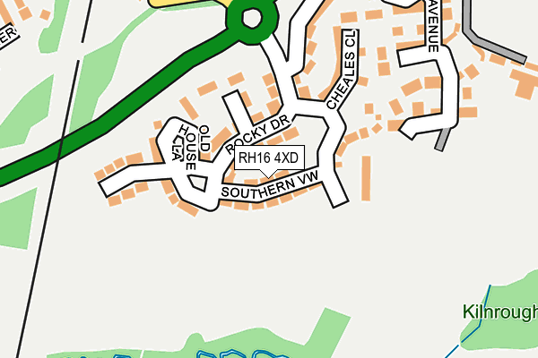
RH16 4XD is located in the Haywards Heath Ashenground electoral ward, within the local authority district of Mid Sussex and the English Parliamentary constituency of Mid Sussex. The Sub Integrated Care Board (ICB) Location is NHS Sussex ICB - 70F and the police force is Sussex. This postcode has been in use since February 2017.


GetTheData
Source: OS OpenMap – Local (Ordnance Survey)
Source: OS VectorMap District (Ordnance Survey)
Licence: Open Government Licence (requires attribution)
| Easting | 532787 |
| Northing | 122236 |
| Latitude | 50.984219 |
| Longitude | -0.109601 |
GetTheData
Source: Open Postcode Geo
Licence: Open Government Licence
| Country | England |
| Postcode District | RH16 |
➜ See where RH16 is on a map ➜ Where is Haywards Heath? | |
GetTheData
Source: Land Registry Price Paid Data
Licence: Open Government Licence
| Ward | Haywards Heath Ashenground |
| Constituency | Mid Sussex |
GetTheData
Source: ONS Postcode Database
Licence: Open Government Licence
2020 18 DEC £750,000 |
2019 24 JUL £715,000 |
12, SOUTHERN VIEW, HAYWARDS HEATH, RH16 4XD 2018 23 MAR £799,950 |
2, SOUTHERN VIEW, HAYWARDS HEATH, RH16 4XD 2018 23 MAR £799,950 |
2018 17 JAN £699,950 |
4, SOUTHERN VIEW, HAYWARDS HEATH, RH16 4XD 2017 8 DEC £825,000 |
2017 27 OCT £722,000 |
14, SOUTHERN VIEW, HAYWARDS HEATH, RH16 4XD 2017 13 OCT £849,950 |
10, SOUTHERN VIEW, HAYWARDS HEATH, RH16 4XD 2017 29 JUN £779,950 |
8, SOUTHERN VIEW, HAYWARDS HEATH, RH16 4XD 2017 20 JUN £779,950 |
GetTheData
Source: HM Land Registry Price Paid Data
Licence: Contains HM Land Registry data © Crown copyright and database right 2025. This data is licensed under the Open Government Licence v3.0.
| Vale Road (Bolding Way) | Haywards Heath | 433m |
| Pinewood Way (Vale Road) | Haywards Heath | 447m |
| Eleven Acre Shaws (Rocky Lane) | Haywards Heath | 481m |
| Eleven Acre Shaws (Rocky Lane) | Haywards Heath | 484m |
| Rumbolds Lane (Sheppeys) | Haywards Heath | 501m |
| Wivelsfield Station | 2.4km |
| Haywards Heath Station | 2.4km |
| Burgess Hill Station | 3.6km |
GetTheData
Source: NaPTAN
Licence: Open Government Licence
| Percentage of properties with Next Generation Access | 100.0% |
| Percentage of properties with Superfast Broadband | 100.0% |
| Percentage of properties with Ultrafast Broadband | 100.0% |
| Percentage of properties with Full Fibre Broadband | 100.0% |
Superfast Broadband is between 30Mbps and 300Mbps
Ultrafast Broadband is > 300Mbps
| Percentage of properties unable to receive 2Mbps | 0.0% |
| Percentage of properties unable to receive 5Mbps | 0.0% |
| Percentage of properties unable to receive 10Mbps | 0.0% |
| Percentage of properties unable to receive 30Mbps | 0.0% |
GetTheData
Source: Ofcom
Licence: Ofcom Terms of Use (requires attribution)
GetTheData
Source: ONS Postcode Database
Licence: Open Government Licence


➜ Get more ratings from the Food Standards Agency
GetTheData
Source: Food Standards Agency
Licence: FSA terms & conditions
| Last Collection | |||
|---|---|---|---|
| Location | Mon-Fri | Sat | Distance |
| Wivelsfield Road | 17:00 | 11:30 | 980m |
| Valebridge Road | 17:15 | 11:15 | 1,032m |
| Priory Way | 17:15 | 12:00 | 1,104m |
GetTheData
Source: Dracos
Licence: Creative Commons Attribution-ShareAlike
The below table lists the International Territorial Level (ITL) codes (formerly Nomenclature of Territorial Units for Statistics (NUTS) codes) and Local Administrative Units (LAU) codes for RH16 4XD:
| ITL 1 Code | Name |
|---|---|
| TLJ | South East (England) |
| ITL 2 Code | Name |
| TLJ2 | Surrey, East and West Sussex |
| ITL 3 Code | Name |
| TLJ28 | West Sussex (North East) |
| LAU 1 Code | Name |
| E07000228 | Mid Sussex |
GetTheData
Source: ONS Postcode Directory
Licence: Open Government Licence
The below table lists the Census Output Area (OA), Lower Layer Super Output Area (LSOA), and Middle Layer Super Output Area (MSOA) for RH16 4XD:
| Code | Name | |
|---|---|---|
| OA | E00161783 | |
| LSOA | E01031728 | Mid Sussex 011B |
| MSOA | E02006614 | Mid Sussex 011 |
GetTheData
Source: ONS Postcode Directory
Licence: Open Government Licence
| RH16 4WQ | Rocky Drive | 95m |
| RH16 4XF | Old House Lane | 156m |
| RH16 4WR | The Coppice | 201m |
| RH16 4UQ | Cedar Avenue | 239m |
| RH16 4RW | Rocky Lane | 292m |
| RH16 4SD | Kilnbarn Way | 298m |
| RH16 4JU | Pinewood Way | 339m |
| RH16 4SF | Old Barn Court | 367m |
| RH16 4TX | Kingfisher Drive | 373m |
| RH16 4JZ | Pinewood Way | 385m |
GetTheData
Source: Open Postcode Geo; Land Registry Price Paid Data
Licence: Open Government Licence