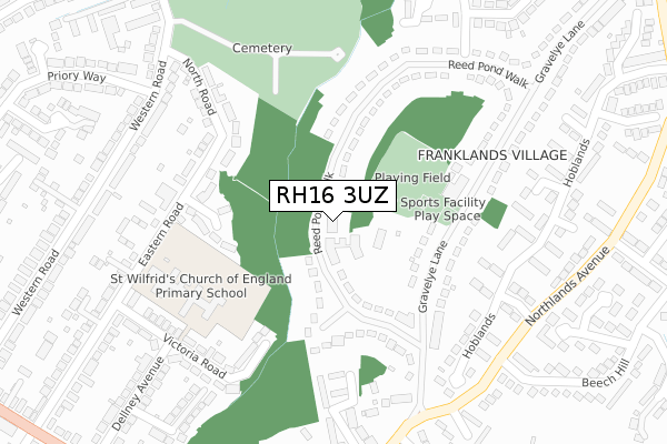
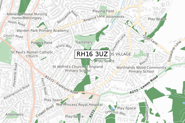
RH16 3UZ is located in the Haywards Heath Franklands electoral ward, within the local authority district of Mid Sussex and the English Parliamentary constituency of Mid Sussex. The Sub Integrated Care Board (ICB) Location is NHS Sussex ICB - 70F and the police force is Sussex. This postcode has been in use since April 2020.


GetTheData
Source: OS Open Zoomstack (Ordnance Survey)
Licence: Open Government Licence (requires attribution)
Attribution: Contains OS data © Crown copyright and database right 2025
Source: Open Postcode Geo
Licence: Open Government Licence (requires attribution)
Attribution: Contains OS data © Crown copyright and database right 2025; Contains Royal Mail data © Royal Mail copyright and database right 2025; Source: Office for National Statistics licensed under the Open Government Licence v.3.0
| Easting | 534220 |
| Northing | 123577 |
| Latitude | 50.995939 |
| Longitude | -0.088703 |
GetTheData
Source: Open Postcode Geo
Licence: Open Government Licence
| Country | England |
| Postcode District | RH16 |
➜ See where RH16 is on a map ➜ Where is Haywards Heath? | |
GetTheData
Source: Land Registry Price Paid Data
Licence: Open Government Licence
| Ward | Haywards Heath Franklands |
| Constituency | Mid Sussex |
GetTheData
Source: ONS Postcode Database
Licence: Open Government Licence
| Church Of The Good Shepherd (Gravelye Lane) | Haywards Heath | 231m |
| Eastern Road | Haywards Heath | 244m |
| Eastern Road | Haywards Heath | 259m |
| Silver Birches (Reed Pond Walk) | Haywards Heath | 322m |
| Hoblands (Northlands Avenue) | Haywards Heath | 322m |
| Haywards Heath Station | 1.6km |
| Wivelsfield Station | 4.2km |
| Burgess Hill Station | 5.4km |
GetTheData
Source: NaPTAN
Licence: Open Government Licence
GetTheData
Source: ONS Postcode Database
Licence: Open Government Licence


➜ Get more ratings from the Food Standards Agency
GetTheData
Source: Food Standards Agency
Licence: FSA terms & conditions
| Last Collection | |||
|---|---|---|---|
| Location | Mon-Fri | Sat | Distance |
| Franklands P O | 17:15 | 11:15 | 195m |
| Gravelye Hall | 17:15 | 11:15 | 361m |
| Northlands Avenue | 17:15 | 11:15 | 422m |
GetTheData
Source: Dracos
Licence: Creative Commons Attribution-ShareAlike
The below table lists the International Territorial Level (ITL) codes (formerly Nomenclature of Territorial Units for Statistics (NUTS) codes) and Local Administrative Units (LAU) codes for RH16 3UZ:
| ITL 1 Code | Name |
|---|---|
| TLJ | South East (England) |
| ITL 2 Code | Name |
| TLJ2 | Surrey, East and West Sussex |
| ITL 3 Code | Name |
| TLJ28 | West Sussex (North East) |
| LAU 1 Code | Name |
| E07000228 | Mid Sussex |
GetTheData
Source: ONS Postcode Directory
Licence: Open Government Licence
The below table lists the Census Output Area (OA), Lower Layer Super Output Area (LSOA), and Middle Layer Super Output Area (MSOA) for RH16 3UZ:
| Code | Name | |
|---|---|---|
| OA | E00161927 | |
| LSOA | E01031756 | Mid Sussex 011E |
| MSOA | E02006614 | Mid Sussex 011 |
GetTheData
Source: ONS Postcode Directory
Licence: Open Government Licence
| RH16 3RA | Franklands Village | 133m |
| RH16 3NW | Albert Close | 169m |
| RH16 3QZ | Franklands Village | 170m |
| RH16 3RR | Franklands Village | 188m |
| RH16 3NJ | North Road | 224m |
| RH16 3NL | Eastern Road | 228m |
| RH16 3NH | North Road | 253m |
| RH16 3EP | Woodridge Close | 256m |
| RH16 3SB | Hoblands | 261m |
| RH16 3LZ | Victoria Road | 274m |
GetTheData
Source: Open Postcode Geo; Land Registry Price Paid Data
Licence: Open Government Licence