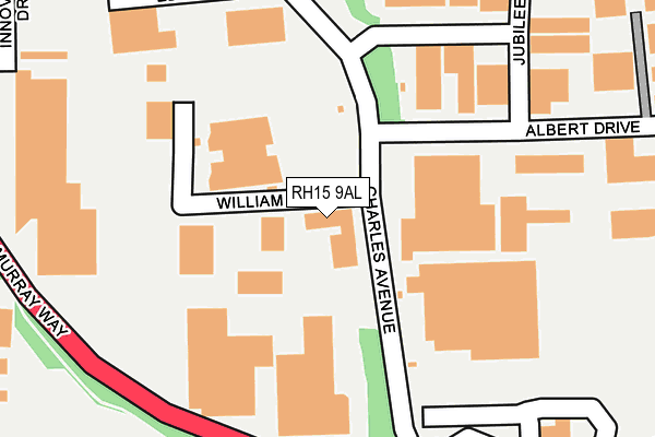
RH15 9AL is located in the Burgess Hill Victoria electoral ward, within the local authority district of Mid Sussex and the English Parliamentary constituency of Mid Sussex. The Sub Integrated Care Board (ICB) Location is NHS Sussex ICB - 70F and the police force is Sussex. This postcode has been in use since October 2010.


GetTheData
Source: OS OpenMap – Local (Ordnance Survey)
Source: OS VectorMap District (Ordnance Survey)
Licence: Open Government Licence (requires attribution)
| Easting | 529975 |
| Northing | 118509 |
| Latitude | 50.951368 |
| Longitude | -0.150996 |
GetTheData
Source: Open Postcode Geo
Licence: Open Government Licence
| Country | England |
| Postcode District | RH15 |
➜ See where RH15 is on a map ➜ Where is Burgess Hill? | |
GetTheData
Source: Land Registry Price Paid Data
Licence: Open Government Licence
Elevation or altitude of RH15 9AL as distance above sea level:
| Metres | Feet | |
|---|---|---|
| Elevation | 30m | 98ft |
Elevation is measured from the approximate centre of the postcode, to the nearest point on an OS contour line from OS Terrain 50, which has contour spacing of ten vertical metres.
➜ How high above sea level am I? Find the elevation of your current position using your device's GPS.
GetTheData
Source: Open Postcode Elevation
Licence: Open Government Licence
| Ward | Burgess Hill Victoria |
| Constituency | Mid Sussex |
GetTheData
Source: ONS Postcode Database
Licence: Open Government Licence
| The Acorn (Charles Avenue) | Burgess Hill | 28m |
| The Acorn (Charles Avenue) | Burgess Hill | 77m |
| Jubilee Road (Albert Drive) | Burgess Hill | 117m |
| Jubilee Road (Albert Drive) | Burgess Hill | 152m |
| Edward Way (Charles Avenue) | Burgess Hill | 197m |
| Burgess Hill Station | 1.7km |
| Wivelsfield Station | 2.6km |
| Hassocks Station | 3km |
GetTheData
Source: NaPTAN
Licence: Open Government Licence
GetTheData
Source: ONS Postcode Database
Licence: Open Government Licence


➜ Get more ratings from the Food Standards Agency
GetTheData
Source: Food Standards Agency
Licence: FSA terms & conditions
| Last Collection | |||
|---|---|---|---|
| Location | Mon-Fri | Sat | Distance |
| Tesco Superstore | 18:15 | 11:30 | 195m |
| Burgess Hill Delivery Office | 18:30 | 12:00 | 397m |
| Victoria Way | 18:30 | 757m | |
GetTheData
Source: Dracos
Licence: Creative Commons Attribution-ShareAlike
The below table lists the International Territorial Level (ITL) codes (formerly Nomenclature of Territorial Units for Statistics (NUTS) codes) and Local Administrative Units (LAU) codes for RH15 9AL:
| ITL 1 Code | Name |
|---|---|
| TLJ | South East (England) |
| ITL 2 Code | Name |
| TLJ2 | Surrey, East and West Sussex |
| ITL 3 Code | Name |
| TLJ28 | West Sussex (North East) |
| LAU 1 Code | Name |
| E07000228 | Mid Sussex |
GetTheData
Source: ONS Postcode Directory
Licence: Open Government Licence
The below table lists the Census Output Area (OA), Lower Layer Super Output Area (LSOA), and Middle Layer Super Output Area (MSOA) for RH15 9AL:
| Code | Name | |
|---|---|---|
| OA | E00161728 | |
| LSOA | E01031715 | Mid Sussex 015D |
| MSOA | E02006618 | Mid Sussex 015 |
GetTheData
Source: ONS Postcode Directory
Licence: Open Government Licence
| RH15 9RY | Charles Avenue | 99m |
| RH15 9AG | William Way | 125m |
| RH15 9TN | Albert Drive | 273m |
| RH15 9TY | Sovereign Business Park | 306m |
| RH15 9QX | Michelbourne Close | 335m |
| RH15 9LS | Selby Close | 341m |
| RH15 9RH | Daynes Way | 389m |
| RH15 9AD | York Road | 390m |
| RH15 9TJ | Consort Way | 400m |
| RH15 9QW | Hammonds Ridge | 411m |
GetTheData
Source: Open Postcode Geo; Land Registry Price Paid Data
Licence: Open Government Licence