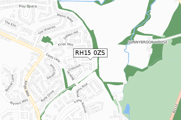
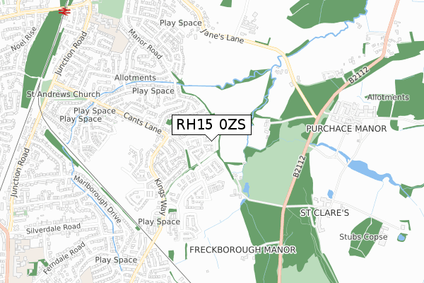
RH15 0ZS is located in the Burgess Hill Franklands electoral ward, within the local authority district of Mid Sussex and the English Parliamentary constituency of Mid Sussex. The Sub Integrated Care Board (ICB) Location is NHS Sussex ICB - 70F and the police force is Sussex. This postcode has been in use since April 2020.


GetTheData
Source: OS Open Zoomstack (Ordnance Survey)
Licence: Open Government Licence (requires attribution)
Attribution: Contains OS data © Crown copyright and database right 2025
Source: Open Postcode Geo
Licence: Open Government Licence (requires attribution)
Attribution: Contains OS data © Crown copyright and database right 2025; Contains Royal Mail data © Royal Mail copyright and database right 2025; Source: Office for National Statistics licensed under the Open Government Licence v.3.0
| Easting | 532814 |
| Northing | 117844 |
| Latitude | 50.944740 |
| Longitude | -0.110818 |
GetTheData
Source: Open Postcode Geo
Licence: Open Government Licence
| Country | England |
| Postcode District | RH15 |
➜ See where RH15 is on a map ➜ Where is Burgess Hill? | |
GetTheData
Source: Land Registry Price Paid Data
Licence: Open Government Licence
| Ward | Burgess Hill Franklands |
| Constituency | Mid Sussex |
GetTheData
Source: ONS Postcode Database
Licence: Open Government Licence
2024 28 JUN £875,000 |
49, STROUDLEY DRIVE, BURGESS HILL, RH15 0ZS 2022 10 MAR £825,000 |
2022 4 MAR £819,000 |
47, STROUDLEY DRIVE, BURGESS HILL, RH15 0ZS 2022 14 JAN £825,000 |
45, STROUDLEY DRIVE, BURGESS HILL, RH15 0ZS 2021 17 DEC £925,000 |
43, STROUDLEY DRIVE, BURGESS HILL, RH15 0ZS 2021 7 JAN £815,000 |
41, STROUDLEY DRIVE, BURGESS HILL, RH15 0ZS 2020 11 DEC £705,000 |
GetTheData
Source: HM Land Registry Price Paid Data
Licence: Contains HM Land Registry data © Crown copyright and database right 2025. This data is licensed under the Open Government Licence v3.0.
| Folders Lane | Burgess Hill | 223m |
| Folders Lane Roundabout (Folders Lane) | Ditchling Common | 480m |
| The Warren South (Kings Way) | Burgess Hill | 514m |
| Folders Lane Roundabout (Folders Lane) | Ditchling Common | 517m |
| The Warren South (Kings Way) | Burgess Hill | 530m |
| Burgess Hill Station | 1.5km |
| Wivelsfield Station | 2.3km |
| Hassocks Station | 3.3km |
GetTheData
Source: NaPTAN
Licence: Open Government Licence
GetTheData
Source: ONS Postcode Database
Licence: Open Government Licence


➜ Get more ratings from the Food Standards Agency
GetTheData
Source: Food Standards Agency
Licence: FSA terms & conditions
| Last Collection | |||
|---|---|---|---|
| Location | Mon-Fri | Sat | Distance |
| Folders Lane | 17:00 | 11:15 | 330m |
| Kingsway | 17:00 | 11:00 | 563m |
| Keymer Road | 17:00 | 11:00 | 1,128m |
GetTheData
Source: Dracos
Licence: Creative Commons Attribution-ShareAlike
The below table lists the International Territorial Level (ITL) codes (formerly Nomenclature of Territorial Units for Statistics (NUTS) codes) and Local Administrative Units (LAU) codes for RH15 0ZS:
| ITL 1 Code | Name |
|---|---|
| TLJ | South East (England) |
| ITL 2 Code | Name |
| TLJ2 | Surrey, East and West Sussex |
| ITL 3 Code | Name |
| TLJ28 | West Sussex (North East) |
| LAU 1 Code | Name |
| E07000228 | Mid Sussex |
GetTheData
Source: ONS Postcode Directory
Licence: Open Government Licence
The below table lists the Census Output Area (OA), Lower Layer Super Output Area (LSOA), and Middle Layer Super Output Area (MSOA) for RH15 0ZS:
| Code | Name | |
|---|---|---|
| OA | E00161659 | |
| LSOA | E01031702 | Mid Sussex 015A |
| MSOA | E02006618 | Mid Sussex 015 |
GetTheData
Source: ONS Postcode Directory
Licence: Open Government Licence
| RH15 0DX | Folders Lane | 209m |
| RH15 0AQ | Keymer Road | 225m |
| RH15 0DY | Folders Lane | 253m |
| BN6 8TP | Ditchling Common | 275m |
| RH15 0QT | Saddlers Close | 325m |
| RH15 0BF | Thornhurst | 366m |
| RH15 0TA | Folders Close | 376m |
| RH15 0QL | Wheelwright Lane | 391m |
| RH15 0GH | Sycamore Drive | 407m |
| RH15 0QS | Wheelwright Lane | 415m |
GetTheData
Source: Open Postcode Geo; Land Registry Price Paid Data
Licence: Open Government Licence