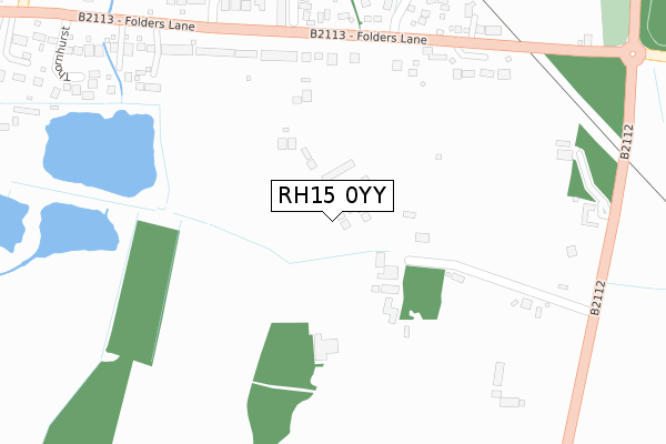
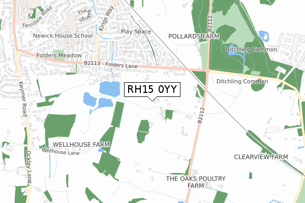
RH15 0YY is located in the Burgess Hill Franklands electoral ward, within the local authority district of Mid Sussex and the English Parliamentary constituency of Mid Sussex. The Sub Integrated Care Board (ICB) Location is NHS Sussex ICB - 70F and the police force is Sussex. This postcode has been in use since February 2019.


GetTheData
Source: OS Open Zoomstack (Ordnance Survey)
Licence: Open Government Licence (requires attribution)
Attribution: Contains OS data © Crown copyright and database right 2024
Source: Open Postcode Geo
Licence: Open Government Licence (requires attribution)
Attribution: Contains OS data © Crown copyright and database right 2024; Contains Royal Mail data © Royal Mail copyright and database right 2024; Source: Office for National Statistics licensed under the Open Government Licence v.3.0
| Easting | 532897 |
| Northing | 117832 |
| Latitude | 50.944613 |
| Longitude | -0.109642 |
GetTheData
Source: Open Postcode Geo
Licence: Open Government Licence
| Country | England |
| Postcode District | RH15 |
➜ See where RH15 is on a map ➜ Where is Burgess Hill? | |
GetTheData
Source: Land Registry Price Paid Data
Licence: Open Government Licence
| Ward | Burgess Hill Franklands |
| Constituency | Mid Sussex |
GetTheData
Source: ONS Postcode Database
Licence: Open Government Licence
| Folders Lane | Burgess Hill | 265m |
| Folders Lane Roundabout (Folders Lane) | Ditchling Common | 410m |
| Folders Lane Roundabout (Folders Lane) | Ditchling Common | 449m |
| Folders Lane Roundabout (B2112) | Ditchling Common | 498m |
| Folders Lane Roundabout (Common Lane) | Ditchling Common | 509m |
| Burgess Hill Station | 1.6km |
| Wivelsfield Station | 2.3km |
| Hassocks Station | 3.4km |
GetTheData
Source: NaPTAN
Licence: Open Government Licence
| Percentage of properties with Next Generation Access | 100.0% |
| Percentage of properties with Superfast Broadband | 0.0% |
| Percentage of properties with Ultrafast Broadband | 0.0% |
| Percentage of properties with Full Fibre Broadband | 0.0% |
Superfast Broadband is between 30Mbps and 300Mbps
Ultrafast Broadband is > 300Mbps
| Percentage of properties unable to receive 2Mbps | 0.0% |
| Percentage of properties unable to receive 5Mbps | 0.0% |
| Percentage of properties unable to receive 10Mbps | 0.0% |
| Percentage of properties unable to receive 30Mbps | 100.0% |
GetTheData
Source: Ofcom
Licence: Ofcom Terms of Use (requires attribution)
GetTheData
Source: ONS Postcode Database
Licence: Open Government Licence


➜ Get more ratings from the Food Standards Agency
GetTheData
Source: Food Standards Agency
Licence: FSA terms & conditions
| Last Collection | |||
|---|---|---|---|
| Location | Mon-Fri | Sat | Distance |
| Folders Lane | 17:00 | 11:15 | 273m |
| Kingsway | 17:00 | 11:00 | 633m |
| Ditchling Common | 16:30 | 08:00 | 1,137m |
GetTheData
Source: Dracos
Licence: Creative Commons Attribution-ShareAlike
The below table lists the International Territorial Level (ITL) codes (formerly Nomenclature of Territorial Units for Statistics (NUTS) codes) and Local Administrative Units (LAU) codes for RH15 0YY:
| ITL 1 Code | Name |
|---|---|
| TLJ | South East (England) |
| ITL 2 Code | Name |
| TLJ2 | Surrey, East and West Sussex |
| ITL 3 Code | Name |
| TLJ28 | West Sussex (North East) |
| LAU 1 Code | Name |
| E07000228 | Mid Sussex |
GetTheData
Source: ONS Postcode Directory
Licence: Open Government Licence
The below table lists the Census Output Area (OA), Lower Layer Super Output Area (LSOA), and Middle Layer Super Output Area (MSOA) for RH15 0YY:
| Code | Name | |
|---|---|---|
| OA | E00161659 | |
| LSOA | E01031702 | Mid Sussex 015A |
| MSOA | E02006618 | Mid Sussex 015 |
GetTheData
Source: ONS Postcode Directory
Licence: Open Government Licence
| BN6 8TP | Ditchling Common | 200m |
| RH15 0DX | Folders Lane | 260m |
| RH15 0DY | Folders Lane | 268m |
| RH15 0AQ | Keymer Road | 271m |
| RH15 0QT | Saddlers Close | 338m |
| RH15 0GH | Sycamore Drive | 401m |
| RH15 0SD | Folders Lane | 418m |
| RH15 0TA | Folders Close | 422m |
| RH15 0QL | Wheelwright Lane | 424m |
| RH15 0GG | Sycamore Drive | 426m |
GetTheData
Source: Open Postcode Geo; Land Registry Price Paid Data
Licence: Open Government Licence