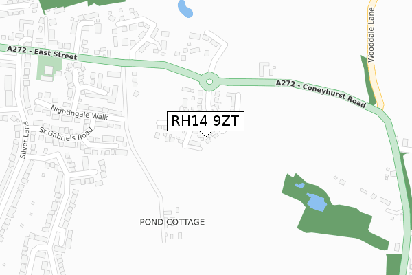
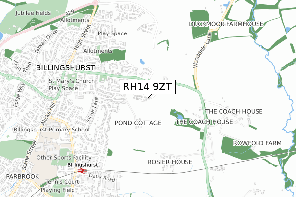
RH14 9ZT is located in the Billingshurst electoral ward, within the local authority district of Horsham and the English Parliamentary constituency of Horsham. The Sub Integrated Care Board (ICB) Location is NHS Sussex ICB - 70F and the police force is Sussex. This postcode has been in use since April 2019.


GetTheData
Source: OS Open Zoomstack (Ordnance Survey)
Licence: Open Government Licence (requires attribution)
Attribution: Contains OS data © Crown copyright and database right 2025
Source: Open Postcode Geo
Licence: Open Government Licence (requires attribution)
Attribution: Contains OS data © Crown copyright and database right 2025; Contains Royal Mail data © Royal Mail copyright and database right 2025; Source: Office for National Statistics licensed under the Open Government Licence v.3.0
| Easting | 509341 |
| Northing | 125750 |
| Latitude | 51.020732 |
| Longitude | -0.442421 |
GetTheData
Source: Open Postcode Geo
Licence: Open Government Licence
| Country | England |
| Postcode District | RH14 |
➜ See where RH14 is on a map ➜ Where is Billingshurst? | |
GetTheData
Source: Land Registry Price Paid Data
Licence: Open Government Licence
| Ward | Billingshurst |
| Constituency | Horsham |
GetTheData
Source: ONS Postcode Database
Licence: Open Government Licence
4, BARNFIELD, BILLINGSHURST, RH14 9ZT 2024 30 AUG £480,000 |
13, BARNFIELD, BILLINGSHURST, RH14 9ZT 2020 30 NOV £555,000 |
15, BARNFIELD, BILLINGSHURST, RH14 9ZT 2020 27 NOV £555,000 |
19, BARNFIELD, BILLINGSHURST, RH14 9ZT 2020 30 OCT £575,000 |
35, BARNFIELD, BILLINGSHURST, RH14 9ZT 2020 11 SEP £500,000 |
17, BARNFIELD, BILLINGSHURST, RH14 9ZT 2020 14 AUG £540,000 |
21, BARNFIELD, BILLINGSHURST, RH14 9ZT 2020 30 JUN £360,000 |
2, BARNFIELD, BILLINGSHURST, RH14 9ZT 2020 31 JAN £465,000 |
9, BARNFIELD, BILLINGSHURST, RH14 9ZT 2019 18 DEC £675,000 |
11, BARNFIELD, BILLINGSHURST, RH14 9ZT 2019 22 NOV £675,000 |
GetTheData
Source: HM Land Registry Price Paid Data
Licence: Contains HM Land Registry data © Crown copyright and database right 2025. This data is licensed under the Open Government Licence v3.0.
| East Street W Bound (East Street) | Billingshurst | 142m |
| East Street | Billingshurst | 149m |
| East Street West Bound (East Street) | Billingshurst | 547m |
| East Street East Bound (East Street) | Billingshurst | 550m |
| Coneyhurst Road | Billingshurst | 569m |
| Billingshurst Station | 0.8km |
GetTheData
Source: NaPTAN
Licence: Open Government Licence
| Percentage of properties with Next Generation Access | 100.0% |
| Percentage of properties with Superfast Broadband | 100.0% |
| Percentage of properties with Ultrafast Broadband | 100.0% |
| Percentage of properties with Full Fibre Broadband | 100.0% |
Superfast Broadband is between 30Mbps and 300Mbps
Ultrafast Broadband is > 300Mbps
| Percentage of properties unable to receive 2Mbps | 0.0% |
| Percentage of properties unable to receive 5Mbps | 0.0% |
| Percentage of properties unable to receive 10Mbps | 0.0% |
| Percentage of properties unable to receive 30Mbps | 0.0% |
GetTheData
Source: Ofcom
Licence: Ofcom Terms of Use (requires attribution)
GetTheData
Source: ONS Postcode Database
Licence: Open Government Licence


➜ Get more ratings from the Food Standards Agency
GetTheData
Source: Food Standards Agency
Licence: FSA terms & conditions
| Last Collection | |||
|---|---|---|---|
| Location | Mon-Fri | Sat | Distance |
| Silver Lane | 16:45 | 09:30 | 501m |
| Billingshurst Delivery Office | 18:00 | 12:30 | 704m |
| Jengers Mead | 17:15 | 12:00 | 755m |
GetTheData
Source: Dracos
Licence: Creative Commons Attribution-ShareAlike
The below table lists the International Territorial Level (ITL) codes (formerly Nomenclature of Territorial Units for Statistics (NUTS) codes) and Local Administrative Units (LAU) codes for RH14 9ZT:
| ITL 1 Code | Name |
|---|---|
| TLJ | South East (England) |
| ITL 2 Code | Name |
| TLJ2 | Surrey, East and West Sussex |
| ITL 3 Code | Name |
| TLJ28 | West Sussex (North East) |
| LAU 1 Code | Name |
| E07000227 | Horsham |
GetTheData
Source: ONS Postcode Directory
Licence: Open Government Licence
The below table lists the Census Output Area (OA), Lower Layer Super Output Area (LSOA), and Middle Layer Super Output Area (MSOA) for RH14 9ZT:
| Code | Name | |
|---|---|---|
| OA | E00161207 | |
| LSOA | E01031615 | Horsham 010E |
| MSOA | E02006597 | Horsham 010 |
GetTheData
Source: ONS Postcode Directory
Licence: Open Government Licence
| RH14 9TT | Gorselands | 202m |
| RH14 9DB | East Street | 210m |
| RH14 9GQ | Treetops | 235m |
| RH14 9TW | Broomfield Drive | 261m |
| RH14 9DA | East Street | 262m |
| RH14 9TY | Nightingale Walk | 267m |
| RH14 9TU | Easton Crescent | 285m |
| RH14 9TX | St Gabriels Road | 304m |
| RH14 9GT | Windmill Place | 343m |
| RH14 9TP | Willow Drive | 349m |
GetTheData
Source: Open Postcode Geo; Land Registry Price Paid Data
Licence: Open Government Licence