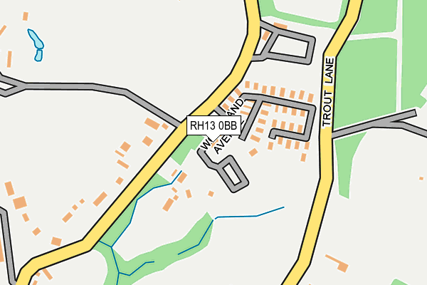
RH13 0BB is located in the Southwater South & Shipley electoral ward, within the local authority district of Horsham and the English Parliamentary constituency of Horsham. The Sub Integrated Care Board (ICB) Location is NHS Sussex ICB - 70F and the police force is Sussex. This postcode has been in use since June 2015.


GetTheData
Source: OS OpenMap – Local (Ordnance Survey)
Source: OS VectorMap District (Ordnance Survey)
Licence: Open Government Licence (requires attribution)
| Easting | 512980 |
| Northing | 125423 |
| Latitude | 51.017090 |
| Longitude | -0.390662 |
GetTheData
Source: Open Postcode Geo
Licence: Open Government Licence
| Country | England |
| Postcode District | RH13 |
➜ See where RH13 is on a map ➜ Where is Brooks Green? | |
GetTheData
Source: Land Registry Price Paid Data
Licence: Open Government Licence
Elevation or altitude of RH13 0BB as distance above sea level:
| Metres | Feet | |
|---|---|---|
| Elevation | 40m | 131ft |
Elevation is measured from the approximate centre of the postcode, to the nearest point on an OS contour line from OS Terrain 50, which has contour spacing of ten vertical metres.
➜ How high above sea level am I? Find the elevation of your current position using your device's GPS.
GetTheData
Source: Open Postcode Elevation
Licence: Open Government Licence
| Ward | Southwater South & Shipley |
| Constituency | Horsham |
GetTheData
Source: ONS Postcode Database
Licence: Open Government Licence
| Caravan Park (Emms Lane) | Brooks Green | 114m |
| Caravan Park (Emms Lane) | Brooks Green | 117m |
| Emms Lane | Brooks Green | 297m |
| Emms Lane | Brooks Green | 298m |
| Saxon Farm (Emms Lane) | Brooks Green | 315m |
| Billingshurst Station | 4.2km |
| Christs Hospital Station | 4.2km |
GetTheData
Source: NaPTAN
Licence: Open Government Licence
| Median download speed | 17.3Mbps |
| Average download speed | 24.8Mbps |
| Maximum download speed | 48.19Mbps |
| Median upload speed | 4.5Mbps |
| Average upload speed | 4.7Mbps |
| Maximum upload speed | 10.00Mbps |
GetTheData
Source: Ofcom
Licence: Ofcom Terms of Use (requires attribution)
GetTheData
Source: ONS Postcode Database
Licence: Open Government Licence

➜ Get more ratings from the Food Standards Agency
GetTheData
Source: Food Standards Agency
Licence: FSA terms & conditions
| Last Collection | |||
|---|---|---|---|
| Location | Mon-Fri | Sat | Distance |
| Cross Lane | 16:30 | 09:30 | 698m |
| Eastlands | 16:45 | 08:00 | 1,853m |
| The Wedges | 16:15 | 08:30 | 2,814m |
GetTheData
Source: Dracos
Licence: Creative Commons Attribution-ShareAlike
The below table lists the International Territorial Level (ITL) codes (formerly Nomenclature of Territorial Units for Statistics (NUTS) codes) and Local Administrative Units (LAU) codes for RH13 0BB:
| ITL 1 Code | Name |
|---|---|
| TLJ | South East (England) |
| ITL 2 Code | Name |
| TLJ2 | Surrey, East and West Sussex |
| ITL 3 Code | Name |
| TLJ28 | West Sussex (North East) |
| LAU 1 Code | Name |
| E07000227 | Horsham |
GetTheData
Source: ONS Postcode Directory
Licence: Open Government Licence
The below table lists the Census Output Area (OA), Lower Layer Super Output Area (LSOA), and Middle Layer Super Output Area (MSOA) for RH13 0BB:
| Code | Name | |
|---|---|---|
| OA | E00161224 | |
| LSOA | E01031611 | Horsham 010A |
| MSOA | E02006597 | Horsham 010 |
GetTheData
Source: ONS Postcode Directory
Licence: Open Government Licence
| RH13 0TR | Emms Lane | 87m |
| RH13 0JN | Trout Lane | 205m |
| RH13 0AT | Kinsbrook | 584m |
| RH13 0QF | Cross Lane | 693m |
| RH13 0QG | Emms Lane | 701m |
| RH13 0JW | Coolham Road | 722m |
| RH13 0TG | Cross Lane | 724m |
| RH13 9DB | Old House Lane | 853m |
| RH13 0QQ | Emms Lane | 933m |
| RH13 8GL | Bakers Lane | 1010m |
GetTheData
Source: Open Postcode Geo; Land Registry Price Paid Data
Licence: Open Government Licence