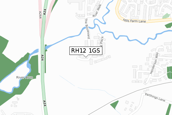
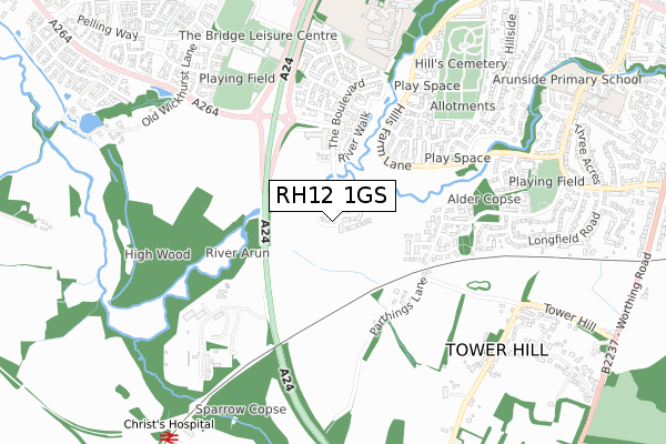
RH12 1GS is located in the Denne electoral ward, within the local authority district of Horsham and the English Parliamentary constituency of Horsham. The Sub Integrated Care Board (ICB) Location is NHS Sussex ICB - 70F and the police force is Sussex. This postcode has been in use since September 2019.


GetTheData
Source: OS Open Zoomstack (Ordnance Survey)
Licence: Open Government Licence (requires attribution)
Attribution: Contains OS data © Crown copyright and database right 2025
Source: Open Postcode Geo
Licence: Open Government Licence (requires attribution)
Attribution: Contains OS data © Crown copyright and database right 2025; Contains Royal Mail data © Royal Mail copyright and database right 2025; Source: Office for National Statistics licensed under the Open Government Licence v.3.0
| Easting | 515392 |
| Northing | 130024 |
| Latitude | 51.057968 |
| Longitude | -0.354826 |
GetTheData
Source: Open Postcode Geo
Licence: Open Government Licence
| Country | England |
| Postcode District | RH12 |
➜ See where RH12 is on a map ➜ Where is Horsham? | |
GetTheData
Source: Land Registry Price Paid Data
Licence: Open Government Licence
| Ward | Denne |
| Constituency | Horsham |
GetTheData
Source: ONS Postcode Database
Licence: Open Government Licence
| Fellcott Way (Hills Farm Lane) | Horsham | 411m |
| Fellcott Way (Hills Farm Lane) | Horsham | 463m |
| Stoneybrook (Hills Farm Lane) | Horsham | 484m |
| Stoneybrook (Hills Farm Lane) | Horsham | 557m |
| Relief Road (Broadbridge Heath Relief Road) | Wickhurst Green | 585m |
| Christs Hospital Station | 1km |
| Horsham Station | 2.7km |
| Littlehaven Station | 4.1km |
GetTheData
Source: NaPTAN
Licence: Open Government Licence
GetTheData
Source: ONS Postcode Database
Licence: Open Government Licence


➜ Get more ratings from the Food Standards Agency
GetTheData
Source: Food Standards Agency
Licence: FSA terms & conditions
| Last Collection | |||
|---|---|---|---|
| Location | Mon-Fri | Sat | Distance |
| Groombridge Way | 17:00 | 12:00 | 422m |
| Granary Way | 17:00 | 12:00 | 657m |
| Needles P O | 17:00 | 12:00 | 923m |
GetTheData
Source: Dracos
Licence: Creative Commons Attribution-ShareAlike
The below table lists the International Territorial Level (ITL) codes (formerly Nomenclature of Territorial Units for Statistics (NUTS) codes) and Local Administrative Units (LAU) codes for RH12 1GS:
| ITL 1 Code | Name |
|---|---|
| TLJ | South East (England) |
| ITL 2 Code | Name |
| TLJ2 | Surrey, East and West Sussex |
| ITL 3 Code | Name |
| TLJ28 | West Sussex (North East) |
| LAU 1 Code | Name |
| E07000227 | Horsham |
GetTheData
Source: ONS Postcode Directory
Licence: Open Government Licence
The below table lists the Census Output Area (OA), Lower Layer Super Output Area (LSOA), and Middle Layer Super Output Area (MSOA) for RH12 1GS:
| Code | Name | |
|---|---|---|
| OA | E00167712 | |
| LSOA | E01031637 | Horsham 007B |
| MSOA | E02006594 | Horsham 007 |
GetTheData
Source: ONS Postcode Directory
Licence: Open Government Licence
| RH12 1HS | East Street | 69m |
| RH12 1GF | The Boulevard | 330m |
| RH12 1XR | Windrum Close | 331m |
| RH12 1UY | Brockhurst Close | 370m |
| RH12 1UX | Fenhurst Close | 386m |
| RH12 1DU | River Walk | 387m |
| RH12 1JX | Henderson Way | 397m |
| RH12 1EP | The Boulevard | 411m |
| RH12 1UZ | Fellcott Way | 417m |
| RH12 1XP | Parsons Walk | 440m |
GetTheData
Source: Open Postcode Geo; Land Registry Price Paid Data
Licence: Open Government Licence