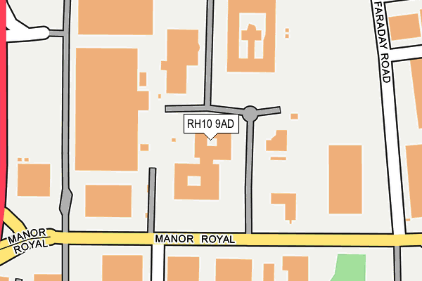
RH10 9AD lies on Crawley Business Quarter in Crawley. RH10 9AD is located in the Langley Green & Tushmore electoral ward, within the local authority district of Crawley and the English Parliamentary constituency of Crawley. The Sub Integrated Care Board (ICB) Location is NHS Sussex ICB - 70F and the police force is Sussex. This postcode has been in use since August 2004.


GetTheData
Source: OS OpenMap – Local (Ordnance Survey)
Source: OS VectorMap District (Ordnance Survey)
Licence: Open Government Licence (requires attribution)
| Easting | 527318 |
| Northing | 138429 |
| Latitude | 51.130990 |
| Longitude | -0.181779 |
GetTheData
Source: Open Postcode Geo
Licence: Open Government Licence
| Street | Crawley Business Quarter |
| Town/City | Crawley |
| Country | England |
| Postcode District | RH10 |
➜ See where RH10 is on a map ➜ Where is Crawley? | |
GetTheData
Source: Land Registry Price Paid Data
Licence: Open Government Licence
Elevation or altitude of RH10 9AD as distance above sea level:
| Metres | Feet | |
|---|---|---|
| Elevation | 70m | 230ft |
Elevation is measured from the approximate centre of the postcode, to the nearest point on an OS contour line from OS Terrain 50, which has contour spacing of ten vertical metres.
➜ How high above sea level am I? Find the elevation of your current position using your device's GPS.
GetTheData
Source: Open Postcode Elevation
Licence: Open Government Licence
| Ward | Langley Green & Tushmore |
| Constituency | Crawley |
GetTheData
Source: ONS Postcode Database
Licence: Open Government Licence
| Manor Royal West (Manor Royal) | Manor Royal | 158m |
| Manor Royal West (Manor Royal) | Manor Royal | 242m |
| Manor Royal Central (Faraday Road) | Manor Royal | 261m |
| Faraday Road | Manor Royal | 270m |
| Manor Royal Central (Manor Royal) | Manor Royal | 271m |
| Crawley Station | 2.1km |
| Three Bridges Station | 2.1km |
| Ifield Station | 2.9km |
GetTheData
Source: NaPTAN
Licence: Open Government Licence
GetTheData
Source: ONS Postcode Database
Licence: Open Government Licence


➜ Get more ratings from the Food Standards Agency
GetTheData
Source: Food Standards Agency
Licence: FSA terms & conditions
| Last Collection | |||
|---|---|---|---|
| Location | Mon-Fri | Sat | Distance |
| Crompton Way | 18:30 | 11:00 | 166m |
| Newton Road | 18:30 | 11:00 | 571m |
| Oakway | 17:30 | 11:00 | 769m |
GetTheData
Source: Dracos
Licence: Creative Commons Attribution-ShareAlike
The below table lists the International Territorial Level (ITL) codes (formerly Nomenclature of Territorial Units for Statistics (NUTS) codes) and Local Administrative Units (LAU) codes for RH10 9AD:
| ITL 1 Code | Name |
|---|---|
| TLJ | South East (England) |
| ITL 2 Code | Name |
| TLJ2 | Surrey, East and West Sussex |
| ITL 3 Code | Name |
| TLJ28 | West Sussex (North East) |
| LAU 1 Code | Name |
| E07000226 | Crawley |
GetTheData
Source: ONS Postcode Directory
Licence: Open Government Licence
The below table lists the Census Output Area (OA), Lower Layer Super Output Area (LSOA), and Middle Layer Super Output Area (MSOA) for RH10 9AD:
| Code | Name | |
|---|---|---|
| OA | E00161059 | |
| LSOA | E01031583 | Crawley 004A |
| MSOA | E02006578 | Crawley 004 |
GetTheData
Source: ONS Postcode Directory
Licence: Open Government Licence
| RH10 8LB | London Road | 338m |
| RH10 9TF | Faraday Road | 342m |
| RH10 8LF | Tushmore Avenue | 359m |
| RH10 9QL | Fleming Way | 361m |
| RH10 8TT | Hollin Court | 368m |
| RH11 7SQ | Martyrs Avenue | 385m |
| RH10 8TX | Hollin Court | 387m |
| RH10 8EX | Tuscany Gardens | 451m |
| RH11 7UH | Dobson Road | 453m |
| RH11 7SH | Old Martyrs | 456m |
GetTheData
Source: Open Postcode Geo; Land Registry Price Paid Data
Licence: Open Government Licence