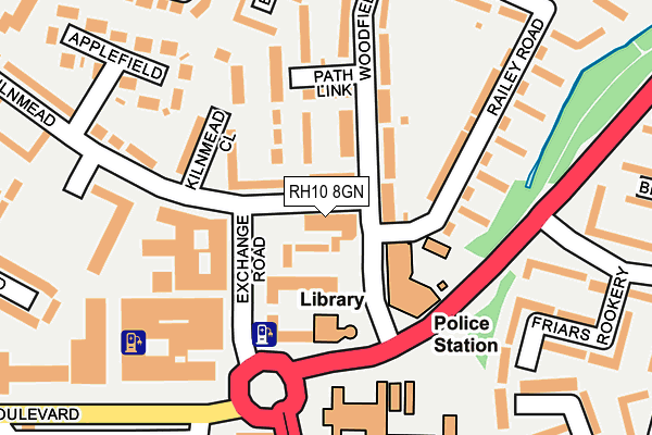
RH10 8GN is located in the Three Bridges electoral ward, within the local authority district of Crawley and the English Parliamentary constituency of Crawley. The Sub Integrated Care Board (ICB) Location is NHS Sussex ICB - 70F and the police force is Sussex. This postcode has been in use since June 2017.


GetTheData
Source: OS OpenMap – Local (Ordnance Survey)
Source: OS VectorMap District (Ordnance Survey)
Licence: Open Government Licence (requires attribution)
| Easting | 527330 |
| Northing | 136989 |
| Latitude | 51.118046 |
| Longitude | -0.182116 |
GetTheData
Source: Open Postcode Geo
Licence: Open Government Licence
| Country | England |
| Postcode District | RH10 |
➜ See where RH10 is on a map ➜ Where is Crawley? | |
GetTheData
Source: Land Registry Price Paid Data
Licence: Open Government Licence
| Ward | Three Bridges |
| Constituency | Crawley |
GetTheData
Source: ONS Postcode Database
Licence: Open Government Licence
| Magistrates Court (Woodfield Road) | Crawley | 65m |
| Exchange Road | Crawley | 73m |
| Northgate Avenue South (Northgate Avenue) | Crawley | 139m |
| Northgate Avenue South (Northgate Avenue) | Crawley | 152m |
| Northgate Avenue Central (Northgate Avenue) | Crawley | 294m |
| Crawley Station | 0.7km |
| Three Bridges Station | 1.5km |
| Ifield Station | 2.3km |
GetTheData
Source: NaPTAN
Licence: Open Government Licence
GetTheData
Source: ONS Postcode Database
Licence: Open Government Licence


➜ Get more ratings from the Food Standards Agency
GetTheData
Source: Food Standards Agency
Licence: FSA terms & conditions
| Last Collection | |||
|---|---|---|---|
| Location | Mon-Fri | Sat | Distance |
| Northgate Parade | 17:30 | 11:00 | 336m |
| Woolborough Road | 17:30 | 11:00 | 390m |
| The Boulevard P O | 19:00 | 12:30 | 424m |
GetTheData
Source: Dracos
Licence: Creative Commons Attribution-ShareAlike
The below table lists the International Territorial Level (ITL) codes (formerly Nomenclature of Territorial Units for Statistics (NUTS) codes) and Local Administrative Units (LAU) codes for RH10 8GN:
| ITL 1 Code | Name |
|---|---|
| TLJ | South East (England) |
| ITL 2 Code | Name |
| TLJ2 | Surrey, East and West Sussex |
| ITL 3 Code | Name |
| TLJ28 | West Sussex (North East) |
| LAU 1 Code | Name |
| E07000226 | Crawley |
GetTheData
Source: ONS Postcode Directory
Licence: Open Government Licence
The below table lists the Census Output Area (OA), Lower Layer Super Output Area (LSOA), and Middle Layer Super Output Area (MSOA) for RH10 8GN:
| Code | Name | |
|---|---|---|
| OA | E00161071 | |
| LSOA | E01031585 | Crawley 004C |
| MSOA | E02006578 | Crawley 004 |
GetTheData
Source: ONS Postcode Directory
Licence: Open Government Licence
| RH10 8BN | Kilnmead | 36m |
| RH10 8BW | Crosspath | 85m |
| RH10 8BY | Woodfield Road | 113m |
| RH10 8BL | Kilnmead Close | 115m |
| RH10 8BS | Path Link | 116m |
| RH10 8BX | Woodfield Road | 152m |
| RH10 8BP | Crosspath | 155m |
| RH10 8DA | Railey Road | 161m |
| RH10 8BZ | Railey Road | 179m |
| RH10 8DD | Railey Road | 239m |
GetTheData
Source: Open Postcode Geo; Land Registry Price Paid Data
Licence: Open Government Licence