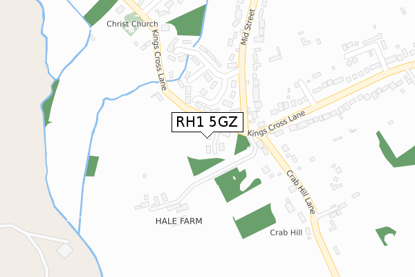
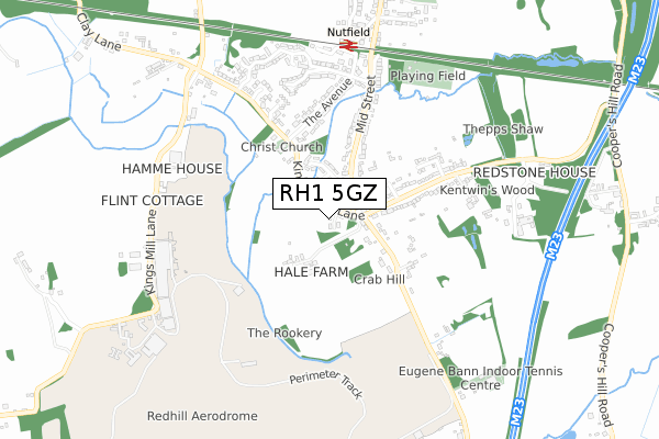
RH1 5GZ is located in the Bletchingley and Nutfield electoral ward, within the local authority district of Tandridge and the English Parliamentary constituency of East Surrey. The Sub Integrated Care Board (ICB) Location is NHS Surrey Heartlands ICB - 92A and the police force is Surrey. This postcode has been in use since July 2018.


GetTheData
Source: OS Open Zoomstack (Ordnance Survey)
Licence: Open Government Licence (requires attribution)
Attribution: Contains OS data © Crown copyright and database right 2025
Source: Open Postcode Geo
Licence: Open Government Licence (requires attribution)
Attribution: Contains OS data © Crown copyright and database right 2025; Contains Royal Mail data © Royal Mail copyright and database right 2025; Source: Office for National Statistics licensed under the Open Government Licence v.3.0
| Easting | 530418 |
| Northing | 148508 |
| Latitude | 51.220878 |
| Longitude | -0.133847 |
GetTheData
Source: Open Postcode Geo
Licence: Open Government Licence
| Country | England |
| Postcode District | RH1 |
➜ See where RH1 is on a map ➜ Where is South Nutfield? | |
GetTheData
Source: Land Registry Price Paid Data
Licence: Open Government Licence
| Ward | Bletchingley And Nutfield |
| Constituency | East Surrey |
GetTheData
Source: ONS Postcode Database
Licence: Open Government Licence
| Ridge Green (Mid Street) | Ridge Green | 89m |
| Ridge Green (Mid Street) | Ridge Green | 114m |
| Kings Cross Lane | Ridge Green | 279m |
| Kings Cross Lane | Ridge Green | 511m |
| Nutfield Railway Station (Mid Street) | South Nutfield | 770m |
| Nutfield Station | 0.7km |
| Earlswood (Surrey) Station | 2.7km |
| Salfords (Surrey) Station | 2.9km |
GetTheData
Source: NaPTAN
Licence: Open Government Licence
| Percentage of properties with Next Generation Access | 100.0% |
| Percentage of properties with Superfast Broadband | 100.0% |
| Percentage of properties with Ultrafast Broadband | 0.0% |
| Percentage of properties with Full Fibre Broadband | 0.0% |
Superfast Broadband is between 30Mbps and 300Mbps
Ultrafast Broadband is > 300Mbps
| Median download speed | 55.0Mbps |
| Average download speed | 53.0Mbps |
| Maximum download speed | 79.98Mbps |
| Median upload speed | 10.0Mbps |
| Average upload speed | 11.3Mbps |
| Maximum upload speed | 20.00Mbps |
| Percentage of properties unable to receive 2Mbps | 0.0% |
| Percentage of properties unable to receive 5Mbps | 0.0% |
| Percentage of properties unable to receive 10Mbps | 0.0% |
| Percentage of properties unable to receive 30Mbps | 0.0% |
GetTheData
Source: Ofcom
Licence: Ofcom Terms of Use (requires attribution)
GetTheData
Source: ONS Postcode Database
Licence: Open Government Licence


➜ Get more ratings from the Food Standards Agency
GetTheData
Source: Food Standards Agency
Licence: FSA terms & conditions
| Last Collection | |||
|---|---|---|---|
| Location | Mon-Fri | Sat | Distance |
| The Avenue South Nutfield | 17:15 | 10:15 | 390m |
| Nutfield Park | 17:15 | 10:15 | 775m |
| South Nutfield P O | 17:15 | 11:15 | 988m |
GetTheData
Source: Dracos
Licence: Creative Commons Attribution-ShareAlike
The below table lists the International Territorial Level (ITL) codes (formerly Nomenclature of Territorial Units for Statistics (NUTS) codes) and Local Administrative Units (LAU) codes for RH1 5GZ:
| ITL 1 Code | Name |
|---|---|
| TLJ | South East (England) |
| ITL 2 Code | Name |
| TLJ2 | Surrey, East and West Sussex |
| ITL 3 Code | Name |
| TLJ26 | East Surrey |
| LAU 1 Code | Name |
| E07000215 | Tandridge |
GetTheData
Source: ONS Postcode Directory
Licence: Open Government Licence
The below table lists the Census Output Area (OA), Lower Layer Super Output Area (LSOA), and Middle Layer Super Output Area (MSOA) for RH1 5GZ:
| Code | Name | |
|---|---|---|
| OA | E00157117 | |
| LSOA | E01030814 | Tandridge 008C |
| MSOA | E02006435 | Tandridge 008 |
GetTheData
Source: ONS Postcode Directory
Licence: Open Government Licence
| RH1 5NP | Kings Cross Lane | 36m |
| RH1 5RW | Ridge Green Close | 112m |
| RH1 5RL | Kings Cross Lane | 140m |
| RH1 5RN | Ridge Green | 191m |
| RH1 5NT | Kings Cross Lane | 192m |
| RH1 5NR | Crab Hill Lane | 236m |
| RH1 5NJ | Kings Cross Lane | 269m |
| RH1 5RP | Mid Street | 314m |
| RH1 5NU | Kings Cross Lane | 367m |
| RH1 5NS | Kings Cross Lane | 419m |
GetTheData
Source: Open Postcode Geo; Land Registry Price Paid Data
Licence: Open Government Licence