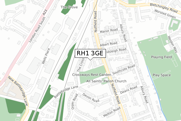
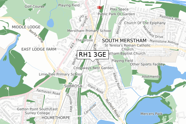
RH1 3GE is located in the Hooley, Merstham & Netherne electoral ward, within the local authority district of Reigate and Banstead and the English Parliamentary constituency of Reigate. The Sub Integrated Care Board (ICB) Location is NHS Surrey Heartlands ICB - 92A and the police force is Surrey. This postcode has been in use since April 2020.


GetTheData
Source: OS Open Zoomstack (Ordnance Survey)
Licence: Open Government Licence (requires attribution)
Attribution: Contains OS data © Crown copyright and database right 2025
Source: Open Postcode Geo
Licence: Open Government Licence (requires attribution)
Attribution: Contains OS data © Crown copyright and database right 2025; Contains Royal Mail data © Royal Mail copyright and database right 2025; Source: Office for National Statistics licensed under the Open Government Licence v.3.0
| Easting | 529078 |
| Northing | 152547 |
| Latitude | 51.257482 |
| Longitude | -0.151571 |
GetTheData
Source: Open Postcode Geo
Licence: Open Government Licence
| Country | England |
| Postcode District | RH1 |
➜ See where RH1 is on a map ➜ Where is South Merstham? | |
GetTheData
Source: Land Registry Price Paid Data
Licence: Open Government Licence
| Ward | Hooley, Merstham & Netherne |
| Constituency | Reigate |
GetTheData
Source: ONS Postcode Database
Licence: Open Government Licence
5, ALL SAINTS GARDENS, MERSTHAM, REDHILL, RH1 3GE 2020 10 JUL £620,000 |
9, ALL SAINTS GARDENS, MERSTHAM, REDHILL, RH1 3GE 2020 24 JUN £600,000 |
GetTheData
Source: HM Land Registry Price Paid Data
Licence: Contains HM Land Registry data © Crown copyright and database right 2025. This data is licensed under the Open Government Licence v3.0.
| Nutfield Road | South Merstham | 81m |
| Church (Battlebridge Lane) | South Merstham | 103m |
| Church (Battlebridge Lane) | South Merstham | 129m |
| Manor Road | Merstham | 176m |
| Southcote Road | South Merstham | 214m |
| Merstham Station | 0.7km |
| Redhill Station | 2.2km |
| Earlswood (Surrey) Station | 3.6km |
GetTheData
Source: NaPTAN
Licence: Open Government Licence
GetTheData
Source: ONS Postcode Database
Licence: Open Government Licence


➜ Get more ratings from the Food Standards Agency
GetTheData
Source: Food Standards Agency
Licence: FSA terms & conditions
| Last Collection | |||
|---|---|---|---|
| Location | Mon-Fri | Sat | Distance |
| South Merstham P O | 17:15 | 12:00 | 78m |
| Sub Rosa Caravan Park | 17:30 | 12:00 | 344m |
| Nutfield Road | 17:15 | 12:00 | 390m |
GetTheData
Source: Dracos
Licence: Creative Commons Attribution-ShareAlike
The below table lists the International Territorial Level (ITL) codes (formerly Nomenclature of Territorial Units for Statistics (NUTS) codes) and Local Administrative Units (LAU) codes for RH1 3GE:
| ITL 1 Code | Name |
|---|---|
| TLJ | South East (England) |
| ITL 2 Code | Name |
| TLJ2 | Surrey, East and West Sussex |
| ITL 3 Code | Name |
| TLJ26 | East Surrey |
| LAU 1 Code | Name |
| E07000211 | Reigate and Banstead |
GetTheData
Source: ONS Postcode Directory
Licence: Open Government Licence
The below table lists the Census Output Area (OA), Lower Layer Super Output Area (LSOA), and Middle Layer Super Output Area (MSOA) for RH1 3GE:
| Code | Name | |
|---|---|---|
| OA | E00156054 | |
| LSOA | E01030602 | Reigate and Banstead 008D |
| MSOA | E02006382 | Reigate and Banstead 008 |
GetTheData
Source: ONS Postcode Directory
Licence: Open Government Licence
| RH1 3NA | The Crossways | 65m |
| RH1 3ER | Nutfield Road | 87m |
| RH1 3EW | Nutfield Road | 146m |
| RH1 3EN | Nutfield Road | 151m |
| RH1 3LH | Battlebridge Lane | 158m |
| RH1 3LU | Albert Road | 167m |
| RH1 3LX | Endsleigh Road | 171m |
| RH1 3LJ | Southcote Road | 185m |
| RH1 3EU | Devon Road | 194m |
| RH1 3LT | Manor Road | 199m |
GetTheData
Source: Open Postcode Geo; Land Registry Price Paid Data
Licence: Open Government Licence