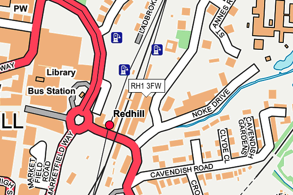
RH1 3FW is located in the Redhill East electoral ward, within the local authority district of Reigate and Banstead and the English Parliamentary constituency of Reigate. The Sub Integrated Care Board (ICB) Location is NHS Surrey Heartlands ICB - 92A and the police force is Surrey. This postcode has been in use since April 2017.


GetTheData
Source: OS OpenMap – Local (Ordnance Survey)
Source: OS VectorMap District (Ordnance Survey)
Licence: Open Government Licence (requires attribution)
| Easting | 528212 |
| Northing | 150643 |
| Latitude | 51.240565 |
| Longitude | -0.164656 |
GetTheData
Source: Open Postcode Geo
Licence: Open Government Licence
| Country | England |
| Postcode District | RH1 |
➜ See where RH1 is on a map | |
GetTheData
Source: Land Registry Price Paid Data
Licence: Open Government Licence
| Ward | Redhill East |
| Constituency | Reigate |
GetTheData
Source: ONS Postcode Database
Licence: Open Government Licence
| Redhill Railway Station (Redstone Hill) | Redhill | 164m |
| St Anne's Mount (St Anne's Drive) | Redhill | 209m |
| Queensway | Redhill | 320m |
| High Street | Redhill | 346m |
| High Street | Redhill | 358m |
| Redhill Station | 0.1km |
| Earlswood (Surrey) Station | 1.5km |
| Nutfield Station | 2.7km |
GetTheData
Source: NaPTAN
Licence: Open Government Licence
GetTheData
Source: ONS Postcode Database
Licence: Open Government Licence


➜ Get more ratings from the Food Standards Agency
GetTheData
Source: Food Standards Agency
Licence: FSA terms & conditions
| Last Collection | |||
|---|---|---|---|
| Location | Mon-Fri | Sat | Distance |
| St Annes Drive | 19:00 | 12:45 | 25m |
| St Annes Drive Meter Box | 19:00 | 25m | |
| Redhill Railway Station | 18:00 | 11:45 | 119m |
GetTheData
Source: Dracos
Licence: Creative Commons Attribution-ShareAlike
The below table lists the International Territorial Level (ITL) codes (formerly Nomenclature of Territorial Units for Statistics (NUTS) codes) and Local Administrative Units (LAU) codes for RH1 3FW:
| ITL 1 Code | Name |
|---|---|
| TLJ | South East (England) |
| ITL 2 Code | Name |
| TLJ2 | Surrey, East and West Sussex |
| ITL 3 Code | Name |
| TLJ26 | East Surrey |
| LAU 1 Code | Name |
| E07000211 | Reigate and Banstead |
GetTheData
Source: ONS Postcode Directory
Licence: Open Government Licence
The below table lists the Census Output Area (OA), Lower Layer Super Output Area (LSOA), and Middle Layer Super Output Area (MSOA) for RH1 3FW:
| Code | Name | |
|---|---|---|
| OA | E00156117 | |
| LSOA | E01030612 | Reigate and Banstead 011C |
| MSOA | E02006385 | Reigate and Banstead 011 |
GetTheData
Source: ONS Postcode Directory
Licence: Open Government Licence
| RH1 4AZ | Knights Place | 107m |
| RH1 4BH | Venner Close | 119m |
| RH1 4AF | Clyde Close | 147m |
| RH1 4AE | Cavendish Road | 168m |
| RH1 1JZ | Ladbroke Cottages | 171m |
| RH1 1AQ | St Annes Mount | 172m |
| RH1 1NZ | Station Road | 190m |
| RH1 1JQ | Ladbroke Road | 191m |
| RH1 1JY | Ladbroke Road | 198m |
| RH1 1AP | St Annes Mount | 199m |
GetTheData
Source: Open Postcode Geo; Land Registry Price Paid Data
Licence: Open Government Licence