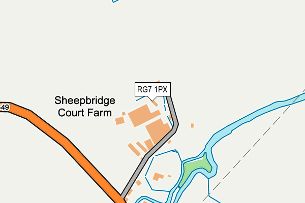
RG7 1PX is located in the Swallowfield electoral ward, within the unitary authority of Wokingham and the English Parliamentary constituency of Wokingham. The Sub Integrated Care Board (ICB) Location is NHS Buckinghamshire, Oxfordshire and Berkshire West ICB - 15A and the police force is Thames Valley. This postcode has been in use since January 1980.


GetTheData
Source: OS OpenMap – Local (Ordnance Survey)
Source: OS VectorMap District (Ordnance Survey)
Licence: Open Government Licence (requires attribution)
| Easting | 472090 |
| Northing | 165555 |
| Latitude | 51.384473 |
| Longitude | -0.965453 |
GetTheData
Source: Open Postcode Geo
Licence: Open Government Licence
| Country | England |
| Postcode District | RG7 |
➜ See where RG7 is on a map | |
GetTheData
Source: Land Registry Price Paid Data
Licence: Open Government Licence
Elevation or altitude of RG7 1PX as distance above sea level:
| Metres | Feet | |
|---|---|---|
| Elevation | 50m | 164ft |
Elevation is measured from the approximate centre of the postcode, to the nearest point on an OS contour line from OS Terrain 50, which has contour spacing of ten vertical metres.
➜ How high above sea level am I? Find the elevation of your current position using your device's GPS.
GetTheData
Source: Open Postcode Elevation
Licence: Open Government Licence
| Ward | Swallowfield |
| Constituency | Wokingham |
GetTheData
Source: ONS Postcode Database
Licence: Open Government Licence
| The Mill House (Basingstoke Road) | Swallowfield | 199m |
| The Mill House (Basingstoke Road) | Swallowfield | 209m |
| Back Lane (Basingstoke Road) | Spencer's Wood | 590m |
| Back Lane (Basingstoke Road) | Spencer's Wood | 604m |
| Swallowfield Street | Swallowfield | 609m |
| Mortimer Station | 5.1km |
GetTheData
Source: NaPTAN
Licence: Open Government Licence
GetTheData
Source: ONS Postcode Database
Licence: Open Government Licence


➜ Get more ratings from the Food Standards Agency
GetTheData
Source: Food Standards Agency
Licence: FSA terms & conditions
| Last Collection | |||
|---|---|---|---|
| Location | Mon-Fri | Sat | Distance |
| Swallowfield Post Office | 17:00 | 09:15 | 843m |
| Spencers Wood Post Office | 17:15 | 10:15 | 1,056m |
| Park Lane | 16:00 | 09:00 | 2,246m |
GetTheData
Source: Dracos
Licence: Creative Commons Attribution-ShareAlike
The below table lists the International Territorial Level (ITL) codes (formerly Nomenclature of Territorial Units for Statistics (NUTS) codes) and Local Administrative Units (LAU) codes for RG7 1PX:
| ITL 1 Code | Name |
|---|---|
| TLJ | South East (England) |
| ITL 2 Code | Name |
| TLJ1 | Berkshire, Buckinghamshire and Oxfordshire |
| ITL 3 Code | Name |
| TLJ11 | Berkshire |
| LAU 1 Code | Name |
| E06000041 | Wokingham |
GetTheData
Source: ONS Postcode Directory
Licence: Open Government Licence
The below table lists the Census Output Area (OA), Lower Layer Super Output Area (LSOA), and Middle Layer Super Output Area (MSOA) for RG7 1PX:
| Code | Name | |
|---|---|---|
| OA | E00084235 | |
| LSOA | E01016691 | Wokingham 017D |
| MSOA | E02003455 | Wokingham 017 |
GetTheData
Source: ONS Postcode Directory
Licence: Open Government Licence
| RG7 1PT | Basingstoke Road | 200m |
| RG7 1QX | Swallowfield Street | 654m |
| RG7 1PS | Basingstoke Road | 701m |
| RG7 1WY | Basingstoke Road | 720m |
| RG7 1PP | Basingstoke Road | 731m |
| RG7 1JG | Lambs Lane | 763m |
| RG7 1QW | Swallowfield Street | 789m |
| RG7 1JB | Lambs Lane | 796m |
| RG7 1FG | Bryant Crescent | 797m |
| RG7 1RG | The Street | 798m |
GetTheData
Source: Open Postcode Geo; Land Registry Price Paid Data
Licence: Open Government Licence