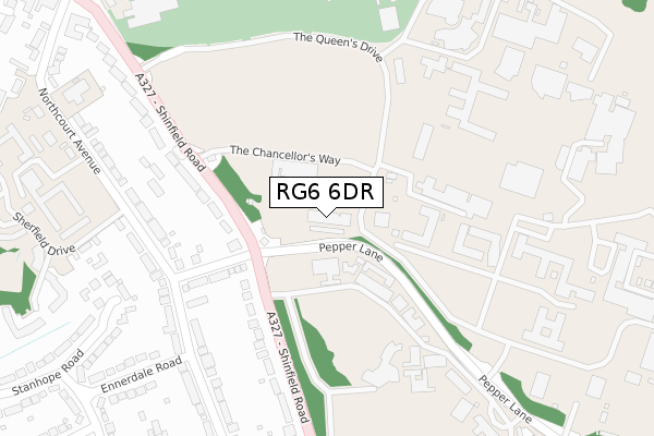
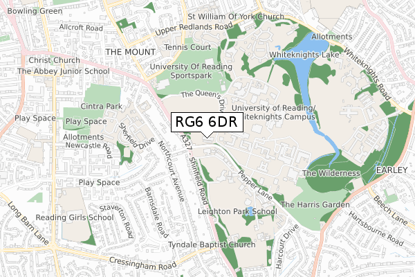
RG6 6DR is located in the Redlands electoral ward, within the unitary authority of Reading and the English Parliamentary constituency of Reading East. The Sub Integrated Care Board (ICB) Location is NHS Buckinghamshire, Oxfordshire and Berkshire West ICB - 15A and the police force is Thames Valley. This postcode has been in use since April 2019.


GetTheData
Source: OS Open Zoomstack (Ordnance Survey)
Licence: Open Government Licence (requires attribution)
Attribution: Contains OS data © Crown copyright and database right 2025
Source: Open Postcode Geo
Licence: Open Government Licence (requires attribution)
Attribution: Contains OS data © Crown copyright and database right 2025; Contains Royal Mail data © Royal Mail copyright and database right 2025; Source: Office for National Statistics licensed under the Open Government Licence v.3.0
| Easting | 473131 |
| Northing | 171696 |
| Latitude | 51.439549 |
| Longitude | -0.949212 |
GetTheData
Source: Open Postcode Geo
Licence: Open Government Licence
| Country | England |
| Postcode District | RG6 |
➜ See where RG6 is on a map ➜ Where is Reading? | |
GetTheData
Source: Land Registry Price Paid Data
Licence: Open Government Licence
| Ward | Redlands |
| Constituency | Reading East |
GetTheData
Source: ONS Postcode Database
Licence: Open Government Licence
| Wellington Avenue (Pepper Lane) | Shinfield Road | 32m |
| Reading University (Chancellors Way) | University Of Reading | 92m |
| Wellington Avenue (Shinfield Road) | Shinfield Road | 135m |
| Wellington Avenue (Shinfield Road) | Shinfield Road | 138m |
| Reading University (The Queens Drive) | University Of Reading | 172m |
| Earley Station | 2.2km |
| Reading Station | 2.7km |
| Reading West Station | 3.4km |
GetTheData
Source: NaPTAN
Licence: Open Government Licence
GetTheData
Source: ONS Postcode Database
Licence: Open Government Licence


➜ Get more ratings from the Food Standards Agency
GetTheData
Source: Food Standards Agency
Licence: FSA terms & conditions
| Last Collection | |||
|---|---|---|---|
| Location | Mon-Fri | Sat | Distance |
| Whiteknights House | 16:45 | 14:00 | 211m |
| Christchurch Road Post Boxce | 17:00 | 12:00 | 555m |
| Allcroft Road | 16:00 | 13:00 | 855m |
GetTheData
Source: Dracos
Licence: Creative Commons Attribution-ShareAlike
The below table lists the International Territorial Level (ITL) codes (formerly Nomenclature of Territorial Units for Statistics (NUTS) codes) and Local Administrative Units (LAU) codes for RG6 6DR:
| ITL 1 Code | Name |
|---|---|
| TLJ | South East (England) |
| ITL 2 Code | Name |
| TLJ1 | Berkshire, Buckinghamshire and Oxfordshire |
| ITL 3 Code | Name |
| TLJ11 | Berkshire |
| LAU 1 Code | Name |
| E06000038 | Reading |
GetTheData
Source: ONS Postcode Directory
Licence: Open Government Licence
The below table lists the Census Output Area (OA), Lower Layer Super Output Area (LSOA), and Middle Layer Super Output Area (MSOA) for RG6 6DR:
| Code | Name | |
|---|---|---|
| OA | E00174473 | |
| LSOA | E01016370 | Reading 016A |
| MSOA | E02003404 | Reading 016 |
GetTheData
Source: ONS Postcode Directory
Licence: Open Government Licence
| RG2 7BJ | Shinfield Road | 148m |
| RG2 7BP | Wellington Avenue | 199m |
| RG2 7HF | Northcourt Avenue | 260m |
| RG2 7HD | Northcourt Avenue | 285m |
| RG2 7BW | Shinfield Road | 328m |
| RG2 7JD | Weardale Close | 334m |
| RG2 7HE | Northcourt Avenue | 350m |
| RG2 7DA | Shinfield Road | 363m |
| RG2 7HH | Ennerdale Road | 394m |
| RG2 7HJ | Stanhope Road | 398m |
GetTheData
Source: Open Postcode Geo; Land Registry Price Paid Data
Licence: Open Government Licence