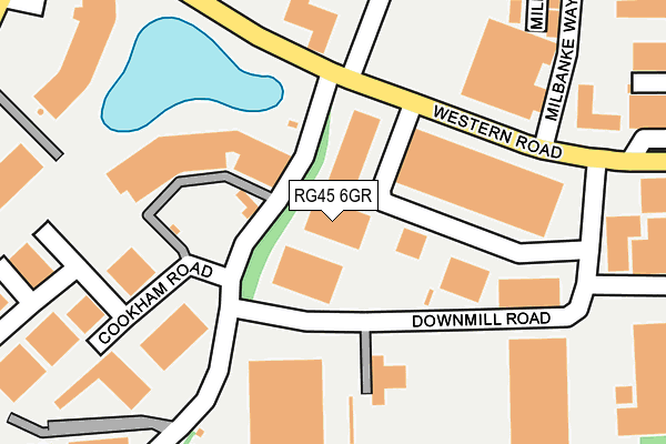
RG45 6GR is located in the Priestwood & Garth electoral ward, within the unitary authority of Bracknell Forest and the English Parliamentary constituency of Bracknell. The Sub Integrated Care Board (ICB) Location is NHS Frimley ICB - D4U1Y and the police force is Thames Valley. This postcode has been in use since December 2000.


GetTheData
Source: OS OpenMap – Local (Ordnance Survey)
Source: OS VectorMap District (Ordnance Survey)
Licence: Open Government Licence (requires attribution)
| Easting | 485581 |
| Northing | 169271 |
| Latitude | 51.416007 |
| Longitude | -0.770736 |
GetTheData
Source: Open Postcode Geo
Licence: Open Government Licence
| Country | England |
| Postcode District | RG45 |
➜ See where RG45 is on a map ➜ Where is Bracknell? | |
GetTheData
Source: Land Registry Price Paid Data
Licence: Open Government Licence
Elevation or altitude of RG45 6GR as distance above sea level:
| Metres | Feet | |
|---|---|---|
| Elevation | 60m | 197ft |
Elevation is measured from the approximate centre of the postcode, to the nearest point on an OS contour line from OS Terrain 50, which has contour spacing of ten vertical metres.
➜ How high above sea level am I? Find the elevation of your current position using your device's GPS.
GetTheData
Source: Open Postcode Elevation
Licence: Open Government Licence
| Ward | Priestwood & Garth |
| Constituency | Bracknell |
GetTheData
Source: ONS Postcode Database
Licence: Open Government Licence
| Vodafone Waterside (Longshot Lane) | Bracknell | 121m |
| Milbanke Way (Western Road) | Western Industrial Area | 168m |
| Farley Moor Lake (Western Road) | Popeswood | 174m |
| Milbanke Way (Western Road) | Western Industrial Area | 178m |
| Farley Moor Lake (Western Road) | Popeswood | 230m |
| Bracknell Station | 1.4km |
| Martins Heron Station | 3.4km |
| Wokingham Station | 5km |
GetTheData
Source: NaPTAN
Licence: Open Government Licence
GetTheData
Source: ONS Postcode Database
Licence: Open Government Licence


➜ Get more ratings from the Food Standards Agency
GetTheData
Source: Food Standards Agency
Licence: FSA terms & conditions
| Last Collection | |||
|---|---|---|---|
| Location | Mon-Fri | Sat | Distance |
| Downsmill Road Meter Box | 18:45 | 87m | |
| Rounds Hill | 16:15 | 11:00 | 358m |
| Bracknell Delivery Office | 18:45 | 12:15 | 493m |
GetTheData
Source: Dracos
Licence: Creative Commons Attribution-ShareAlike
The below table lists the International Territorial Level (ITL) codes (formerly Nomenclature of Territorial Units for Statistics (NUTS) codes) and Local Administrative Units (LAU) codes for RG45 6GR:
| ITL 1 Code | Name |
|---|---|
| TLJ | South East (England) |
| ITL 2 Code | Name |
| TLJ1 | Berkshire, Buckinghamshire and Oxfordshire |
| ITL 3 Code | Name |
| TLJ11 | Berkshire |
| LAU 1 Code | Name |
| E06000036 | Bracknell Forest |
GetTheData
Source: ONS Postcode Directory
Licence: Open Government Licence
The below table lists the Census Output Area (OA), Lower Layer Super Output Area (LSOA), and Middle Layer Super Output Area (MSOA) for RG45 6GR:
| Code | Name | |
|---|---|---|
| OA | E00082050 | |
| LSOA | E01016242 | Bracknell Forest 004D |
| MSOA | E02003355 | Bracknell Forest 004 |
GetTheData
Source: ONS Postcode Directory
Licence: Open Government Licence
| RG12 1TL | Western Road | 184m |
| RG12 1RP | Milbanke Way | 290m |
| RG12 1QS | Downmill Road | 303m |
| RG42 1PD | Rounds Hill | 316m |
| RG12 1RB | Cookham Road | 321m |
| RG42 1PB | Wokingham Road | 348m |
| RG12 1QP | Western Road | 362m |
| RG42 1PR | Ingress Vale | 367m |
| RG42 1PP | Wokingham Road | 368m |
| RG12 1RL | Longshot Industrial Estate | 394m |
GetTheData
Source: Open Postcode Geo; Land Registry Price Paid Data
Licence: Open Government Licence