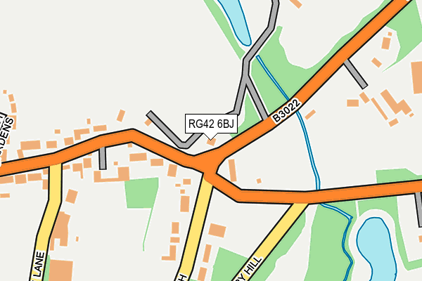
RG42 6BJ is in Warfield, Bracknell. RG42 6BJ is located in the Binfield North & Warfield West electoral ward, within the unitary authority of Bracknell Forest and the English Parliamentary constituency of Windsor. The Sub Integrated Care Board (ICB) Location is NHS Frimley ICB - D4U1Y and the police force is Thames Valley. This postcode has been in use since July 1995.


GetTheData
Source: OS OpenMap – Local (Ordnance Survey)
Source: OS VectorMap District (Ordnance Survey)
Licence: Open Government Licence (requires attribution)
| Easting | 488276 |
| Northing | 171130 |
| Latitude | 51.432306 |
| Longitude | -0.731512 |
GetTheData
Source: Open Postcode Geo
Licence: Open Government Licence
| Locality | Warfield |
| Town/City | Bracknell |
| Country | England |
| Postcode District | RG42 |
➜ See where RG42 is on a map | |
GetTheData
Source: Land Registry Price Paid Data
Licence: Open Government Licence
Elevation or altitude of RG42 6BJ as distance above sea level:
| Metres | Feet | |
|---|---|---|
| Elevation | 60m | 197ft |
Elevation is measured from the approximate centre of the postcode, to the nearest point on an OS contour line from OS Terrain 50, which has contour spacing of ten vertical metres.
➜ How high above sea level am I? Find the elevation of your current position using your device's GPS.
GetTheData
Source: Open Postcode Elevation
Licence: Open Government Licence
| Ward | Binfield North & Warfield West |
| Constituency | Windsor |
GetTheData
Source: ONS Postcode Database
Licence: Open Government Licence
| Five Ways Corner (Forest Road) | Whitegrove | 84m |
| Five Ways Corner (Jiggs Lane North) | Whitegrove | 92m |
| Goose Corner (Forest Road) | Hayley Green | 420m |
| Joseph Court (County Lane) | Whitegrove | 562m |
| Joseph Court (County Lane) | Whitegrove | 577m |
| Bracknell Station | 2.6km |
| Martins Heron Station | 2.8km |
| Ascot Station | 4.8km |
GetTheData
Source: NaPTAN
Licence: Open Government Licence
| Percentage of properties with Next Generation Access | 100.0% |
| Percentage of properties with Superfast Broadband | 50.0% |
| Percentage of properties with Ultrafast Broadband | 0.0% |
| Percentage of properties with Full Fibre Broadband | 0.0% |
Superfast Broadband is between 30Mbps and 300Mbps
Ultrafast Broadband is > 300Mbps
| Percentage of properties unable to receive 2Mbps | 0.0% |
| Percentage of properties unable to receive 5Mbps | 0.0% |
| Percentage of properties unable to receive 10Mbps | 0.0% |
| Percentage of properties unable to receive 30Mbps | 50.0% |
GetTheData
Source: Ofcom
Licence: Ofcom Terms of Use (requires attribution)
GetTheData
Source: ONS Postcode Database
Licence: Open Government Licence


➜ Get more ratings from the Food Standards Agency
GetTheData
Source: Food Standards Agency
Licence: FSA terms & conditions
| Last Collection | |||
|---|---|---|---|
| Location | Mon-Fri | Sat | Distance |
| Warfiled Street | 16:00 | 09:15 | 424m |
| Westmorland Drive | 17:15 | 11:45 | 955m |
| Warfield Road | 16:00 | 11:15 | 1,163m |
GetTheData
Source: Dracos
Licence: Creative Commons Attribution-ShareAlike
The below table lists the International Territorial Level (ITL) codes (formerly Nomenclature of Territorial Units for Statistics (NUTS) codes) and Local Administrative Units (LAU) codes for RG42 6BJ:
| ITL 1 Code | Name |
|---|---|
| TLJ | South East (England) |
| ITL 2 Code | Name |
| TLJ1 | Berkshire, Buckinghamshire and Oxfordshire |
| ITL 3 Code | Name |
| TLJ11 | Berkshire |
| LAU 1 Code | Name |
| E06000036 | Bracknell Forest |
GetTheData
Source: ONS Postcode Directory
Licence: Open Government Licence
The below table lists the Census Output Area (OA), Lower Layer Super Output Area (LSOA), and Middle Layer Super Output Area (MSOA) for RG42 6BJ:
| Code | Name | |
|---|---|---|
| OA | E00081815 | |
| LSOA | E01016186 | Bracknell Forest 002C |
| MSOA | E02003353 | Bracknell Forest 002 |
GetTheData
Source: ONS Postcode Directory
Licence: Open Government Licence
| RG42 6BG | Warfield Street | 127m |
| RG42 3DH | Jigs Lane North | 171m |
| RG42 3DJ | Jigs Lane North | 194m |
| RG42 6BH | Bracknell Road | 208m |
| RG42 6BB | Warfield Street | 264m |
| RG42 6AW | Newhurst Gardens | 325m |
| RG42 6AD | Old Bakery Mews | 353m |
| RG42 6DG | Hayley Green | 392m |
| RG42 6AU | Warfield Street | 398m |
| RG42 3JN | Devon Chase | 416m |
GetTheData
Source: Open Postcode Geo; Land Registry Price Paid Data
Licence: Open Government Licence