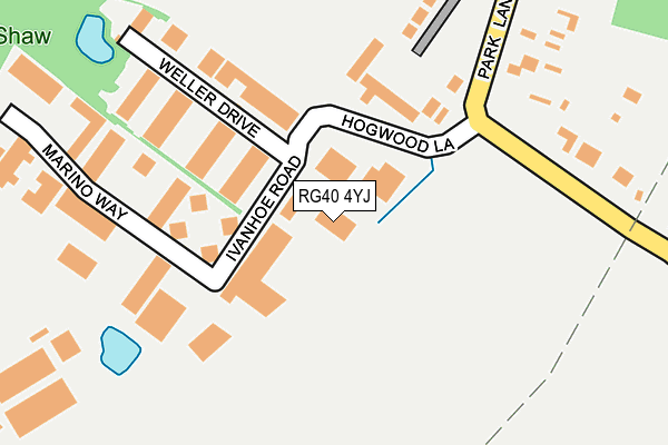
RG40 4YJ is located in the Finchampstead South electoral ward, within the unitary authority of Wokingham and the English Parliamentary constituency of Bracknell. The Sub Integrated Care Board (ICB) Location is NHS Buckinghamshire, Oxfordshire and Berkshire West ICB - 15A and the police force is Thames Valley. This postcode has been in use since July 1995.


GetTheData
Source: OS OpenMap – Local (Ordnance Survey)
Source: OS VectorMap District (Ordnance Survey)
Licence: Open Government Licence (requires attribution)
| Easting | 477289 |
| Northing | 164641 |
| Latitude | 51.375574 |
| Longitude | -0.890937 |
GetTheData
Source: Open Postcode Geo
Licence: Open Government Licence
| Country | England |
| Postcode District | RG40 |
➜ See where RG40 is on a map ➜ Where is Wokingham? | |
GetTheData
Source: Land Registry Price Paid Data
Licence: Open Government Licence
Elevation or altitude of RG40 4YJ as distance above sea level:
| Metres | Feet | |
|---|---|---|
| Elevation | 60m | 197ft |
Elevation is measured from the approximate centre of the postcode, to the nearest point on an OS contour line from OS Terrain 50, which has contour spacing of ten vertical metres.
➜ How high above sea level am I? Find the elevation of your current position using your device's GPS.
GetTheData
Source: Open Postcode Elevation
Licence: Open Government Licence
| Ward | Finchampstead South |
| Constituency | Bracknell |
GetTheData
Source: ONS Postcode Database
Licence: Open Government Licence
| Hogwood Lane Industrial Estate (Park Lane) | Finchampstead | 269m |
| Hogwood Lane Industrial Estate (Park Lane) | Finchampstead | 277m |
| Robinson Crusoe (Park Lane) | Hogwood Lane Industrial Estate | 356m |
| Robinson Crusoe (Park Lane) | Hogwood Lane Industrial Estate | 367m |
| Coleshill Farm (Nine Mile Ride) | Hogwood Lane Industrial Estate | 638m |
| Wokingham Station | 5.2km |
GetTheData
Source: NaPTAN
Licence: Open Government Licence
GetTheData
Source: ONS Postcode Database
Licence: Open Government Licence


➜ Get more ratings from the Food Standards Agency
GetTheData
Source: Food Standards Agency
Licence: FSA terms & conditions
| Last Collection | |||
|---|---|---|---|
| Location | Mon-Fri | Sat | Distance |
| Baird Road | 16:30 | 09:00 | 1,075m |
| Arborfield Camp | 16:30 | 07:45 | 1,084m |
| Arborfield Camp Post Office | 16:45 | 08:15 | 1,389m |
GetTheData
Source: Dracos
Licence: Creative Commons Attribution-ShareAlike
The below table lists the International Territorial Level (ITL) codes (formerly Nomenclature of Territorial Units for Statistics (NUTS) codes) and Local Administrative Units (LAU) codes for RG40 4YJ:
| ITL 1 Code | Name |
|---|---|
| TLJ | South East (England) |
| ITL 2 Code | Name |
| TLJ1 | Berkshire, Buckinghamshire and Oxfordshire |
| ITL 3 Code | Name |
| TLJ11 | Berkshire |
| LAU 1 Code | Name |
| E06000041 | Wokingham |
GetTheData
Source: ONS Postcode Directory
Licence: Open Government Licence
The below table lists the Census Output Area (OA), Lower Layer Super Output Area (LSOA), and Middle Layer Super Output Area (MSOA) for RG40 4YJ:
| Code | Name | |
|---|---|---|
| OA | E00084002 | |
| LSOA | E01016641 | Wokingham 018C |
| MSOA | E02003456 | Wokingham 018 |
GetTheData
Source: ONS Postcode Directory
Licence: Open Government Licence
| RG40 4QW | Hogwood Lane | 59m |
| RG40 4QQ | Ivanhoe Road | 99m |
| RG40 4RF | Marino Way | 200m |
| RG40 4QY | Sheerlands Road | 322m |
| RG40 4PY | Park Lane | 413m |
| RG40 4QE | Park Lane | 531m |
| RG40 4QA | Nine Mile Ride | 554m |
| RG40 4QB | Nine Mile Ride | 597m |
| RG40 4PT | Park Lane | 735m |
| RG40 4QD | Nine Mile Ride | 740m |
GetTheData
Source: Open Postcode Geo; Land Registry Price Paid Data
Licence: Open Government Licence