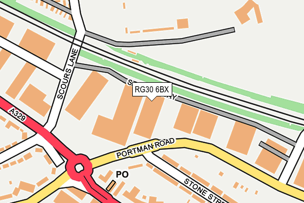
RG30 6BX is located in the Kentwood electoral ward, within the unitary authority of Reading and the English Parliamentary constituency of Reading West. The Sub Integrated Care Board (ICB) Location is NHS Buckinghamshire, Oxfordshire and Berkshire West ICB - 15A and the police force is Thames Valley. This postcode has been in use since July 1995.


GetTheData
Source: OS OpenMap – Local (Ordnance Survey)
Source: OS VectorMap District (Ordnance Survey)
Licence: Open Government Licence (requires attribution)
| Easting | 468734 |
| Northing | 174302 |
| Latitude | 51.463528 |
| Longitude | -1.011956 |
GetTheData
Source: Open Postcode Geo
Licence: Open Government Licence
| Country | England |
| Postcode District | RG30 |
➜ See where RG30 is on a map ➜ Where is Reading? | |
GetTheData
Source: Land Registry Price Paid Data
Licence: Open Government Licence
Elevation or altitude of RG30 6BX as distance above sea level:
| Metres | Feet | |
|---|---|---|
| Elevation | 40m | 131ft |
Elevation is measured from the approximate centre of the postcode, to the nearest point on an OS contour line from OS Terrain 50, which has contour spacing of ten vertical metres.
➜ How high above sea level am I? Find the elevation of your current position using your device's GPS.
GetTheData
Source: Open Postcode Elevation
Licence: Open Government Licence
| Ward | Kentwood |
| Constituency | Reading West |
GetTheData
Source: ONS Postcode Database
Licence: Open Government Licence
| Norcot Junction (A329 Oxford Road) | Norcot | 179m |
| Norcot Junction (A329 Oxford Road) | Norcot | 202m |
| Cold Store (A329 Oxford Road) | Norcot | 258m |
| Cold Store (A329 Oxford Road) | Norcot | 295m |
| Pond House (Oxford Road) | Reading West | 387m |
| Tilehurst Station | 1.5km |
| Reading West Station | 1.8km |
| Reading Station | 2.8km |
GetTheData
Source: NaPTAN
Licence: Open Government Licence
| Median download speed | 15.4Mbps |
| Average download speed | 28.9Mbps |
| Maximum download speed | 80.00Mbps |
| Median upload speed | 1.2Mbps |
| Average upload speed | 6.4Mbps |
| Maximum upload speed | 20.00Mbps |
GetTheData
Source: Ofcom
Licence: Ofcom Terms of Use (requires attribution)
Estimated total energy consumption in RG30 6BX by fuel type, 2015.
| Consumption (kWh) | 115,547 |
|---|---|
| Meter count | 7 |
| Mean (kWh/meter) | 16,507 |
| Median (kWh/meter) | 4,150 |
GetTheData
Source: Postcode level gas estimates: 2015 (experimental)
Source: Postcode level electricity estimates: 2015 (experimental)
Licence: Open Government Licence
GetTheData
Source: ONS Postcode Database
Licence: Open Government Licence


➜ Get more ratings from the Food Standards Agency
GetTheData
Source: Food Standards Agency
Licence: FSA terms & conditions
| Last Collection | |||
|---|---|---|---|
| Location | Mon-Fri | Sat | Distance |
| Norcot Post Office | 18:30 | 14:30 | 164m |
| Craig Avenue | 16:00 | 13:00 | 395m |
| Waitrose Oxford Road | 18:30 | 14:15 | 607m |
GetTheData
Source: Dracos
Licence: Creative Commons Attribution-ShareAlike
| Risk of RG30 6BX flooding from rivers and sea | Low |
| ➜ RG30 6BX flood map | |
GetTheData
Source: Open Flood Risk by Postcode
Licence: Open Government Licence
The below table lists the International Territorial Level (ITL) codes (formerly Nomenclature of Territorial Units for Statistics (NUTS) codes) and Local Administrative Units (LAU) codes for RG30 6BX:
| ITL 1 Code | Name |
|---|---|
| TLJ | South East (England) |
| ITL 2 Code | Name |
| TLJ1 | Berkshire, Buckinghamshire and Oxfordshire |
| ITL 3 Code | Name |
| TLJ11 | Berkshire |
| LAU 1 Code | Name |
| E06000038 | Reading |
GetTheData
Source: ONS Postcode Directory
Licence: Open Government Licence
The below table lists the Census Output Area (OA), Lower Layer Super Output Area (LSOA), and Middle Layer Super Output Area (MSOA) for RG30 6BX:
| Code | Name | |
|---|---|---|
| OA | E00082755 | |
| LSOA | E01016382 | Reading 006B |
| MSOA | E02003394 | Reading 006 |
GetTheData
Source: ONS Postcode Directory
Licence: Open Government Licence
| RG30 1EN | Winslet Place | 162m |
| RG30 1HU | Stone Street | 194m |
| RG30 6YD | Oxford Road | 209m |
| RG30 2QY | Branagh Court | 279m |
| RG30 1EL | Oxford Road | 294m |
| RG30 1HR | Tidmarsh Street | 302m |
| RG30 6AX | Riverside Park | 305m |
| RG30 1HX | Tidmarsh Street | 327m |
| RG30 2QX | Branagh Court | 333m |
| RG30 6AT | Bramshaw Road | 334m |
GetTheData
Source: Open Postcode Geo; Land Registry Price Paid Data
Licence: Open Government Licence