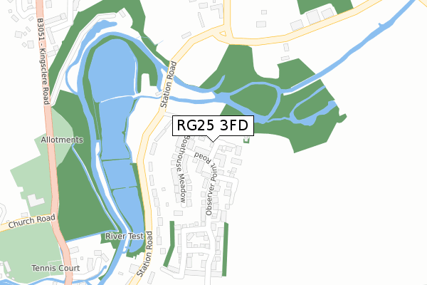
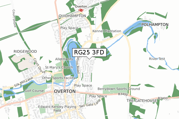
RG25 3FD is located in the Whitchurch, Overton & Laverstoke electoral ward, within the local authority district of Basingstoke and Deane and the English Parliamentary constituency of North West Hampshire. The Sub Integrated Care Board (ICB) Location is NHS Hampshire and Isle of Wight ICB - D9Y0V and the police force is Hampshire. This postcode has been in use since September 2018.


GetTheData
Source: OS Open Zoomstack (Ordnance Survey)
Licence: Open Government Licence (requires attribution)
Attribution: Contains OS data © Crown copyright and database right 2025
Source: Open Postcode Geo
Licence: Open Government Licence (requires attribution)
Attribution: Contains OS data © Crown copyright and database right 2025; Contains Royal Mail data © Royal Mail copyright and database right 2025; Source: Office for National Statistics licensed under the Open Government Licence v.3.0
| Easting | 451877 |
| Northing | 150122 |
| Latitude | 51.247917 |
| Longitude | -1.258106 |
GetTheData
Source: Open Postcode Geo
Licence: Open Government Licence
| Country | England |
| Postcode District | RG25 |
➜ See where RG25 is on a map ➜ Where is Overton? | |
GetTheData
Source: Land Registry Price Paid Data
Licence: Open Government Licence
| Ward | Whitchurch, Overton & Laverstoke |
| Constituency | North West Hampshire |
GetTheData
Source: ONS Postcode Database
Licence: Open Government Licence
2, MILL MEAD, OVERTON, BASINGSTOKE, RG25 3FD 2018 3 OCT £594,995 |
6, MILL MEAD, OVERTON, BASINGSTOKE, RG25 3FD 2018 28 SEP £539,995 |
8, MILL MEAD, OVERTON, BASINGSTOKE, RG25 3FD 2018 28 SEP £504,995 |
4, MILL MEAD, OVERTON, BASINGSTOKE, RG25 3FD 2018 28 SEP £499,995 |
GetTheData
Source: HM Land Registry Price Paid Data
Licence: Contains HM Land Registry data © Crown copyright and database right 2025. This data is licensed under the Open Government Licence v3.0.
| Overton Surgery (Station Road) | Quidhampton | 132m |
| St Mary's Church (Church Road) | Overton | 426m |
| Turnpike Cottages (London Road) | Overton | 470m |
| Turnpike Cottages | Overton | 479m |
| Library (High Street) | Overton | 579m |
| Overton Station | 0.7km |
GetTheData
Source: NaPTAN
Licence: Open Government Licence
| Percentage of properties with Next Generation Access | 100.0% |
| Percentage of properties with Superfast Broadband | 100.0% |
| Percentage of properties with Ultrafast Broadband | 100.0% |
| Percentage of properties with Full Fibre Broadband | 100.0% |
Superfast Broadband is between 30Mbps and 300Mbps
Ultrafast Broadband is > 300Mbps
| Percentage of properties unable to receive 2Mbps | 0.0% |
| Percentage of properties unable to receive 5Mbps | 0.0% |
| Percentage of properties unable to receive 10Mbps | 0.0% |
| Percentage of properties unable to receive 30Mbps | 0.0% |
GetTheData
Source: Ofcom
Licence: Ofcom Terms of Use (requires attribution)
GetTheData
Source: ONS Postcode Database
Licence: Open Government Licence


➜ Get more ratings from the Food Standards Agency
GetTheData
Source: Food Standards Agency
Licence: FSA terms & conditions
| Last Collection | |||
|---|---|---|---|
| Location | Mon-Fri | Sat | Distance |
| The Green | 17:00 | 08:00 | 604m |
| Silk Mill Lane | 16:15 | 07:00 | 660m |
| Overton Station | 16:00 | 08:00 | 679m |
GetTheData
Source: Dracos
Licence: Creative Commons Attribution-ShareAlike
The below table lists the International Territorial Level (ITL) codes (formerly Nomenclature of Territorial Units for Statistics (NUTS) codes) and Local Administrative Units (LAU) codes for RG25 3FD:
| ITL 1 Code | Name |
|---|---|
| TLJ | South East (England) |
| ITL 2 Code | Name |
| TLJ3 | Hampshire and Isle of Wight |
| ITL 3 Code | Name |
| TLJ37 | North Hampshire |
| LAU 1 Code | Name |
| E07000084 | Basingstoke and Deane |
GetTheData
Source: ONS Postcode Directory
Licence: Open Government Licence
The below table lists the Census Output Area (OA), Lower Layer Super Output Area (LSOA), and Middle Layer Super Output Area (MSOA) for RG25 3FD:
| Code | Name | |
|---|---|---|
| OA | E00114574 | |
| LSOA | E01022534 | Basingstoke and Deane 022C |
| MSOA | E02004696 | Basingstoke and Deane 022 |
GetTheData
Source: ONS Postcode Directory
Licence: Open Government Licence
| RG25 3DZ | Station Road | 167m |
| RG25 3PD | Overton Hill | 305m |
| RG25 3PE | Overton Hill | 361m |
| RG25 3DX | Lambs Close | 374m |
| RG25 3DU | Station Road | 377m |
| RG25 3EB | Quidhampton | 385m |
| RG25 3JU | Riverside Close | 395m |
| RG25 3JA | Kingsclere Road | 438m |
| RG25 3TB | Station Road | 460m |
| RG25 3JQ | Foxdown | 466m |
GetTheData
Source: Open Postcode Geo; Land Registry Price Paid Data
Licence: Open Government Licence