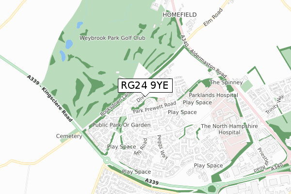
RG24 9YE is located in the Sherborne St John & Rooksdown electoral ward, within the local authority district of Basingstoke and Deane and the English Parliamentary constituency of Basingstoke. The Sub Integrated Care Board (ICB) Location is NHS Hampshire and Isle of Wight ICB - D9Y0V and the police force is Hampshire. This postcode has been in use since December 2017.


GetTheData
Source: OS Open Zoomstack (Ordnance Survey)
Licence: Open Government Licence (requires attribution)
Attribution: Contains OS data © Crown copyright and database right 2025
Source: Open Postcode Geo
Licence: Open Government Licence (requires attribution)
Attribution: Contains OS data © Crown copyright and database right 2025; Contains Royal Mail data © Royal Mail copyright and database right 2025; Source: Office for National Statistics licensed under the Open Government Licence v.3.0
| Easting | 461477 |
| Northing | 154142 |
| Latitude | 51.283109 |
| Longitude | -1.119889 |
GetTheData
Source: Open Postcode Geo
Licence: Open Government Licence
| Country | England |
| Postcode District | RG24 |
➜ See where RG24 is on a map ➜ Where is Basingstoke? | |
GetTheData
Source: Land Registry Price Paid Data
Licence: Open Government Licence
| Ward | Sherborne St John & Rooksdown |
| Constituency | Basingstoke |
GetTheData
Source: ONS Postcode Database
Licence: Open Government Licence
| Fairway House (Park Prewett Road) | Rooksdown | 126m |
| Fairway House (Park Prewett Road) | Rooksdown | 141m |
| Rooksdown Community Centre (Park Prewett Road) | Rooksdown | 262m |
| Rooksdown Community Centre (Park Prewett Road) | Rooksdown | 265m |
| Knowle Road (Park Prewett Road) | Rooksdown | 296m |
| Basingstoke Station | 2.8km |
GetTheData
Source: NaPTAN
Licence: Open Government Licence
| Percentage of properties with Next Generation Access | 100.0% |
| Percentage of properties with Superfast Broadband | 100.0% |
| Percentage of properties with Ultrafast Broadband | 97.1% |
| Percentage of properties with Full Fibre Broadband | 97.1% |
Superfast Broadband is between 30Mbps and 300Mbps
Ultrafast Broadband is > 300Mbps
| Percentage of properties unable to receive 2Mbps | 0.0% |
| Percentage of properties unable to receive 5Mbps | 0.0% |
| Percentage of properties unable to receive 10Mbps | 0.0% |
| Percentage of properties unable to receive 30Mbps | 0.0% |
GetTheData
Source: Ofcom
Licence: Ofcom Terms of Use (requires attribution)
GetTheData
Source: ONS Postcode Database
Licence: Open Government Licence


➜ Get more ratings from the Food Standards Agency
GetTheData
Source: Food Standards Agency
Licence: FSA terms & conditions
| Last Collection | |||
|---|---|---|---|
| Location | Mon-Fri | Sat | Distance |
| Mill Road | 16:00 | 10:00 | 417m |
| Gillies Way | 16:00 | 10:00 | 436m |
| Basingstoke District Hospital | 16:00 | 12:00 | 648m |
GetTheData
Source: Dracos
Licence: Creative Commons Attribution-ShareAlike
The below table lists the International Territorial Level (ITL) codes (formerly Nomenclature of Territorial Units for Statistics (NUTS) codes) and Local Administrative Units (LAU) codes for RG24 9YE:
| ITL 1 Code | Name |
|---|---|
| TLJ | South East (England) |
| ITL 2 Code | Name |
| TLJ3 | Hampshire and Isle of Wight |
| ITL 3 Code | Name |
| TLJ37 | North Hampshire |
| LAU 1 Code | Name |
| E07000084 | Basingstoke and Deane |
GetTheData
Source: ONS Postcode Directory
Licence: Open Government Licence
The below table lists the Census Output Area (OA), Lower Layer Super Output Area (LSOA), and Middle Layer Super Output Area (MSOA) for RG24 9YE:
| Code | Name | |
|---|---|---|
| OA | E00114615 | |
| LSOA | E01032841 | Basingstoke and Deane 010G |
| MSOA | E02004684 | Basingstoke and Deane 010 |
GetTheData
Source: ONS Postcode Directory
Licence: Open Government Licence
| RG24 9RG | Park Prewett Road | 163m |
| RG24 9RD | Greenlands Road | 187m |
| RG24 9RB | Northbrook Crescent | 222m |
| RG24 9RF | Watertower Way | 267m |
| RG24 9RE | Canadian Way | 273m |
| RG24 9RL | Elder Road | 303m |
| RG24 9RN | Knowle Road | 307m |
| RG24 9RR | Idsworth Court | 307m |
| RG24 9ND | Park Prewett Road | 324m |
| RG24 9SD | Nightingale Gardens | 354m |
GetTheData
Source: Open Postcode Geo; Land Registry Price Paid Data
Licence: Open Government Licence