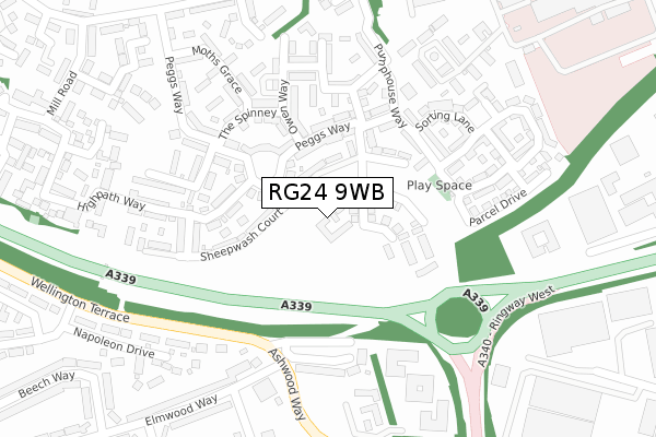
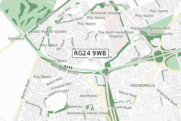
RG24 9WB is located in the Sherborne St John & Rooksdown electoral ward, within the local authority district of Basingstoke and Deane and the English Parliamentary constituency of Basingstoke. The Sub Integrated Care Board (ICB) Location is NHS Hampshire and Isle of Wight ICB - D9Y0V and the police force is Hampshire. This postcode has been in use since October 2018.


GetTheData
Source: OS Open Zoomstack (Ordnance Survey)
Licence: Open Government Licence (requires attribution)
Attribution: Contains OS data © Crown copyright and database right 2025
Source: Open Postcode Geo
Licence: Open Government Licence (requires attribution)
Attribution: Contains OS data © Crown copyright and database right 2025; Contains Royal Mail data © Royal Mail copyright and database right 2025; Source: Office for National Statistics licensed under the Open Government Licence v.3.0
| Easting | 461812 |
| Northing | 153466 |
| Latitude | 51.276995 |
| Longitude | -1.115203 |
GetTheData
Source: Open Postcode Geo
Licence: Open Government Licence
| Country | England |
| Postcode District | RG24 |
➜ See where RG24 is on a map ➜ Where is Basingstoke? | |
GetTheData
Source: Land Registry Price Paid Data
Licence: Open Government Licence
| Ward | Sherborne St John & Rooksdown |
| Constituency | Basingstoke |
GetTheData
Source: ONS Postcode Database
Licence: Open Government Licence
| Ashwood Way | Winklebury | 270m |
| Dunsford Crescent (Wellington Terrace) | Winklebury | 307m |
| Ashwood Way | Winklebury | 334m |
| Harness House (Private Road Park Prewett Hospital) | Rooksdown | 383m |
| Harness House (Private Road Park Prewett Hospital) | Rooksdown | 383m |
| Basingstoke Station | 2.2km |
GetTheData
Source: NaPTAN
Licence: Open Government Licence
GetTheData
Source: ONS Postcode Database
Licence: Open Government Licence


➜ Get more ratings from the Food Standards Agency
GetTheData
Source: Food Standards Agency
Licence: FSA terms & conditions
| Last Collection | |||
|---|---|---|---|
| Location | Mon-Fri | Sat | Distance |
| Wellington Terrace | 16:00 | 12:00 | 337m |
| Mill Road | 16:00 | 10:00 | 456m |
| Basingstoke Delivery Office | 18:45 | 12:45 | 575m |
GetTheData
Source: Dracos
Licence: Creative Commons Attribution-ShareAlike
The below table lists the International Territorial Level (ITL) codes (formerly Nomenclature of Territorial Units for Statistics (NUTS) codes) and Local Administrative Units (LAU) codes for RG24 9WB:
| ITL 1 Code | Name |
|---|---|
| TLJ | South East (England) |
| ITL 2 Code | Name |
| TLJ3 | Hampshire and Isle of Wight |
| ITL 3 Code | Name |
| TLJ37 | North Hampshire |
| LAU 1 Code | Name |
| E07000084 | Basingstoke and Deane |
GetTheData
Source: ONS Postcode Directory
Licence: Open Government Licence
The below table lists the Census Output Area (OA), Lower Layer Super Output Area (LSOA), and Middle Layer Super Output Area (MSOA) for RG24 9WB:
| Code | Name | |
|---|---|---|
| OA | E00167838 | |
| LSOA | E01032840 | Basingstoke and Deane 010F |
| MSOA | E02004684 | Basingstoke and Deane 010 |
GetTheData
Source: ONS Postcode Directory
Licence: Open Government Licence
| RG24 9GW | Sheepwash Court | 86m |
| RG24 9WN | Peggs Way | 131m |
| RG24 9GX | Cutting Drive | 137m |
| RG24 9FX | Peggs Way | 144m |
| RG24 9WP | Peggs Way | 154m |
| RG24 9GJ | The Spinney | 188m |
| RG24 9GY | Pumphouse Way | 205m |
| RG24 9GH | Owen Way | 209m |
| RG24 9SW | Basswood Drive | 210m |
| RG24 9GU | Downside Close | 224m |
GetTheData
Source: Open Postcode Geo; Land Registry Price Paid Data
Licence: Open Government Licence