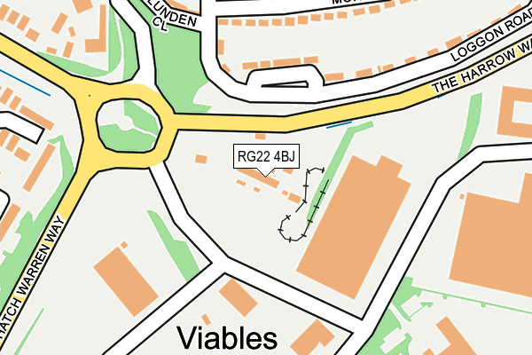
RG22 4BJ is located in the Eastrop & Grove electoral ward, within the local authority district of Basingstoke and Deane and the English Parliamentary constituency of Basingstoke. The Sub Integrated Care Board (ICB) Location is NHS Hampshire and Isle of Wight ICB - D9Y0V and the police force is Hampshire. This postcode has been in use since September 1991.


GetTheData
Source: OS OpenMap – Local (Ordnance Survey)
Source: OS VectorMap District (Ordnance Survey)
Licence: Open Government Licence (requires attribution)
| Easting | 463128 |
| Northing | 150246 |
| Latitude | 51.247901 |
| Longitude | -1.096906 |
GetTheData
Source: Open Postcode Geo
Licence: Open Government Licence
| Country | England |
| Postcode District | RG22 |
➜ See where RG22 is on a map ➜ Where is Basingstoke? | |
GetTheData
Source: Land Registry Price Paid Data
Licence: Open Government Licence
Elevation or altitude of RG22 4BJ as distance above sea level:
| Metres | Feet | |
|---|---|---|
| Elevation | 100m | 328ft |
Elevation is measured from the approximate centre of the postcode, to the nearest point on an OS contour line from OS Terrain 50, which has contour spacing of ten vertical metres.
➜ How high above sea level am I? Find the elevation of your current position using your device's GPS.
GetTheData
Source: Open Postcode Elevation
Licence: Open Government Licence
| Ward | Eastrop & Grove |
| Constituency | Basingstoke |
GetTheData
Source: ONS Postcode Database
Licence: Open Government Licence
| Viables Roundabout | Brighton Hill | 62m |
| Viables Industrial Estate (Jays Close) | Viables | 107m |
| Viables Roundabout (Jays Close) | Brighton Hill | 114m |
| Viables Industrial Estate (Jays Close) | Viables | 179m |
| Viables Industrial Estate | Cranbourne | 229m |
| Basingstoke Station | 2.4km |
GetTheData
Source: NaPTAN
Licence: Open Government Licence
GetTheData
Source: ONS Postcode Database
Licence: Open Government Licence


➜ Get more ratings from the Food Standards Agency
GetTheData
Source: Food Standards Agency
Licence: FSA terms & conditions
| Last Collection | |||
|---|---|---|---|
| Location | Mon-Fri | Sat | Distance |
| Cranbourne Lane | 17:00 | 10:30 | 331m |
| Shepherd Road | 17:00 | 10:30 | 479m |
| Kingsmill Post Office | 17:00 | 12:00 | 616m |
GetTheData
Source: Dracos
Licence: Creative Commons Attribution-ShareAlike
The below table lists the International Territorial Level (ITL) codes (formerly Nomenclature of Territorial Units for Statistics (NUTS) codes) and Local Administrative Units (LAU) codes for RG22 4BJ:
| ITL 1 Code | Name |
|---|---|
| TLJ | South East (England) |
| ITL 2 Code | Name |
| TLJ3 | Hampshire and Isle of Wight |
| ITL 3 Code | Name |
| TLJ37 | North Hampshire |
| LAU 1 Code | Name |
| E07000084 | Basingstoke and Deane |
GetTheData
Source: ONS Postcode Directory
Licence: Open Government Licence
The below table lists the Census Output Area (OA), Lower Layer Super Output Area (LSOA), and Middle Layer Super Output Area (MSOA) for RG22 4BJ:
| Code | Name | |
|---|---|---|
| OA | E00114421 | |
| LSOA | E01022505 | Basingstoke and Deane 016E |
| MSOA | E02004690 | Basingstoke and Deane 016 |
GetTheData
Source: ONS Postcode Directory
Licence: Open Government Licence
| RG21 3PF | Loggon Road | 163m |
| RG21 3LJ | Morley Road | 210m |
| RG21 3PE | Blunden Close | 239m |
| RG21 3LH | Morley Road | 241m |
| RG21 3LW | Morley Road | 243m |
| RG21 3LL | Meadow Road | 269m |
| RG22 4JR | Porter Road | 273m |
| RG21 3LN | Kathleen Close | 280m |
| RG21 3PB | Loggon Road | 291m |
| RG21 3PA | Loggon Road | 303m |
GetTheData
Source: Open Postcode Geo; Land Registry Price Paid Data
Licence: Open Government Licence