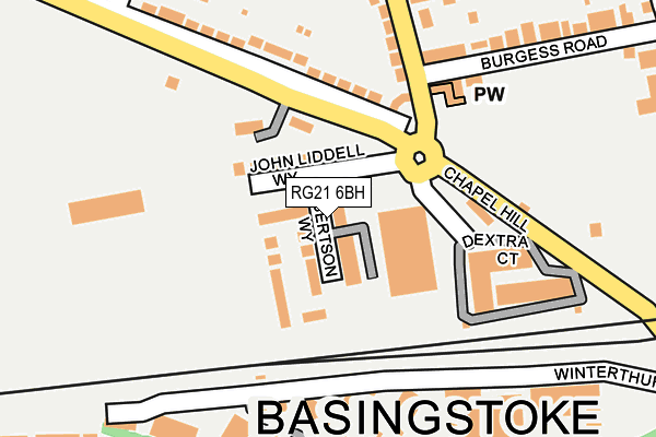
RG21 6BH is located in the Norden electoral ward, within the local authority district of Basingstoke and Deane and the English Parliamentary constituency of Basingstoke. The Sub Integrated Care Board (ICB) Location is NHS Hampshire and Isle of Wight ICB - D9Y0V and the police force is Hampshire. This postcode has been in use since June 2017.


GetTheData
Source: OS OpenMap – Local (Ordnance Survey)
Source: OS VectorMap District (Ordnance Survey)
Licence: Open Government Licence (requires attribution)
| Easting | 463294 |
| Northing | 152588 |
| Latitude | 51.268939 |
| Longitude | -1.094114 |
GetTheData
Source: Open Postcode Geo
Licence: Open Government Licence
| Country | England |
| Postcode District | RG21 |
➜ See where RG21 is on a map ➜ Where is Basingstoke? | |
GetTheData
Source: Land Registry Price Paid Data
Licence: Open Government Licence
| Ward | Norden |
| Constituency | Basingstoke |
GetTheData
Source: ONS Postcode Database
Licence: Open Government Licence
| The Rising Sun (Chapel Hill) | South View | 176m |
| The Rising Sun (Chapel Hill) | South View | 178m |
| Eli Lilly (Kingsclere Road) | Houndmills | 263m |
| Victory Roundabout (Alencon Link) | Basingstoke | 274m |
| Sherborne Road (Cromwell Road) | South View | 284m |
| Basingstoke Station | 0.5km |
GetTheData
Source: NaPTAN
Licence: Open Government Licence
| Percentage of properties with Next Generation Access | 100.0% |
| Percentage of properties with Superfast Broadband | 100.0% |
| Percentage of properties with Ultrafast Broadband | 100.0% |
| Percentage of properties with Full Fibre Broadband | 100.0% |
Superfast Broadband is between 30Mbps and 300Mbps
Ultrafast Broadband is > 300Mbps
| Percentage of properties unable to receive 2Mbps | 0.0% |
| Percentage of properties unable to receive 5Mbps | 0.0% |
| Percentage of properties unable to receive 10Mbps | 0.0% |
| Percentage of properties unable to receive 30Mbps | 0.0% |
GetTheData
Source: Ofcom
Licence: Ofcom Terms of Use (requires attribution)
GetTheData
Source: ONS Postcode Database
Licence: Open Government Licence


➜ Get more ratings from the Food Standards Agency
GetTheData
Source: Food Standards Agency
Licence: FSA terms & conditions
| Last Collection | |||
|---|---|---|---|
| Location | Mon-Fri | Sat | Distance |
| London Street Meter Box | 18:30 | 128m | |
| Cromwell Road | 17:00 | 10:30 | 281m |
| Lancaster Road | 17:00 | 10:30 | 288m |
GetTheData
Source: Dracos
Licence: Creative Commons Attribution-ShareAlike
The below table lists the International Territorial Level (ITL) codes (formerly Nomenclature of Territorial Units for Statistics (NUTS) codes) and Local Administrative Units (LAU) codes for RG21 6BH:
| ITL 1 Code | Name |
|---|---|
| TLJ | South East (England) |
| ITL 2 Code | Name |
| TLJ3 | Hampshire and Isle of Wight |
| ITL 3 Code | Name |
| TLJ37 | North Hampshire |
| LAU 1 Code | Name |
| E07000084 | Basingstoke and Deane |
GetTheData
Source: ONS Postcode Directory
Licence: Open Government Licence
The below table lists the Census Output Area (OA), Lower Layer Super Output Area (LSOA), and Middle Layer Super Output Area (MSOA) for RG21 6BH:
| Code | Name | |
|---|---|---|
| OA | E00114535 | |
| LSOA | E01022526 | Basingstoke and Deane 009C |
| MSOA | E02004683 | Basingstoke and Deane 009 |
GetTheData
Source: ONS Postcode Directory
Licence: Open Government Licence
| RG21 7UF | Winterthur Way | 134m |
| RG21 7UH | Winterthur Way | 138m |
| RG21 7UG | Winterthur Way | 139m |
| RG21 5TB | Chapel Hill | 158m |
| RG21 7UN | Winterthur Way | 173m |
| RG21 5UH | Chapel Hill | 175m |
| RG21 7UQ | Winterthur Way | 178m |
| RG21 7UE | Winterthur Way | 185m |
| RG21 5UQ | Kingsclere Road | 197m |
| RG21 7UW | Winterthur Way | 202m |
GetTheData
Source: Open Postcode Geo; Land Registry Price Paid Data
Licence: Open Government Licence