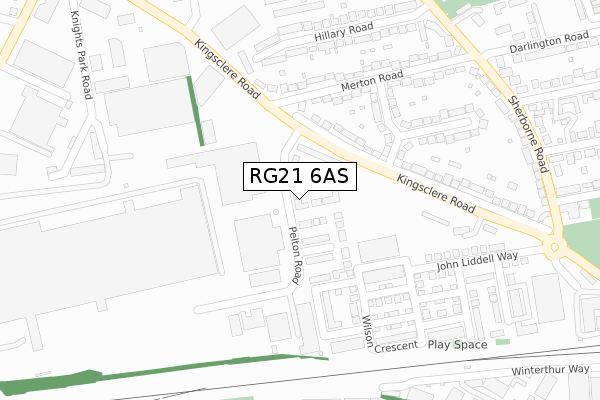
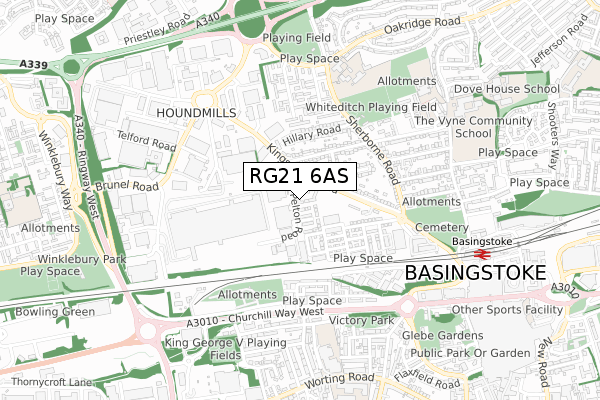
RG21 6AS is located in the Norden electoral ward, within the local authority district of Basingstoke and Deane and the English Parliamentary constituency of Basingstoke. The Sub Integrated Care Board (ICB) Location is NHS Hampshire and Isle of Wight ICB - D9Y0V and the police force is Hampshire. This postcode has been in use since August 2019.


GetTheData
Source: OS Open Zoomstack (Ordnance Survey)
Licence: Open Government Licence (requires attribution)
Attribution: Contains OS data © Crown copyright and database right 2025
Source: Open Postcode Geo
Licence: Open Government Licence (requires attribution)
Attribution: Contains OS data © Crown copyright and database right 2025; Contains Royal Mail data © Royal Mail copyright and database right 2025; Source: Office for National Statistics licensed under the Open Government Licence v.3.0
| Easting | 462997 |
| Northing | 152759 |
| Latitude | 51.270509 |
| Longitude | -1.098341 |
GetTheData
Source: Open Postcode Geo
Licence: Open Government Licence
| Country | England |
| Postcode District | RG21 |
➜ See where RG21 is on a map ➜ Where is Basingstoke? | |
GetTheData
Source: Land Registry Price Paid Data
Licence: Open Government Licence
| Ward | Norden |
| Constituency | Basingstoke |
GetTheData
Source: ONS Postcode Database
Licence: Open Government Licence
| Merton Road | Houndmills | 93m |
| Eli Lilly (Kingsclere Road) | Houndmills | 148m |
| Lancaster Road (Merton Road) | South View | 233m |
| Merton Road (Kingsclere Road) | Houndmills | 266m |
| Merton Road (Sherborne Road) | South View | 359m |
| Basingstoke Station | 0.8km |
GetTheData
Source: NaPTAN
Licence: Open Government Licence
GetTheData
Source: ONS Postcode Database
Licence: Open Government Licence


➜ Get more ratings from the Food Standards Agency
GetTheData
Source: Food Standards Agency
Licence: FSA terms & conditions
| Last Collection | |||
|---|---|---|---|
| Location | Mon-Fri | Sat | Distance |
| Lancaster Road | 17:00 | 10:30 | 145m |
| London Street Meter Box | 18:30 | 284m | |
| Cromwell Road | 17:00 | 10:30 | 403m |
GetTheData
Source: Dracos
Licence: Creative Commons Attribution-ShareAlike
The below table lists the International Territorial Level (ITL) codes (formerly Nomenclature of Territorial Units for Statistics (NUTS) codes) and Local Administrative Units (LAU) codes for RG21 6AS:
| ITL 1 Code | Name |
|---|---|
| TLJ | South East (England) |
| ITL 2 Code | Name |
| TLJ3 | Hampshire and Isle of Wight |
| ITL 3 Code | Name |
| TLJ37 | North Hampshire |
| LAU 1 Code | Name |
| E07000084 | Basingstoke and Deane |
GetTheData
Source: ONS Postcode Directory
Licence: Open Government Licence
The below table lists the Census Output Area (OA), Lower Layer Super Output Area (LSOA), and Middle Layer Super Output Area (MSOA) for RG21 6AS:
| Code | Name | |
|---|---|---|
| OA | E00114515 | |
| LSOA | E01022526 | Basingstoke and Deane 009C |
| MSOA | E02004683 | Basingstoke and Deane 009 |
GetTheData
Source: ONS Postcode Directory
Licence: Open Government Licence
| RG21 5UD | Kingsclere Road | 130m |
| RG21 5UF | Lancaster Road | 165m |
| RG21 5UB | Merton Road | 209m |
| RG21 5UE | Lancaster Road | 240m |
| RG21 5UQ | Kingsclere Road | 265m |
| RG21 5TN | Hillary Road | 275m |
| RG21 5UA | Merton Road | 291m |
| RG21 5TW | Hillary Road | 297m |
| RG21 5TU | Millard Close | 346m |
| RG21 5TQ | Sherborne Road | 349m |
GetTheData
Source: Open Postcode Geo; Land Registry Price Paid Data
Licence: Open Government Licence