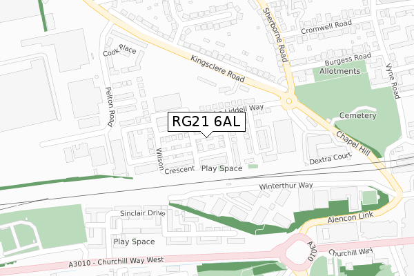
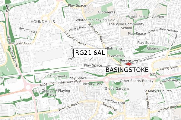
RG21 6AL is located in the Norden electoral ward, within the local authority district of Basingstoke and Deane and the English Parliamentary constituency of Basingstoke. The Sub Integrated Care Board (ICB) Location is NHS Hampshire and Isle of Wight ICB - D9Y0V and the police force is Hampshire. This postcode has been in use since February 2018.


GetTheData
Source: OS Open Zoomstack (Ordnance Survey)
Licence: Open Government Licence (requires attribution)
Attribution: Contains OS data © Crown copyright and database right 2025
Source: Open Postcode Geo
Licence: Open Government Licence (requires attribution)
Attribution: Contains OS data © Crown copyright and database right 2025; Contains Royal Mail data © Royal Mail copyright and database right 2025; Source: Office for National Statistics licensed under the Open Government Licence v.3.0
| Easting | 463195 |
| Northing | 152594 |
| Latitude | 51.269004 |
| Longitude | -1.095532 |
GetTheData
Source: Open Postcode Geo
Licence: Open Government Licence
| Country | England |
| Postcode District | RG21 |
➜ See where RG21 is on a map ➜ Where is Basingstoke? | |
GetTheData
Source: Land Registry Price Paid Data
Licence: Open Government Licence
| Ward | Norden |
| Constituency | Basingstoke |
GetTheData
Source: ONS Postcode Database
Licence: Open Government Licence
2023 14 JUL £317,000 |
2023 22 JUN £320,000 |
2022 25 MAR £330,000 |
2020 20 NOV £294,995 |
3, HASLER PLACE, BASINGSTOKE, RG21 6AL 2018 23 APR £282,995 |
2018 19 APR £282,995 |
2018 6 MAR £279,995 |
2018 1 MAR £279,995 |
GetTheData
Source: HM Land Registry Price Paid Data
Licence: Contains HM Land Registry data © Crown copyright and database right 2025. This data is licensed under the Open Government Licence v3.0.
| Eli Lilly (Kingsclere Road) | Houndmills | 214m |
| The Rising Sun (Chapel Hill) | South View | 271m |
| The Rising Sun (Chapel Hill) | South View | 275m |
| Sinclair Drive (Churchill Way West) | Brookvale | 309m |
| Merton Road | Houndmills | 325m |
| Basingstoke Station | 0.6km |
GetTheData
Source: NaPTAN
Licence: Open Government Licence
| Percentage of properties with Next Generation Access | 100.0% |
| Percentage of properties with Superfast Broadband | 100.0% |
| Percentage of properties with Ultrafast Broadband | 100.0% |
| Percentage of properties with Full Fibre Broadband | 100.0% |
Superfast Broadband is between 30Mbps and 300Mbps
Ultrafast Broadband is > 300Mbps
| Percentage of properties unable to receive 2Mbps | 0.0% |
| Percentage of properties unable to receive 5Mbps | 0.0% |
| Percentage of properties unable to receive 10Mbps | 0.0% |
| Percentage of properties unable to receive 30Mbps | 0.0% |
GetTheData
Source: Ofcom
Licence: Ofcom Terms of Use (requires attribution)
GetTheData
Source: ONS Postcode Database
Licence: Open Government Licence


➜ Get more ratings from the Food Standards Agency
GetTheData
Source: Food Standards Agency
Licence: FSA terms & conditions
| Last Collection | |||
|---|---|---|---|
| Location | Mon-Fri | Sat | Distance |
| London Street Meter Box | 18:30 | 147m | |
| Lancaster Road | 17:00 | 10:30 | 239m |
| Cromwell Road | 17:00 | 10:30 | 323m |
GetTheData
Source: Dracos
Licence: Creative Commons Attribution-ShareAlike
The below table lists the International Territorial Level (ITL) codes (formerly Nomenclature of Territorial Units for Statistics (NUTS) codes) and Local Administrative Units (LAU) codes for RG21 6AL:
| ITL 1 Code | Name |
|---|---|
| TLJ | South East (England) |
| ITL 2 Code | Name |
| TLJ3 | Hampshire and Isle of Wight |
| ITL 3 Code | Name |
| TLJ37 | North Hampshire |
| LAU 1 Code | Name |
| E07000084 | Basingstoke and Deane |
GetTheData
Source: ONS Postcode Directory
Licence: Open Government Licence
The below table lists the Census Output Area (OA), Lower Layer Super Output Area (LSOA), and Middle Layer Super Output Area (MSOA) for RG21 6AL:
| Code | Name | |
|---|---|---|
| OA | E00114515 | |
| LSOA | E01022526 | Basingstoke and Deane 009C |
| MSOA | E02004683 | Basingstoke and Deane 009 |
GetTheData
Source: ONS Postcode Directory
Licence: Open Government Licence
| RG21 7UW | Winterthur Way | 164m |
| RG21 7UN | Winterthur Way | 169m |
| RG21 7UF | Winterthur Way | 171m |
| RG21 7UG | Winterthur Way | 176m |
| RG21 7UH | Winterthur Way | 197m |
| RG21 5UQ | Kingsclere Road | 199m |
| RG21 7UQ | Winterthur Way | 199m |
| RG21 6AG | Sinclair Drive | 209m |
| RG21 7UE | Winterthur Way | 229m |
| RG21 6AE | Sinclair Drive | 251m |
GetTheData
Source: Open Postcode Geo; Land Registry Price Paid Data
Licence: Open Government Licence