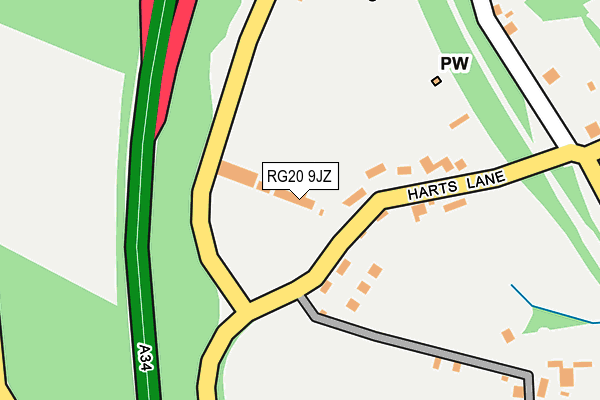
RG20 9JZ is located in the Evingar electoral ward, within the local authority district of Basingstoke and Deane and the English Parliamentary constituency of North West Hampshire. The Sub Integrated Care Board (ICB) Location is NHS Hampshire and Isle of Wight ICB - D9Y0V and the police force is Hampshire. This postcode has been in use since July 1995.


GetTheData
Source: OS OpenMap – Local (Ordnance Survey)
Source: OS VectorMap District (Ordnance Survey)
Licence: Open Government Licence (requires attribution)
| Easting | 446167 |
| Northing | 160748 |
| Latitude | 51.343948 |
| Longitude | -1.338555 |
GetTheData
Source: Open Postcode Geo
Licence: Open Government Licence
| Country | England |
| Postcode District | RG20 |
➜ See where RG20 is on a map ➜ Where is Burghclere? | |
GetTheData
Source: Land Registry Price Paid Data
Licence: Open Government Licence
Elevation or altitude of RG20 9JZ as distance above sea level:
| Metres | Feet | |
|---|---|---|
| Elevation | 140m | 459ft |
Elevation is measured from the approximate centre of the postcode, to the nearest point on an OS contour line from OS Terrain 50, which has contour spacing of ten vertical metres.
➜ How high above sea level am I? Find the elevation of your current position using your device's GPS.
GetTheData
Source: Open Postcode Elevation
Licence: Open Government Licence
| Ward | Evingar |
| Constituency | North West Hampshire |
GetTheData
Source: ONS Postcode Database
Licence: Open Government Licence
| Carpenters Arms (Harts Lane) | Burghclere | 133m |
| Breachfield (Harts Lane) | Burghclere | 621m |
| Breachfield (Harts Lane) | Burghclere | 684m |
| Primary School (Church Lane) | Burghclere | 976m |
| Harts Lane (Well Street) | Burghclere | 1,164m |
GetTheData
Source: NaPTAN
Licence: Open Government Licence
GetTheData
Source: ONS Postcode Database
Licence: Open Government Licence


➜ Get more ratings from the Food Standards Agency
GetTheData
Source: Food Standards Agency
Licence: FSA terms & conditions
| Last Collection | |||
|---|---|---|---|
| Location | Mon-Fri | Sat | Distance |
| Hichclere Station | 16:30 | 10:45 | 451m |
| Church Lane, Burghclere | 16:45 | 10:45 | 999m |
| Dodds Farm | 16:30 | 08:30 | 1,035m |
GetTheData
Source: Dracos
Licence: Creative Commons Attribution-ShareAlike
The below table lists the International Territorial Level (ITL) codes (formerly Nomenclature of Territorial Units for Statistics (NUTS) codes) and Local Administrative Units (LAU) codes for RG20 9JZ:
| ITL 1 Code | Name |
|---|---|
| TLJ | South East (England) |
| ITL 2 Code | Name |
| TLJ3 | Hampshire and Isle of Wight |
| ITL 3 Code | Name |
| TLJ37 | North Hampshire |
| LAU 1 Code | Name |
| E07000084 | Basingstoke and Deane |
GetTheData
Source: ONS Postcode Directory
Licence: Open Government Licence
The below table lists the Census Output Area (OA), Lower Layer Super Output Area (LSOA), and Middle Layer Super Output Area (MSOA) for RG20 9JZ:
| Code | Name | |
|---|---|---|
| OA | E00114344 | |
| LSOA | E01022489 | Basingstoke and Deane 003B |
| MSOA | E02004677 | Basingstoke and Deane 003 |
GetTheData
Source: ONS Postcode Directory
Licence: Open Government Licence
| RG20 9JU | Harts Lane | 59m |
| RG20 9JY | Harts Lane | 105m |
| RG20 9JT | Harts Lane | 132m |
| RG20 9JR | Pound Lane | 272m |
| RG20 9AH | Laurel Bank | 365m |
| RG20 9JS | Ox Drove | 442m |
| RG20 9JN | Harts Lane | 449m |
| RG20 9JW | Harts Lane | 465m |
| RG20 9JP | Spring Lane | 501m |
| RG20 9HZ | Breachfield | 608m |
GetTheData
Source: Open Postcode Geo; Land Registry Price Paid Data
Licence: Open Government Licence