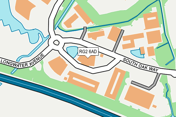
RG2 6AD is located in the Shinfield South electoral ward, within the unitary authority of Wokingham and the English Parliamentary constituency of Wokingham. The Sub Integrated Care Board (ICB) Location is NHS Buckinghamshire, Oxfordshire and Berkshire West ICB - 15A and the police force is Thames Valley. This postcode has been in use since October 2009.


GetTheData
Source: OS OpenMap – Local (Ordnance Survey)
Source: OS VectorMap District (Ordnance Survey)
Licence: Open Government Licence (requires attribution)
| Easting | 470343 |
| Northing | 169442 |
| Latitude | 51.419637 |
| Longitude | -0.989784 |
GetTheData
Source: Open Postcode Geo
Licence: Open Government Licence
| Country | England |
| Postcode District | RG2 |
➜ See where RG2 is on a map ➜ Where is Reading? | |
GetTheData
Source: Land Registry Price Paid Data
Licence: Open Government Licence
Elevation or altitude of RG2 6AD as distance above sea level:
| Metres | Feet | |
|---|---|---|
| Elevation | 40m | 131ft |
Elevation is measured from the approximate centre of the postcode, to the nearest point on an OS contour line from OS Terrain 50, which has contour spacing of ten vertical metres.
➜ How high above sea level am I? Find the elevation of your current position using your device's GPS.
GetTheData
Source: Open Postcode Elevation
Licence: Open Government Licence
| Ward | Shinfield South |
| Constituency | Wokingham |
GetTheData
Source: ONS Postcode Database
Licence: Open Government Licence
| 500 South Oak Way (South Oak Way) | Greenpark | 58m |
| Lime Square (South Oak Way) | Greenpark | 126m |
| Lime Square (South Oak Way) | Greenpark | 168m |
| 500 Brook Drive (Brook Drive) | Greenpark | 197m |
| 400 Brook Drive (Brook Drive) | Greenpark | 253m |
| Reading West Station | 4km |
| Reading Station | 4.5km |
| Earley Station | 5.5km |
GetTheData
Source: NaPTAN
Licence: Open Government Licence
GetTheData
Source: ONS Postcode Database
Licence: Open Government Licence


➜ Get more ratings from the Food Standards Agency
GetTheData
Source: Food Standards Agency
Licence: FSA terms & conditions
| Last Collection | |||
|---|---|---|---|
| Location | Mon-Fri | Sat | Distance |
| Post House | 17:15 | 13:15 | 1,362m |
| Lower Basingstoke Road | 17:00 | 13:15 | 1,448m |
| Lindisfarne Way | 17:30 | 12:00 | 1,592m |
GetTheData
Source: Dracos
Licence: Creative Commons Attribution-ShareAlike
| Risk of RG2 6AD flooding from rivers and sea | Low |
| ➜ RG2 6AD flood map | |
GetTheData
Source: Open Flood Risk by Postcode
Licence: Open Government Licence
The below table lists the International Territorial Level (ITL) codes (formerly Nomenclature of Territorial Units for Statistics (NUTS) codes) and Local Administrative Units (LAU) codes for RG2 6AD:
| ITL 1 Code | Name |
|---|---|
| TLJ | South East (England) |
| ITL 2 Code | Name |
| TLJ1 | Berkshire, Buckinghamshire and Oxfordshire |
| ITL 3 Code | Name |
| TLJ11 | Berkshire |
| LAU 1 Code | Name |
| E06000041 | Wokingham |
GetTheData
Source: ONS Postcode Directory
Licence: Open Government Licence
The below table lists the Census Output Area (OA), Lower Layer Super Output Area (LSOA), and Middle Layer Super Output Area (MSOA) for RG2 6AD:
| Code | Name | |
|---|---|---|
| OA | E00084199 | |
| LSOA | E01016682 | Wokingham 017A |
| MSOA | E02003455 | Wokingham 017 |
GetTheData
Source: ONS Postcode Directory
Licence: Open Government Licence
| RG2 0FL | 530m | |
| RG7 1NH | Hartley Court Road | 550m |
| RG2 0RJ | Mayfield Trade Centre | 890m |
| RG2 0SU | Acre Road | 999m |
| RG30 3UJ | 1093m | |
| RG30 3UL | 1139m | |
| RG30 3UG | Keepers Cottages | 1145m |
| RG7 1NS | Hartley Court Road | 1197m |
| RG7 1NU | Great Lea | 1217m |
| RG2 0QX | Bennet Road | 1261m |
GetTheData
Source: Open Postcode Geo; Land Registry Price Paid Data
Licence: Open Government Licence