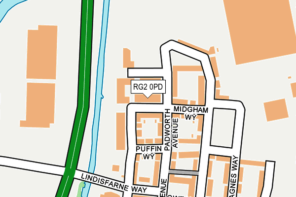
RG2 0PD is located in the Whitley electoral ward, within the unitary authority of Reading and the English Parliamentary constituency of Reading West. The Sub Integrated Care Board (ICB) Location is NHS Buckinghamshire, Oxfordshire and Berkshire West ICB - 15A and the police force is Thames Valley. This postcode has been in use since June 2017.


GetTheData
Source: OS OpenMap – Local (Ordnance Survey)
Source: OS VectorMap District (Ordnance Survey)
Licence: Open Government Licence (requires attribution)
| Easting | 471265 |
| Northing | 170909 |
| Latitude | 51.432712 |
| Longitude | -0.976211 |
GetTheData
Source: Open Postcode Geo
Licence: Open Government Licence
| Country | England |
| Postcode District | RG2 |
➜ See where RG2 is on a map ➜ Where is Reading? | |
GetTheData
Source: Land Registry Price Paid Data
Licence: Open Government Licence
| Ward | Whitley |
| Constituency | Reading West |
GetTheData
Source: ONS Postcode Database
Licence: Open Government Licence
| Hilton Hotel (Drake Way) | Kennet Island | 183m |
| Hilton Hotel (Drake Way) | Kennet Island | 192m |
| Central Piazza (Lindisfarne Way) | Kennet Island | 219m |
| Kennet Island Turn (A33) | Kennet Island | 230m |
| Central Piazza (Lindisfarne Way) | Kennet Island | 243m |
| Reading West Station | 2.7km |
| Reading Station | 2.9km |
| Earley Station | 4.2km |
GetTheData
Source: NaPTAN
Licence: Open Government Licence
| Percentage of properties with Next Generation Access | 100.0% |
| Percentage of properties with Superfast Broadband | 100.0% |
| Percentage of properties with Ultrafast Broadband | 100.0% |
| Percentage of properties with Full Fibre Broadband | 100.0% |
Superfast Broadband is between 30Mbps and 300Mbps
Ultrafast Broadband is > 300Mbps
| Median download speed | 3.5Mbps |
| Average download speed | 3.7Mbps |
| Maximum download speed | 6.81Mbps |
| Median upload speed | 0.8Mbps |
| Average upload speed | 0.7Mbps |
| Maximum upload speed | 0.95Mbps |
| Percentage of properties unable to receive 2Mbps | 0.0% |
| Percentage of properties unable to receive 5Mbps | 0.0% |
| Percentage of properties unable to receive 10Mbps | 0.0% |
| Percentage of properties unable to receive 30Mbps | 0.0% |
GetTheData
Source: Ofcom
Licence: Ofcom Terms of Use (requires attribution)
GetTheData
Source: ONS Postcode Database
Licence: Open Government Licence


➜ Get more ratings from the Food Standards Agency
GetTheData
Source: Food Standards Agency
Licence: FSA terms & conditions
| Last Collection | |||
|---|---|---|---|
| Location | Mon-Fri | Sat | Distance |
| Lindisfarne Way | 17:30 | 12:00 | 237m |
| Manor Farm | 17:00 | 13:00 | 632m |
| Waterloo Road | 17:00 | 14:15 | 1,317m |
GetTheData
Source: Dracos
Licence: Creative Commons Attribution-ShareAlike
The below table lists the International Territorial Level (ITL) codes (formerly Nomenclature of Territorial Units for Statistics (NUTS) codes) and Local Administrative Units (LAU) codes for RG2 0PD:
| ITL 1 Code | Name |
|---|---|
| TLJ | South East (England) |
| ITL 2 Code | Name |
| TLJ1 | Berkshire, Buckinghamshire and Oxfordshire |
| ITL 3 Code | Name |
| TLJ11 | Berkshire |
| LAU 1 Code | Name |
| E06000038 | Reading |
GetTheData
Source: ONS Postcode Directory
Licence: Open Government Licence
The below table lists the Census Output Area (OA), Lower Layer Super Output Area (LSOA), and Middle Layer Super Output Area (MSOA) for RG2 0PD:
| Code | Name | |
|---|---|---|
| OA | E00174531 | |
| LSOA | E01016442 | Reading 017E |
| MSOA | E02003405 | Reading 017 |
GetTheData
Source: ONS Postcode Directory
Licence: Open Government Licence
| RG2 0WR | Drake Way | 34m |
| RG2 0WT | Padworth Avenue | 61m |
| RG2 0NX | Drake Way | 85m |
| RG2 0WW | Midgham Way | 94m |
| RG2 0WS | Puffin Way | 110m |
| RG2 0WU | Greenham Avenue | 113m |
| RG2 0GT | Puffin Way | 131m |
| RG2 0GY | Whale Avenue | 157m |
| RG2 0GW | Havergate Way | 162m |
| RG2 0GS | Lindisfarne Way | 166m |
GetTheData
Source: Open Postcode Geo; Land Registry Price Paid Data
Licence: Open Government Licence