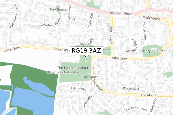
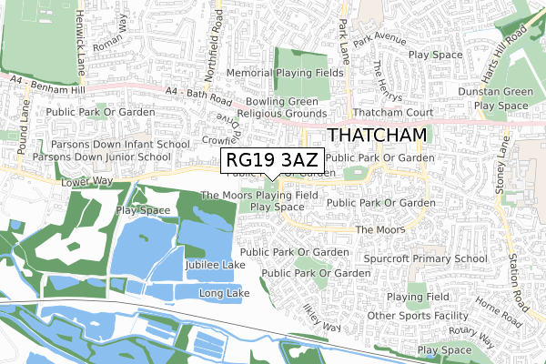
RG19 3AZ is located in the Thatcham West electoral ward, within the unitary authority of West Berkshire and the English Parliamentary constituency of Newbury. The Sub Integrated Care Board (ICB) Location is NHS Buckinghamshire, Oxfordshire and Berkshire West ICB - 15A and the police force is Thames Valley. This postcode has been in use since April 2018.


GetTheData
Source: OS Open Zoomstack (Ordnance Survey)
Licence: Open Government Licence (requires attribution)
Attribution: Contains OS data © Crown copyright and database right 2025
Source: Open Postcode Geo
Licence: Open Government Licence (requires attribution)
Attribution: Contains OS data © Crown copyright and database right 2025; Contains Royal Mail data © Royal Mail copyright and database right 2025; Source: Office for National Statistics licensed under the Open Government Licence v.3.0
| Easting | 451259 |
| Northing | 167183 |
| Latitude | 51.401369 |
| Longitude | -1.264508 |
GetTheData
Source: Open Postcode Geo
Licence: Open Government Licence
| Country | England |
| Postcode District | RG19 |
➜ See where RG19 is on a map ➜ Where is Thatcham? | |
GetTheData
Source: Land Registry Price Paid Data
Licence: Open Government Licence
| Ward | Thatcham West |
| Constituency | Newbury |
GetTheData
Source: ONS Postcode Database
Licence: Open Government Licence
| Glebelands (Lower Way) | Thatcham | 59m |
| Glebelands (Lower Way) | Thatcham | 63m |
| Green Lane (A4 Bath Road) | Thatcham | 276m |
| Green Lane (A4 Bath Road) | Thatcham | 308m |
| Nevil Court (The Moors) | Thatcham | 328m |
| Thatcham Station | 1.7km |
| Newbury Racecourse Station | 3km |
| Newbury Station | 4.1km |
GetTheData
Source: NaPTAN
Licence: Open Government Licence
GetTheData
Source: ONS Postcode Database
Licence: Open Government Licence


➜ Get more ratings from the Food Standards Agency
GetTheData
Source: Food Standards Agency
Licence: FSA terms & conditions
| Last Collection | |||
|---|---|---|---|
| Location | Mon-Fri | Sat | Distance |
| Green Lane | 17:30 | 11:15 | 171m |
| Thatcham High Street | 17:30 | 11:30 | 428m |
| Bath Road | 17:30 | 07:30 | 442m |
GetTheData
Source: Dracos
Licence: Creative Commons Attribution-ShareAlike
The below table lists the International Territorial Level (ITL) codes (formerly Nomenclature of Territorial Units for Statistics (NUTS) codes) and Local Administrative Units (LAU) codes for RG19 3AZ:
| ITL 1 Code | Name |
|---|---|
| TLJ | South East (England) |
| ITL 2 Code | Name |
| TLJ1 | Berkshire, Buckinghamshire and Oxfordshire |
| ITL 3 Code | Name |
| TLJ11 | Berkshire |
| LAU 1 Code | Name |
| E06000037 | West Berkshire |
GetTheData
Source: ONS Postcode Directory
Licence: Open Government Licence
The below table lists the Census Output Area (OA), Lower Layer Super Output Area (LSOA), and Middle Layer Super Output Area (MSOA) for RG19 3AZ:
| Code | Name | |
|---|---|---|
| OA | E00082491 | |
| LSOA | E01016332 | West Berkshire 016C |
| MSOA | E02003382 | West Berkshire 016 |
GetTheData
Source: ONS Postcode Directory
Licence: Open Government Licence
| RG19 3RN | Lower Way | 91m |
| RG19 3QZ | Glebelands | 112m |
| RG19 3UY | Exmoor Road | 127m |
| RG19 3QJ | Rope Walk | 153m |
| RG19 3XB | Malham Road | 178m |
| RG19 3RQ | Hollington Place | 181m |
| RG19 3RG | Green Lane | 200m |
| RG19 3SZ | St Marks Close | 206m |
| RG19 3LB | Fylingdales | 207m |
| RG19 3JY | The Turnery | 217m |
GetTheData
Source: Open Postcode Geo; Land Registry Price Paid Data
Licence: Open Government Licence