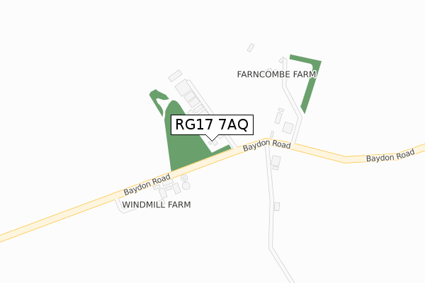
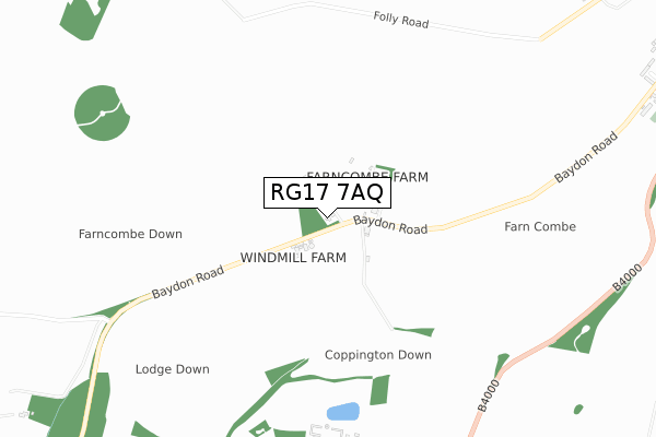
RG17 7AQ is located in the Lambourn electoral ward, within the unitary authority of West Berkshire and the English Parliamentary constituency of Newbury. The Sub Integrated Care Board (ICB) Location is NHS Buckinghamshire, Oxfordshire and Berkshire West ICB - 15A and the police force is Thames Valley. This postcode has been in use since December 2018.


GetTheData
Source: OS Open Zoomstack (Ordnance Survey)
Licence: Open Government Licence (requires attribution)
Attribution: Contains OS data © Crown copyright and database right 2025
Source: Open Postcode Geo
Licence: Open Government Licence (requires attribution)
Attribution: Contains OS data © Crown copyright and database right 2025; Contains Royal Mail data © Royal Mail copyright and database right 2025; Source: Office for National Statistics licensed under the Open Government Licence v.3.0
| Easting | 430932 |
| Northing | 178103 |
| Latitude | 51.501023 |
| Longitude | -1.555755 |
GetTheData
Source: Open Postcode Geo
Licence: Open Government Licence
| Country | England |
| Postcode District | RG17 |
➜ See where RG17 is on a map | |
GetTheData
Source: Land Registry Price Paid Data
Licence: Open Government Licence
| Ward | Lambourn |
| Constituency | Newbury |
GetTheData
Source: ONS Postcode Database
Licence: Open Government Licence
| Kingwood House Stables (B4000) | Lambourn Woodlands | 983m |
| Kingwood House Stables (B4000) | Lambourn Woodlands | 989m |
| Parsonage Place (Parsonage Lane) | Lambourn | 1,810m |
GetTheData
Source: NaPTAN
Licence: Open Government Licence
GetTheData
Source: ONS Postcode Database
Licence: Open Government Licence


➜ Get more ratings from the Food Standards Agency
GetTheData
Source: Food Standards Agency
Licence: FSA terms & conditions
| Last Collection | |||
|---|---|---|---|
| Location | Mon-Fri | Sat | Distance |
| Brockhampton Road, Lambourne | 16:15 | 09:30 | 1,601m |
| Lambourn Post Office | 17:15 | 10:00 | 1,856m |
| Membury Services North | 16:00 | 07:30 | 1,944m |
GetTheData
Source: Dracos
Licence: Creative Commons Attribution-ShareAlike
The below table lists the International Territorial Level (ITL) codes (formerly Nomenclature of Territorial Units for Statistics (NUTS) codes) and Local Administrative Units (LAU) codes for RG17 7AQ:
| ITL 1 Code | Name |
|---|---|
| TLJ | South East (England) |
| ITL 2 Code | Name |
| TLJ1 | Berkshire, Buckinghamshire and Oxfordshire |
| ITL 3 Code | Name |
| TLJ11 | Berkshire |
| LAU 1 Code | Name |
| E06000037 | West Berkshire |
GetTheData
Source: ONS Postcode Directory
Licence: Open Government Licence
The below table lists the Census Output Area (OA), Lower Layer Super Output Area (LSOA), and Middle Layer Super Output Area (MSOA) for RG17 7AQ:
| Code | Name | |
|---|---|---|
| OA | E00082368 | |
| LSOA | E01016304 | West Berkshire 002B |
| MSOA | E02003368 | West Berkshire 002 |
GetTheData
Source: ONS Postcode Directory
Licence: Open Government Licence
| RG17 7BN | 160m | |
| RG17 8BP | Derby Close | 1348m |
| RG17 8NT | Baydon Road | 1412m |
| RG17 7LE | Greenways | 1455m |
| RG17 8NG | Rockfel Road | 1541m |
| RG17 7TS | Ermin Street | 1550m |
| RG17 8NP | Hungerford Hill | 1562m |
| RG17 8ND | Stork House Drive | 1578m |
| RG17 7LG | Greenways | 1594m |
| RG17 8QE | Folly Road | 1603m |
GetTheData
Source: Open Postcode Geo; Land Registry Price Paid Data
Licence: Open Government Licence