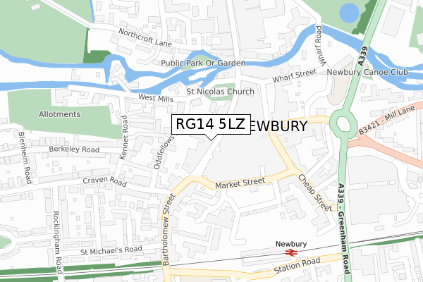
RG14 5LZ is located in the Newbury Central electoral ward, within the unitary authority of West Berkshire and the English Parliamentary constituency of Newbury. The Sub Integrated Care Board (ICB) Location is NHS Buckinghamshire, Oxfordshire and Berkshire West ICB - 15A and the police force is Thames Valley. This postcode has been in use since September 2017.


GetTheData
Source: OS Open Zoomstack (Ordnance Survey)
Licence: Open Government Licence (requires attribution)
Attribution: Contains OS data © Crown copyright and database right 2024
Source: Open Postcode Geo
Licence: Open Government Licence (requires attribution)
Attribution: Contains OS data © Crown copyright and database right 2024; Contains Royal Mail data © Royal Mail copyright and database right 2024; Source: Office for National Statistics licensed under the Open Government Licence v.3.0
| Easting | 447045 |
| Northing | 166985 |
| Latitude | 51.399953 |
| Longitude | -1.325108 |
GetTheData
Source: Open Postcode Geo
Licence: Open Government Licence
| Country | England |
| Postcode District | RG14 |
➜ See where RG14 is on a map | |
GetTheData
Source: Land Registry Price Paid Data
Licence: Open Government Licence
| Ward | Newbury Central |
| Constituency | Newbury |
GetTheData
Source: ONS Postcode Database
Licence: Open Government Licence
| Newbury Post Office (Cheap Street) | Newbury | 154m |
| Newbury Post Office (Cheap Street) | Newbury | 155m |
| Kennet Road (Craven Road) | Newbury | 232m |
| Kennet Road (Craven Road) | Newbury | 287m |
| Newbury Station (Station Road) | Newbury | 331m |
| Newbury Station | 0.3km |
| Newbury Racecourse Station | 1.2km |
GetTheData
Source: NaPTAN
Licence: Open Government Licence
GetTheData
Source: ONS Postcode Database
Licence: Open Government Licence


➜ Get more ratings from the Food Standards Agency
GetTheData
Source: Food Standards Agency
Licence: FSA terms & conditions
| Last Collection | |||
|---|---|---|---|
| Location | Mon-Fri | Sat | Distance |
| Newbury Delivery Office | 18:30 | 12:45 | 157m |
| Mansion House | 17:30 | 11:00 | 158m |
| The Maltings | 17:30 | 12:00 | 199m |
GetTheData
Source: Dracos
Licence: Creative Commons Attribution-ShareAlike
The below table lists the International Territorial Level (ITL) codes (formerly Nomenclature of Territorial Units for Statistics (NUTS) codes) and Local Administrative Units (LAU) codes for RG14 5LZ:
| ITL 1 Code | Name |
|---|---|
| TLJ | South East (England) |
| ITL 2 Code | Name |
| TLJ1 | Berkshire, Buckinghamshire and Oxfordshire |
| ITL 3 Code | Name |
| TLJ11 | Berkshire |
| LAU 1 Code | Name |
| E06000037 | West Berkshire |
GetTheData
Source: ONS Postcode Directory
Licence: Open Government Licence
The below table lists the Census Output Area (OA), Lower Layer Super Output Area (LSOA), and Middle Layer Super Output Area (MSOA) for RG14 5LZ:
| Code | Name | |
|---|---|---|
| OA | E00082570 | |
| LSOA | E01016347 | West Berkshire 019C |
| MSOA | E02003385 | West Berkshire 019 |
GetTheData
Source: ONS Postcode Directory
Licence: Open Government Licence
| RG14 5LL | Bartholomew Street | 26m |
| RG14 5AF | Oddfellows Road | 93m |
| RG14 5PL | Church Mews | 93m |
| RG14 5PY | West Mills | 106m |
| RG14 5HB | Bartholomew Street | 121m |
| RG14 5QB | Oddfellows Road | 128m |
| RG14 5PU | Oddfellows Road | 137m |
| RG14 5HW | Town Mills | 138m |
| RG14 5AD | The Arcade | 140m |
| RG14 5DT | Bartholomew Street | 150m |
GetTheData
Source: Open Postcode Geo; Land Registry Price Paid Data
Licence: Open Government Licence