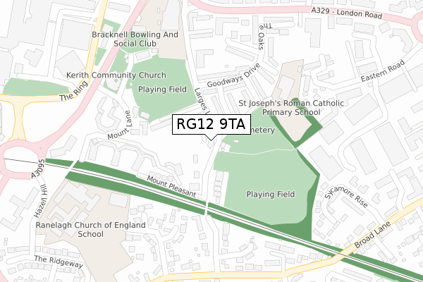
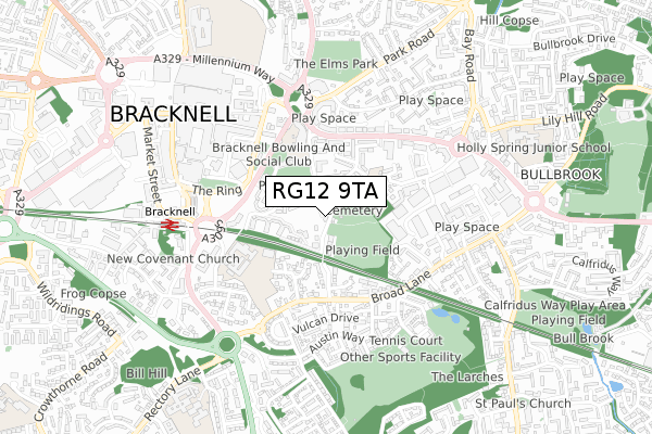
RG12 9TA is located in the Town Centre & The Parks electoral ward, within the unitary authority of Bracknell Forest and the English Parliamentary constituency of Bracknell. The Sub Integrated Care Board (ICB) Location is NHS Frimley ICB - D4U1Y and the police force is Thames Valley. This postcode has been in use since November 2018.


GetTheData
Source: OS Open Zoomstack (Ordnance Survey)
Licence: Open Government Licence (requires attribution)
Attribution: Contains OS data © Crown copyright and database right 2024
Source: Open Postcode Geo
Licence: Open Government Licence (requires attribution)
Attribution: Contains OS data © Crown copyright and database right 2024; Contains Royal Mail data © Royal Mail copyright and database right 2024; Source: Office for National Statistics licensed under the Open Government Licence v.3.0
| Easting | 487497 |
| Northing | 168989 |
| Latitude | 51.413181 |
| Longitude | -0.743243 |
GetTheData
Source: Open Postcode Geo
Licence: Open Government Licence
| Country | England |
| Postcode District | RG12 |
➜ See where RG12 is on a map ➜ Where is Bracknell? | |
GetTheData
Source: Land Registry Price Paid Data
Licence: Open Government Licence
| Ward | Town Centre & The Parks |
| Constituency | Bracknell |
GetTheData
Source: ONS Postcode Database
Licence: Open Government Licence
| Larges Bridge Drive (Broad Lane) | The Parks | 323m |
| Deepfield Road West (Deepfield Road) | Bullbrook | 429m |
| Deepfield Road West (Deepfield Road) | Bullbrook | 433m |
| The Ring - Parish Church (Charles Square Car Park) | Bracknell | 436m |
| Bay Road (London Road) | Bracknell | 466m |
| Bracknell Station | 0.6km |
| Martins Heron Station | 1.5km |
| Ascot Station | 4.8km |
GetTheData
Source: NaPTAN
Licence: Open Government Licence
| Percentage of properties with Next Generation Access | 100.0% |
| Percentage of properties with Superfast Broadband | 100.0% |
| Percentage of properties with Ultrafast Broadband | 0.0% |
| Percentage of properties with Full Fibre Broadband | 0.0% |
Superfast Broadband is between 30Mbps and 300Mbps
Ultrafast Broadband is > 300Mbps
| Percentage of properties unable to receive 2Mbps | 0.0% |
| Percentage of properties unable to receive 5Mbps | 0.0% |
| Percentage of properties unable to receive 10Mbps | 0.0% |
| Percentage of properties unable to receive 30Mbps | 0.0% |
GetTheData
Source: Ofcom
Licence: Ofcom Terms of Use (requires attribution)
GetTheData
Source: ONS Postcode Database
Licence: Open Government Licence


➜ Get more ratings from the Food Standards Agency
GetTheData
Source: Food Standards Agency
Licence: FSA terms & conditions
| Last Collection | |||
|---|---|---|---|
| Location | Mon-Fri | Sat | Distance |
| Beedon Drive | 16:00 | 12:00 | 314m |
| High Street P.o. Meter Box | 448m | ||
| High Street Post Office | 18:30 | 12:15 | 449m |
GetTheData
Source: Dracos
Licence: Creative Commons Attribution-ShareAlike
The below table lists the International Territorial Level (ITL) codes (formerly Nomenclature of Territorial Units for Statistics (NUTS) codes) and Local Administrative Units (LAU) codes for RG12 9TA:
| ITL 1 Code | Name |
|---|---|
| TLJ | South East (England) |
| ITL 2 Code | Name |
| TLJ1 | Berkshire, Buckinghamshire and Oxfordshire |
| ITL 3 Code | Name |
| TLJ11 | Berkshire |
| LAU 1 Code | Name |
| E06000036 | Bracknell Forest |
GetTheData
Source: ONS Postcode Directory
Licence: Open Government Licence
The below table lists the Census Output Area (OA), Lower Layer Super Output Area (LSOA), and Middle Layer Super Output Area (MSOA) for RG12 9TA:
| Code | Name | |
|---|---|---|
| OA | E00082098 | |
| LSOA | E01016249 | Bracknell Forest 007D |
| MSOA | E02003358 | Bracknell Forest 007 |
GetTheData
Source: ONS Postcode Directory
Licence: Open Government Licence
| RG12 9AX | Farnham Close | 70m |
| RG12 9AH | Marchmont Place | 113m |
| RG12 9EA | Mount Lane | 150m |
| RG12 9AU | Goodways Drive | 162m |
| RG12 9AQ | Huntsgreen Court | 164m |
| RG12 9AY | Drayton Close | 169m |
| RG12 9AT | Larges Lane | 199m |
| RG12 9AZ | Kenton Close | 204m |
| RG12 9DQ | Buttermere Gardens | 207m |
| RG12 9BA | Tebbit Close | 218m |
GetTheData
Source: Open Postcode Geo; Land Registry Price Paid Data
Licence: Open Government Licence