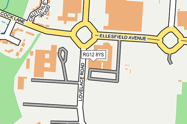
RG12 8YS is located in the Binfield South & Jennett's Park electoral ward, within the unitary authority of Bracknell Forest and the English Parliamentary constituency of Bracknell. The Sub Integrated Care Board (ICB) Location is NHS Frimley ICB - D4U1Y and the police force is Thames Valley. This postcode has been in use since September 1991.


GetTheData
Source: OS OpenMap – Local (Ordnance Survey)
Source: OS VectorMap District (Ordnance Survey)
Licence: Open Government Licence (requires attribution)
| Easting | 485373 |
| Northing | 168373 |
| Latitude | 51.407966 |
| Longitude | -0.773942 |
GetTheData
Source: Open Postcode Geo
Licence: Open Government Licence
| Country | England |
| Postcode District | RG12 |
➜ See where RG12 is on a map ➜ Where is Bracknell? | |
GetTheData
Source: Land Registry Price Paid Data
Licence: Open Government Licence
Elevation or altitude of RG12 8YS as distance above sea level:
| Metres | Feet | |
|---|---|---|
| Elevation | 70m | 230ft |
Elevation is measured from the approximate centre of the postcode, to the nearest point on an OS contour line from OS Terrain 50, which has contour spacing of ten vertical metres.
➜ How high above sea level am I? Find the elevation of your current position using your device's GPS.
GetTheData
Source: Open Postcode Elevation
Licence: Open Government Licence
| Ward | Binfield South & Jennett's Park |
| Constituency | Bracknell |
GetTheData
Source: ONS Postcode Database
Licence: Open Government Licence
| Southern Industrial Area (Lovelace Road) | Southern Industrial Area | 44m |
| Southern Industrial Area (Lovelace Road) | Southern Industrial Area | 87m |
| Ellesfield Avenue | Southern Industrial Area | 102m |
| Ellesfield Avenue | Southern Industrial Area | 171m |
| Doncastle Road | Southern Industrial Area | 200m |
| Bracknell Station | 1.6km |
| Martins Heron Station | 3.4km |
| Wokingham Station | 4.8km |
GetTheData
Source: NaPTAN
Licence: Open Government Licence
GetTheData
Source: ONS Postcode Database
Licence: Open Government Licence

➜ Get more ratings from the Food Standards Agency
GetTheData
Source: Food Standards Agency
Licence: FSA terms & conditions
| Last Collection | |||
|---|---|---|---|
| Location | Mon-Fri | Sat | Distance |
| Ringwood | 16:00 | 11:45 | 423m |
| Bracknell Delivery Office | 18:45 | 12:15 | 568m |
| Ellisfield Avenue | 18:30 | 11:45 | 627m |
GetTheData
Source: Dracos
Licence: Creative Commons Attribution-ShareAlike
The below table lists the International Territorial Level (ITL) codes (formerly Nomenclature of Territorial Units for Statistics (NUTS) codes) and Local Administrative Units (LAU) codes for RG12 8YS:
| ITL 1 Code | Name |
|---|---|
| TLJ | South East (England) |
| ITL 2 Code | Name |
| TLJ1 | Berkshire, Buckinghamshire and Oxfordshire |
| ITL 3 Code | Name |
| TLJ11 | Berkshire |
| LAU 1 Code | Name |
| E06000036 | Bracknell Forest |
GetTheData
Source: ONS Postcode Directory
Licence: Open Government Licence
The below table lists the Census Output Area (OA), Lower Layer Super Output Area (LSOA), and Middle Layer Super Output Area (MSOA) for RG12 8YS:
| Code | Name | |
|---|---|---|
| OA | E00081915 | |
| LSOA | E01016209 | Bracknell Forest 009A |
| MSOA | E02003360 | Bracknell Forest 009 |
GetTheData
Source: ONS Postcode Directory
Licence: Open Government Licence
| RG12 8BZ | Crutchley Wood | 227m |
| RG12 8AH | Partridge Close | 255m |
| RG12 8AJ | Harrier Way | 289m |
| RG12 8FW | Redstart Croft | 336m |
| RG12 8AN | Quail Corner | 370m |
| RG12 8FG | Barn Owl Drive | 403m |
| RG12 8FL | Willoughby Road | 412m |
| RG12 8DN | Critcher Close | 420m |
| RG12 8FA | Barn Owl Drive | 422m |
| RG12 8FN | Cuckoo Lane | 425m |
GetTheData
Source: Open Postcode Geo; Land Registry Price Paid Data
Licence: Open Government Licence