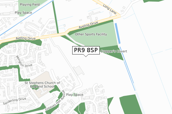
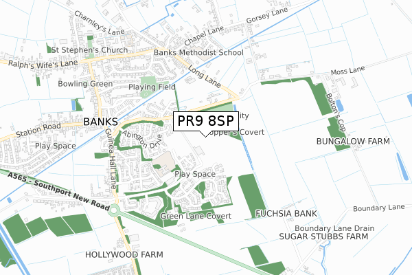
PR9 8SP is located in the North Meols & Hesketh Bank electoral ward, within the local authority district of West Lancashire and the English Parliamentary constituency of South Ribble. The Sub Integrated Care Board (ICB) Location is NHS Lancashire and South Cumbria ICB - 02G and the police force is Lancashire. This postcode has been in use since December 2022.


GetTheData
Source: OS Open Zoomstack (Ordnance Survey)
Licence: Open Government Licence (requires attribution)
Attribution: Contains OS data © Crown copyright and database right 2025
Source: Open Postcode Geo
Licence: Open Government Licence (requires attribution)
Attribution: Contains OS data © Crown copyright and database right 2025; Contains Royal Mail data © Royal Mail copyright and database right 2025; Source: Office for National Statistics licensed under the Open Government Licence v.3.0
| Easting | 339692 |
| Northing | 420488 |
| Latitude | 53.677376 |
| Longitude | -2.914451 |
GetTheData
Source: Open Postcode Geo
Licence: Open Government Licence
| Country | England |
| Postcode District | PR9 |
➜ See where PR9 is on a map ➜ Where is Banks? | |
GetTheData
Source: Land Registry Price Paid Data
Licence: Open Government Licence
| Ward | North Meols & Hesketh Bank |
| Constituency | South Ribble |
GetTheData
Source: ONS Postcode Database
Licence: Open Government Licence
12, SHERBROOK DRIVE, BANKS, SOUTHPORT, PR9 8SP 2024 20 JUN £344,500 |
14, SHERBROOK DRIVE, BANKS, SOUTHPORT, PR9 8SP 2024 17 MAY £338,995 |
16, SHERBROOK DRIVE, BANKS, SOUTHPORT, PR9 8SP 2023 21 DEC £338,000 |
22, SHERBROOK DRIVE, BANKS, SOUTHPORT, PR9 8SP 2023 18 DEC £262,500 |
18, SHERBROOK DRIVE, BANKS, SOUTHPORT, PR9 8SP 2023 8 DEC £399,995 |
41, SHERBROOK DRIVE, BANKS, SOUTHPORT, PR9 8SP 2023 16 OCT £327,500 |
8, SHERBROOK DRIVE, BANKS, SOUTHPORT, PR9 8SP 2023 13 OCT £332,500 |
6, SHERBROOK DRIVE, BANKS, SOUTHPORT, PR9 8SP 2023 3 AUG £284,995 |
39, SHERBROOK DRIVE, BANKS, SOUTHPORT, PR9 8SP 2023 28 JUL £377,000 |
37, SHERBROOK DRIVE, BANKS, SOUTHPORT, PR9 8SP 2023 12 JUN £349,995 |
GetTheData
Source: HM Land Registry Price Paid Data
Licence: Contains HM Land Registry data © Crown copyright and database right 2025. This data is licensed under the Open Government Licence v3.0.
| Guinea Hall Mews (Guinea Hall Lane) | Banks | 535m |
| Methodist School (Chapel Lane) | Banks | 539m |
| Guinea Hall Mews (Guinea Hall Lane) | Banks | 546m |
| Fleetwood Drive (Church Road) | Banks | 571m |
| Fleetwood Drive (Church Road) | Banks | 575m |
| Meols Cop Station | 5.3km |
GetTheData
Source: NaPTAN
Licence: Open Government Licence
GetTheData
Source: ONS Postcode Database
Licence: Open Government Licence


➜ Get more ratings from the Food Standards Agency
GetTheData
Source: Food Standards Agency
Licence: FSA terms & conditions
| Last Collection | |||
|---|---|---|---|
| Location | Mon-Fri | Sat | Distance |
| The Ferry | 17:00 | 11:00 | 1,832m |
| Nelric Camp | 16:30 | 11:00 | 2,103m |
| Banks Road | 16:15 | 11:00 | 2,103m |
GetTheData
Source: Dracos
Licence: Creative Commons Attribution-ShareAlike
| Risk of PR9 8SP flooding from rivers and sea | Very Low |
| ➜ PR9 8SP flood map | |
GetTheData
Source: Open Flood Risk by Postcode
Licence: Open Government Licence
The below table lists the International Territorial Level (ITL) codes (formerly Nomenclature of Territorial Units for Statistics (NUTS) codes) and Local Administrative Units (LAU) codes for PR9 8SP:
| ITL 1 Code | Name |
|---|---|
| TLD | North West (England) |
| ITL 2 Code | Name |
| TLD4 | Lancashire |
| ITL 3 Code | Name |
| TLD47 | Chorley and West Lancashire |
| LAU 1 Code | Name |
| E07000127 | West Lancashire |
GetTheData
Source: ONS Postcode Directory
Licence: Open Government Licence
The below table lists the Census Output Area (OA), Lower Layer Super Output Area (LSOA), and Middle Layer Super Output Area (MSOA) for PR9 8SP:
| Code | Name | |
|---|---|---|
| OA | E00129443 | |
| LSOA | E01025507 | West Lancashire 002A |
| MSOA | E02005305 | West Lancashire 002 |
GetTheData
Source: ONS Postcode Directory
Licence: Open Government Licence
| PR9 8GX | Abington Drive | 168m |
| PR9 8GZ | Abington Drive | 195m |
| PR9 8GY | Abington Drive | 208m |
| PR9 8FU | Lonmore Close | 220m |
| PR9 8BL | Greaves Hall Avenue | 221m |
| PR9 8FH | Brightstone Close | 250m |
| PR9 8FT | Woodvale Court | 306m |
| PR9 8FP | Fareham Drive | 315m |
| PR9 8BJ | Aveling Drive | 318m |
| PR9 8FL | Abington Drive | 335m |
GetTheData
Source: Open Postcode Geo; Land Registry Price Paid Data
Licence: Open Government Licence