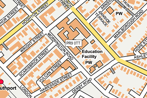
PR9 0TT is located in the Duke's electoral ward, within the metropolitan district of Sefton and the English Parliamentary constituency of Southport. The Sub Integrated Care Board (ICB) Location is NHS Cheshire and Merseyside ICB - 01V and the police force is Merseyside. This postcode has been in use since January 1980.


GetTheData
Source: OS OpenMap – Local (Ordnance Survey)
Source: OS VectorMap District (Ordnance Survey)
Licence: Open Government Licence (requires attribution)
| Easting | 334153 |
| Northing | 417275 |
| Latitude | 53.647816 |
| Longitude | -2.997609 |
GetTheData
Source: Open Postcode Geo
Licence: Open Government Licence
| Country | England |
| Postcode District | PR9 |
➜ See where PR9 is on a map ➜ Where is Southport? | |
GetTheData
Source: Land Registry Price Paid Data
Licence: Open Government Licence
Elevation or altitude of PR9 0TT as distance above sea level:
| Metres | Feet | |
|---|---|---|
| Elevation | 10m | 33ft |
Elevation is measured from the approximate centre of the postcode, to the nearest point on an OS contour line from OS Terrain 50, which has contour spacing of ten vertical metres.
➜ How high above sea level am I? Find the elevation of your current position using your device's GPS.
GetTheData
Source: Open Postcode Elevation
Licence: Open Government Licence
| Ward | Duke's |
| Constituency | Southport |
GetTheData
Source: ONS Postcode Database
Licence: Open Government Licence
| Sussex Road (Derby Road) | Southport | 162m |
| Wright St (Church Street) | Southport | 177m |
| Mornington Road (Derby Road) | Southport | 181m |
| Kensington Road (Derby Road) | Southport | 189m |
| Church Street (Hoghton Street) | Southport | 208m |
| Southport Station | 0.4km |
| Meols Cop Station | 1.5km |
| Birkdale Station | 1.9km |
GetTheData
Source: NaPTAN
Licence: Open Government Licence
GetTheData
Source: ONS Postcode Database
Licence: Open Government Licence


➜ Get more ratings from the Food Standards Agency
GetTheData
Source: Food Standards Agency
Licence: FSA terms & conditions
| Last Collection | |||
|---|---|---|---|
| Location | Mon-Fri | Sat | Distance |
| 44 Hoghton Street | 18:30 | 11:30 | 216m |
| Ashley Road | 16:15 | 11:15 | 220m |
| 75 London Street | 16:00 | 11:30 | 254m |
GetTheData
Source: Dracos
Licence: Creative Commons Attribution-ShareAlike
The below table lists the International Territorial Level (ITL) codes (formerly Nomenclature of Territorial Units for Statistics (NUTS) codes) and Local Administrative Units (LAU) codes for PR9 0TT:
| ITL 1 Code | Name |
|---|---|
| TLD | North West (England) |
| ITL 2 Code | Name |
| TLD7 | Merseyside |
| ITL 3 Code | Name |
| TLD73 | Sefton |
| LAU 1 Code | Name |
| E08000014 | Sefton |
GetTheData
Source: ONS Postcode Directory
Licence: Open Government Licence
The below table lists the Census Output Area (OA), Lower Layer Super Output Area (LSOA), and Middle Layer Super Output Area (MSOA) for PR9 0TT:
| Code | Name | |
|---|---|---|
| OA | E00035353 | |
| LSOA | E01006969 | Sefton 004D |
| MSOA | E02001432 | Sefton 004 |
GetTheData
Source: ONS Postcode Directory
Licence: Open Government Licence
| PR9 0TW | Vulcan Street | 131m |
| PR9 0TU | Scarisbrick Street | 145m |
| PR9 0UD | Scarisbrick Street | 162m |
| PR9 0TN | Hawesside Street | 165m |
| PR9 0QT | Church Street | 166m |
| PR9 0TY | Derby Road | 167m |
| PR9 0QS | Church Street | 167m |
| PR9 0TZ | Derby Road | 174m |
| PR9 0QY | Arnside Terrace | 175m |
| PR9 0TL | Wright Street | 178m |
GetTheData
Source: Open Postcode Geo; Land Registry Price Paid Data
Licence: Open Government Licence