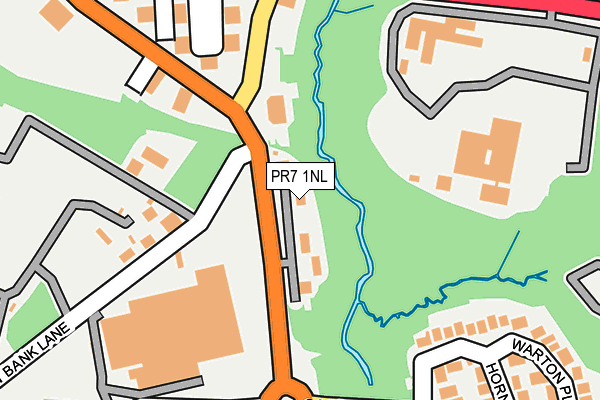
PR7 1NL lies on Chorley West Business Park in Chorley. PR7 1NL is located in the Chorley North West electoral ward, within the local authority district of Chorley and the English Parliamentary constituency of Chorley. The Sub Integrated Care Board (ICB) Location is NHS Lancashire and South Cumbria ICB - 00X and the police force is Lancashire. This postcode has been in use since July 1990.


GetTheData
Source: OS OpenMap – Local (Ordnance Survey)
Source: OS VectorMap District (Ordnance Survey)
Licence: Open Government Licence (requires attribution)
| Easting | 356916 |
| Northing | 417690 |
| Latitude | 53.653937 |
| Longitude | -2.653336 |
GetTheData
Source: Open Postcode Geo
Licence: Open Government Licence
| Street | Chorley West Business Park |
| Town/City | Chorley |
| Country | England |
| Postcode District | PR7 |
➜ See where PR7 is on a map ➜ Where is Chorley? | |
GetTheData
Source: Land Registry Price Paid Data
Licence: Open Government Licence
Elevation or altitude of PR7 1NL as distance above sea level:
| Metres | Feet | |
|---|---|---|
| Elevation | 50m | 164ft |
Elevation is measured from the approximate centre of the postcode, to the nearest point on an OS contour line from OS Terrain 50, which has contour spacing of ten vertical metres.
➜ How high above sea level am I? Find the elevation of your current position using your device's GPS.
GetTheData
Source: Open Postcode Elevation
Licence: Open Government Licence
| Ward | Chorley North West |
| Constituency | Chorley |
GetTheData
Source: ONS Postcode Database
Licence: Open Government Licence
| Ackhurst Road | Gillibrand | 97m |
| Foxhole Road | Gillibrand | 240m |
| Lancashire College (Southport Road) | Southport Road | 291m |
| Ackhurst Road (Yarrow Valley Way) | Southport Road | 292m |
| Foxhole Road | Gillibrand | 292m |
| Euxton Balshaw Lane Station | 1.4km |
| Chorley Station | 1.8km |
| Buckshaw Parkway Station | 2.2km |
GetTheData
Source: NaPTAN
Licence: Open Government Licence
Estimated total energy consumption in PR7 1NL by fuel type, 2015.
| Consumption (kWh) | 144,973 |
|---|---|
| Meter count | 9 |
| Mean (kWh/meter) | 16,108 |
| Median (kWh/meter) | 16,859 |
GetTheData
Source: Postcode level gas estimates: 2015 (experimental)
Source: Postcode level electricity estimates: 2015 (experimental)
Licence: Open Government Licence
GetTheData
Source: ONS Postcode Database
Licence: Open Government Licence


➜ Get more ratings from the Food Standards Agency
GetTheData
Source: Food Standards Agency
Licence: FSA terms & conditions
| Last Collection | |||
|---|---|---|---|
| Location | Mon-Fri | Sat | Distance |
| Common Bank Industrial Estate | 17:45 | 77m | |
| Common Bank Industrial Estate | 17:45 | 11:30 | 103m |
| Astley Village Post Office | 17:00 | 11:30 | 995m |
GetTheData
Source: Dracos
Licence: Creative Commons Attribution-ShareAlike
The below table lists the International Territorial Level (ITL) codes (formerly Nomenclature of Territorial Units for Statistics (NUTS) codes) and Local Administrative Units (LAU) codes for PR7 1NL:
| ITL 1 Code | Name |
|---|---|
| TLD | North West (England) |
| ITL 2 Code | Name |
| TLD4 | Lancashire |
| ITL 3 Code | Name |
| TLD47 | Chorley and West Lancashire |
| LAU 1 Code | Name |
| E07000118 | Chorley |
GetTheData
Source: ONS Postcode Directory
Licence: Open Government Licence
The below table lists the Census Output Area (OA), Lower Layer Super Output Area (LSOA), and Middle Layer Super Output Area (MSOA) for PR7 1NL:
| Code | Name | |
|---|---|---|
| OA | E00126565 | |
| LSOA | E01024935 | Chorley 008D |
| MSOA | E02005196 | Chorley 008 |
GetTheData
Source: ONS Postcode Directory
Licence: Open Government Licence
| PR7 1NR | Common Bank Lane | 198m |
| PR7 2RQ | Warton Place | 307m |
| PR7 2RJ | Hornchurch Drive | 313m |
| PR7 1NT | Southport Road | 401m |
| PR7 1NH | Common Bank Industrial Estate | 403m |
| PR7 2QY | Stansted Road | 414m |
| PR7 2QU | Binbrook Place | 458m |
| PR7 1SH | The Farthings | 467m |
| PR7 2QF | Collingwood Road | 535m |
| PR7 2QJ | Yeadon Grove | 539m |
GetTheData
Source: Open Postcode Geo; Land Registry Price Paid Data
Licence: Open Government Licence