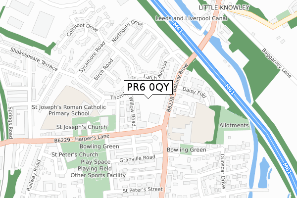
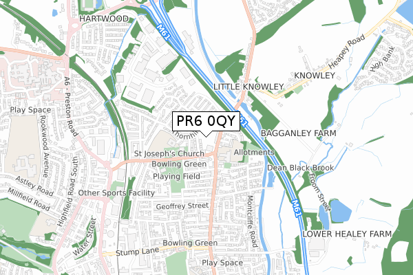
PR6 0QY is located in the Chorley North & Astley electoral ward, within the local authority district of Chorley and the English Parliamentary constituency of Chorley. The Sub Integrated Care Board (ICB) Location is NHS Lancashire and South Cumbria ICB - 00X and the police force is Lancashire. This postcode has been in use since October 2019.


GetTheData
Source: OS Open Zoomstack (Ordnance Survey)
Licence: Open Government Licence (requires attribution)
Attribution: Contains OS data © Crown copyright and database right 2025
Source: Open Postcode Geo
Licence: Open Government Licence (requires attribution)
Attribution: Contains OS data © Crown copyright and database right 2025; Contains Royal Mail data © Royal Mail copyright and database right 2025; Source: Office for National Statistics licensed under the Open Government Licence v.3.0
| Easting | 359157 |
| Northing | 418621 |
| Latitude | 53.662485 |
| Longitude | -2.619555 |
GetTheData
Source: Open Postcode Geo
Licence: Open Government Licence
| Country | England |
| Postcode District | PR6 |
➜ See where PR6 is on a map ➜ Where is Chorley? | |
GetTheData
Source: Land Registry Price Paid Data
Licence: Open Government Licence
| Ward | Chorley North & Astley |
| Constituency | Chorley |
GetTheData
Source: ONS Postcode Database
Licence: Open Government Licence
| Morris Road (Harpers Lane) | Harpers Lane | 116m |
| St Josephs Parish Centre (Harpers Lane) | Harpers Lane | 170m |
| Motorway Bridge (Botany Brow) | Little Knowley | 268m |
| St Peters Street (Eaves Lane) | Eaves Lane | 313m |
| The Lock And Quay (Blackburn Brow) | Little Knowley | 365m |
| Chorley Station | 1.2km |
| Buckshaw Parkway Station | 3km |
| Euxton Balshaw Lane Station | 3.5km |
GetTheData
Source: NaPTAN
Licence: Open Government Licence
GetTheData
Source: ONS Postcode Database
Licence: Open Government Licence


➜ Get more ratings from the Food Standards Agency
GetTheData
Source: Food Standards Agency
Licence: FSA terms & conditions
| Last Collection | |||
|---|---|---|---|
| Location | Mon-Fri | Sat | Distance |
| Erskine Road | 17:00 | 11:30 | 195m |
| Gillibrand Street | 17:15 | 11:45 | 647m |
| Highfield Road North | 16:45 | 11:30 | 869m |
GetTheData
Source: Dracos
Licence: Creative Commons Attribution-ShareAlike
The below table lists the International Territorial Level (ITL) codes (formerly Nomenclature of Territorial Units for Statistics (NUTS) codes) and Local Administrative Units (LAU) codes for PR6 0QY:
| ITL 1 Code | Name |
|---|---|
| TLD | North West (England) |
| ITL 2 Code | Name |
| TLD4 | Lancashire |
| ITL 3 Code | Name |
| TLD47 | Chorley and West Lancashire |
| LAU 1 Code | Name |
| E07000118 | Chorley |
GetTheData
Source: ONS Postcode Directory
Licence: Open Government Licence
The below table lists the Census Output Area (OA), Lower Layer Super Output Area (LSOA), and Middle Layer Super Output Area (MSOA) for PR6 0QY:
| Code | Name | |
|---|---|---|
| OA | E00126536 | |
| LSOA | E01024929 | Chorley 006A |
| MSOA | E02005194 | Chorley 006 |
GetTheData
Source: ONS Postcode Directory
Licence: Open Government Licence
| PR6 0JA | Willow Road | 52m |
| PR6 0JN | Botany Brow | 84m |
| PR6 0JE | Elm Grove | 104m |
| PR6 0HT | Harpers Lane | 107m |
| PR6 0JL | Larch Avenue | 114m |
| PR6 0JB | Thornhill Road | 128m |
| PR6 0JW | Botany Brow | 128m |
| PR6 0JQ | Chestnut Avenue | 142m |
| PR6 0HU | Harpers Lane | 158m |
| PR6 0JF | Cedar Road | 163m |
GetTheData
Source: Open Postcode Geo; Land Registry Price Paid Data
Licence: Open Government Licence