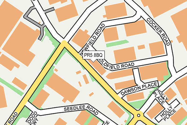
PR5 8BQ is located in the Bamber Bridge East electoral ward, within the local authority district of South Ribble and the English Parliamentary constituency of Ribble Valley. The Sub Integrated Care Board (ICB) Location is NHS Lancashire and South Cumbria ICB - 00X and the police force is Lancashire. This postcode has been in use since June 2017.


GetTheData
Source: OS OpenMap – Local (Ordnance Survey)
Source: OS VectorMap District (Ordnance Survey)
Licence: Open Government Licence (requires attribution)
| Easting | 357349 |
| Northing | 425135 |
| Latitude | 53.720885 |
| Longitude | -2.647812 |
GetTheData
Source: Open Postcode Geo
Licence: Open Government Licence
| Country | England |
| Postcode District | PR5 |
➜ See where PR5 is on a map ➜ Where is Bamber Bridge? | |
GetTheData
Source: Land Registry Price Paid Data
Licence: Open Government Licence
| Ward | Bamber Bridge East |
| Constituency | Ribble Valley |
GetTheData
Source: ONS Postcode Database
Licence: Open Government Licence
| Dawson Place (Brierley Road) | Walton Summit | 42m |
| Dawson Place (Brierley Road) | Walton Summit | 59m |
| Cocker Road (Walton Summit Road) | Walton Summit | 166m |
| Cocker Road (Walton Summit Road) | Walton Summit | 185m |
| Four Oaks Road | Walton Summit | 235m |
| Bamber Bridge Station | 1.1km |
| Lostock Hall Station | 2.6km |
| Leyland Station | 3.6km |
GetTheData
Source: NaPTAN
Licence: Open Government Licence
GetTheData
Source: ONS Postcode Database
Licence: Open Government Licence


➜ Get more ratings from the Food Standards Agency
GetTheData
Source: Food Standards Agency
Licence: FSA terms & conditions
| Last Collection | |||
|---|---|---|---|
| Location | Mon-Fri | Sat | Distance |
| Walton Summit (2) | 17:30 | 09:00 | 390m |
| Walton Summit (2) | 18:30 | 397m | |
| Hospital Inn | 16:30 | 09:30 | 818m |
GetTheData
Source: Dracos
Licence: Creative Commons Attribution-ShareAlike
The below table lists the International Territorial Level (ITL) codes (formerly Nomenclature of Territorial Units for Statistics (NUTS) codes) and Local Administrative Units (LAU) codes for PR5 8BQ:
| ITL 1 Code | Name |
|---|---|
| TLD | North West (England) |
| ITL 2 Code | Name |
| TLD4 | Lancashire |
| ITL 3 Code | Name |
| TLD45 | Mid Lancashire |
| LAU 1 Code | Name |
| E07000126 | South Ribble |
GetTheData
Source: ONS Postcode Directory
Licence: Open Government Licence
The below table lists the Census Output Area (OA), Lower Layer Super Output Area (LSOA), and Middle Layer Super Output Area (MSOA) for PR5 8BQ:
| Code | Name | |
|---|---|---|
| OA | E00128905 | |
| LSOA | E01025401 | South Ribble 008C |
| MSOA | E02005294 | South Ribble 008 |
GetTheData
Source: ONS Postcode Directory
Licence: Open Government Licence
| PR5 8BG | Oldfield Road | 91m |
| PR5 8AQ | Walton Summit Road | 123m |
| PR5 8AJ | Bradkirk Place | 346m |
| PR5 8AH | Brierley Road | 434m |
| PR5 8AB | Reedfield Place | 452m |
| PR5 8AU | Carr Place | 456m |
| PR5 8AR | Ranglet Road | 491m |
| PR5 6BG | Tramway Lane | 493m |
| PR5 8AA | Reedfield Place | 517m |
| PR5 6NE | Langden Crescent | 545m |
GetTheData
Source: Open Postcode Geo; Land Registry Price Paid Data
Licence: Open Government Licence