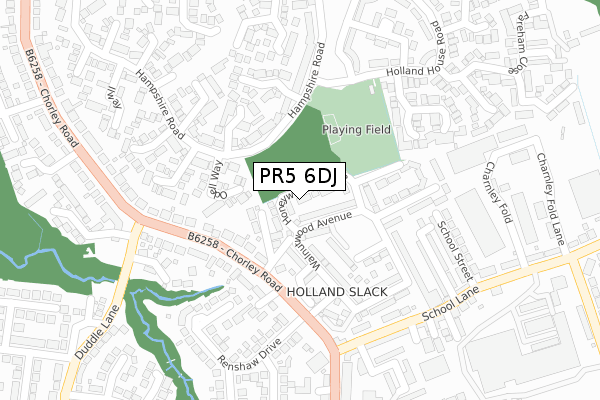
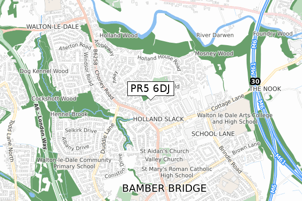
PR5 6DJ is located in the Walton-le-Dale East electoral ward, within the local authority district of South Ribble and the English Parliamentary constituency of Ribble Valley. The Sub Integrated Care Board (ICB) Location is NHS Lancashire and South Cumbria ICB - 01E and the police force is Lancashire. This postcode has been in use since September 2017.


GetTheData
Source: OS Open Zoomstack (Ordnance Survey)
Licence: Open Government Licence (requires attribution)
Attribution: Contains OS data © Crown copyright and database right 2024
Source: Open Postcode Geo
Licence: Open Government Licence (requires attribution)
Attribution: Contains OS data © Crown copyright and database right 2024; Contains Royal Mail data © Royal Mail copyright and database right 2024; Source: Office for National Statistics licensed under the Open Government Licence v.3.0
| Easting | 356313 |
| Northing | 427045 |
| Latitude | 53.737965 |
| Longitude | -2.663781 |
GetTheData
Source: Open Postcode Geo
Licence: Open Government Licence
| Country | England |
| Postcode District | PR5 |
➜ See where PR5 is on a map ➜ Where is Bamber Bridge? | |
GetTheData
Source: Land Registry Price Paid Data
Licence: Open Government Licence
| Ward | Walton-le-dale East |
| Constituency | Ribble Valley |
GetTheData
Source: ONS Postcode Database
Licence: Open Government Licence
2022 15 JUL £252,000 |
2021 30 JUL £200,000 |
2020 28 SEP £215,000 |
2020 17 JUL £222,500 |
1, HONEYWOOD AVENUE, BAMBER BRIDGE, PRESTON, PR5 6DJ 2018 29 MAR £219,995 |
14, HONEYWOOD AVENUE, BAMBER BRIDGE, PRESTON, PR5 6DJ 2018 29 MAR £196,995 |
3, HONEYWOOD AVENUE, BAMBER BRIDGE, PRESTON, PR5 6DJ 2018 28 FEB £183,995 |
5, HONEYWOOD AVENUE, BAMBER BRIDGE, PRESTON, PR5 6DJ 2018 28 FEB £196,995 |
11, HONEYWOOD AVENUE, BAMBER BRIDGE, PRESTON, PR5 6DJ 2017 20 DEC £217,995 |
2017 18 DEC £196,995 |
GetTheData
Source: HM Land Registry Price Paid Data
Licence: Contains HM Land Registry data © Crown copyright and database right 2024. This data is licensed under the Open Government Licence v3.0.
| Renshaw Drive (Chorley Road) | Bamber Bridge | 168m |
| Duddle Lane (Chorley Road) | Bamber Bridge | 176m |
| Renshaw Drive (Chorley Road) | Bamber Bridge | 178m |
| School Lane Garage (School Lane) | Bamber Bridge | 253m |
| School Lane Garage (School Lane) | Bamber Bridge | 264m |
| Bamber Bridge Station | 1.2km |
| Lostock Hall Station | 2.2km |
| Preston Station | 3.6km |
GetTheData
Source: NaPTAN
Licence: Open Government Licence
| Percentage of properties with Next Generation Access | 100.0% |
| Percentage of properties with Superfast Broadband | 100.0% |
| Percentage of properties with Ultrafast Broadband | 0.0% |
| Percentage of properties with Full Fibre Broadband | 0.0% |
Superfast Broadband is between 30Mbps and 300Mbps
Ultrafast Broadband is > 300Mbps
| Median download speed | 54.1Mbps |
| Average download speed | 48.2Mbps |
| Maximum download speed | 73.34Mbps |
| Median upload speed | 11.8Mbps |
| Average upload speed | 12.5Mbps |
| Maximum upload speed | 20.00Mbps |
| Percentage of properties unable to receive 2Mbps | 0.0% |
| Percentage of properties unable to receive 5Mbps | 0.0% |
| Percentage of properties unable to receive 10Mbps | 0.0% |
| Percentage of properties unable to receive 30Mbps | 0.0% |
GetTheData
Source: Ofcom
Licence: Ofcom Terms of Use (requires attribution)
GetTheData
Source: ONS Postcode Database
Licence: Open Government Licence


➜ Get more ratings from the Food Standards Agency
GetTheData
Source: Food Standards Agency
Licence: FSA terms & conditions
| Last Collection | |||
|---|---|---|---|
| Location | Mon-Fri | Sat | Distance |
| Hampshire Road, Walton Le Dale | 16:00 | 09:00 | 349m |
| Duddle Lane | 18:00 | 08:30 | 598m |
| Cinnamon Hill Post Office | 18:00 | 11:00 | 604m |
GetTheData
Source: Dracos
Licence: Creative Commons Attribution-ShareAlike
The below table lists the International Territorial Level (ITL) codes (formerly Nomenclature of Territorial Units for Statistics (NUTS) codes) and Local Administrative Units (LAU) codes for PR5 6DJ:
| ITL 1 Code | Name |
|---|---|
| TLD | North West (England) |
| ITL 2 Code | Name |
| TLD4 | Lancashire |
| ITL 3 Code | Name |
| TLD45 | Mid Lancashire |
| LAU 1 Code | Name |
| E07000126 | South Ribble |
GetTheData
Source: ONS Postcode Directory
Licence: Open Government Licence
The below table lists the Census Output Area (OA), Lower Layer Super Output Area (LSOA), and Middle Layer Super Output Area (MSOA) for PR5 6DJ:
| Code | Name | |
|---|---|---|
| OA | E00128920 | |
| LSOA | E01025403 | South Ribble 004A |
| MSOA | E02005290 | South Ribble 004 |
GetTheData
Source: ONS Postcode Directory
Licence: Open Government Licence
| PR5 6DP | Olivewood Road | 115m |
| PR5 4JS | Chorley Road | 123m |
| PR5 6DG | Cottonwood Close | 133m |
| PR5 6DT | Walnutwood Avenue | 135m |
| PR5 4ND | Odell Way | 140m |
| PR5 6BW | Alderwood Road | 157m |
| PR5 4LZ | Roworth Close | 161m |
| PR5 6DS | Walnutwood Avenue | 167m |
| PR5 4RL | Chorley Road | 184m |
| PR5 6DR | Aspenwood Close | 195m |
GetTheData
Source: Open Postcode Geo; Land Registry Price Paid Data
Licence: Open Government Licence