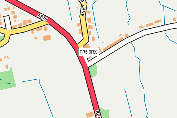
PR5 0RX is located in the Clayton East, Brindle & Hoghton electoral ward, within the local authority district of Chorley and the English Parliamentary constituency of Chorley. The Sub Integrated Care Board (ICB) Location is NHS Lancashire and South Cumbria ICB - 00X and the police force is Lancashire. This postcode has been in use since January 1980.


GetTheData
Source: OS OpenMap – Local (Ordnance Survey)
Source: OS VectorMap District (Ordnance Survey)
Licence: Open Government Licence (requires attribution)
| Easting | 361339 |
| Northing | 426678 |
| Latitude | 53.735064 |
| Longitude | -2.587545 |
GetTheData
Source: Open Postcode Geo
Licence: Open Government Licence
| Country | England |
| Postcode District | PR5 |
➜ See where PR5 is on a map ➜ Where is Hoghton? | |
GetTheData
Source: Land Registry Price Paid Data
Licence: Open Government Licence
Elevation or altitude of PR5 0RX as distance above sea level:
| Metres | Feet | |
|---|---|---|
| Elevation | 100m | 328ft |
Elevation is measured from the approximate centre of the postcode, to the nearest point on an OS contour line from OS Terrain 50, which has contour spacing of ten vertical metres.
➜ How high above sea level am I? Find the elevation of your current position using your device's GPS.
GetTheData
Source: Open Postcode Elevation
Licence: Open Government Licence
| Ward | Clayton East, Brindle & Hoghton |
| Constituency | Chorley |
GetTheData
Source: ONS Postcode Database
Licence: Open Government Licence
| Boars Head (Blackburn Old Road) | Hoghton | 25m |
| Boars Head (Hoghton Lane) | Hoghton | 39m |
| Station Road (The Straits) | Hoghton | 704m |
| Station Road (Hoghton Lane) | Hoghton | 751m |
| Dover Lane (Hoghton Lane) | Hoghton | 969m |
| Pleasington Station | 2.9km |
| Cherry Tree Station | 4.6km |
| Bamber Bridge Station | 4.9km |
GetTheData
Source: NaPTAN
Licence: Open Government Licence
GetTheData
Source: ONS Postcode Database
Licence: Open Government Licence


➜ Get more ratings from the Food Standards Agency
GetTheData
Source: Food Standards Agency
Licence: FSA terms & conditions
| Last Collection | |||
|---|---|---|---|
| Location | Mon-Fri | Sat | Distance |
| Private Road Brindle | 16:30 | 10:30 | 1,134m |
| Hoghton Bottoms | 16:15 | 10:00 | 1,287m |
| Brindle Mill | 16:30 | 09:00 | 2,035m |
GetTheData
Source: Dracos
Licence: Creative Commons Attribution-ShareAlike
The below table lists the International Territorial Level (ITL) codes (formerly Nomenclature of Territorial Units for Statistics (NUTS) codes) and Local Administrative Units (LAU) codes for PR5 0RX:
| ITL 1 Code | Name |
|---|---|
| TLD | North West (England) |
| ITL 2 Code | Name |
| TLD4 | Lancashire |
| ITL 3 Code | Name |
| TLD47 | Chorley and West Lancashire |
| LAU 1 Code | Name |
| E07000118 | Chorley |
GetTheData
Source: ONS Postcode Directory
Licence: Open Government Licence
The below table lists the Census Output Area (OA), Lower Layer Super Output Area (LSOA), and Middle Layer Super Output Area (MSOA) for PR5 0RX:
| Code | Name | |
|---|---|---|
| OA | E00126498 | |
| LSOA | E01024921 | Chorley 002A |
| MSOA | E02005190 | Chorley 002 |
GetTheData
Source: ONS Postcode Directory
Licence: Open Government Licence
| PR5 0SG | Blackburn Old Road | 285m |
| PR5 0DS | Fowler Close | 340m |
| PR5 0RY | Chapel Lane | 374m |
| PR5 0RU | Gib Lane | 394m |
| PR5 0DD | Station Road | 457m |
| PR5 0DH | The Crossings | 501m |
| PR5 0SW | Willowfield Chase | 521m |
| PR5 0RG | Hollins Close | 669m |
| PR5 0RT | Bell Villas | 708m |
| PR5 0SJ | Blackburn Old Road | 799m |
GetTheData
Source: Open Postcode Geo; Land Registry Price Paid Data
Licence: Open Government Licence