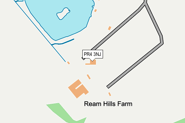
PR4 3NJ is located in the Rural North Fylde electoral ward, within the local authority district of Fylde and the English Parliamentary constituency of Fylde. The Sub Integrated Care Board (ICB) Location is NHS Lancashire and South Cumbria ICB - 02M and the police force is Lancashire. This postcode has been in use since March 2017.


GetTheData
Source: OS OpenMap – Local (Ordnance Survey)
Source: OS VectorMap District (Ordnance Survey)
Licence: Open Government Licence (requires attribution)
| Easting | 336966 |
| Northing | 434026 |
| Latitude | 53.798716 |
| Longitude | -2.958475 |
GetTheData
Source: Open Postcode Geo
Licence: Open Government Licence
| Country | England |
| Postcode District | PR4 |
➜ See where PR4 is on a map | |
GetTheData
Source: Land Registry Price Paid Data
Licence: Open Government Licence
| Ward | Rural North Fylde |
| Constituency | Fylde |
GetTheData
Source: ONS Postcode Database
Licence: Open Government Licence
| Staining Wood Farm (Preston New Road) | Peel Hill | 1,440m |
| Staining Farm (Preston New Road) | Peel Hill | 1,453m |
| Village Hall (Knowsley Crescent) | Weeton | 1,520m |
| Maple Farm (Preston New Road) | Peel Hill | 1,556m |
| Eagle And Child (Singleton Road) | Weeton | 1,587m |
| Moss Side Station | 3.9km |
| Kirkham & Wesham Station | 5.1km |
| Layton (Lancs) Station | 6.2km |
GetTheData
Source: NaPTAN
Licence: Open Government Licence
GetTheData
Source: ONS Postcode Database
Licence: Open Government Licence


➜ Get more ratings from the Food Standards Agency
GetTheData
Source: Food Standards Agency
Licence: FSA terms & conditions
| Last Collection | |||
|---|---|---|---|
| Location | Mon-Fri | Sat | Distance |
| Kentmere Drive | 17:00 | 11:00 | 1,297m |
| Carrbridge Park | 16:00 | 11:45 | 1,568m |
| Weeton Village | 16:00 | 10:00 | 1,668m |
GetTheData
Source: Dracos
Licence: Creative Commons Attribution-ShareAlike
The below table lists the International Territorial Level (ITL) codes (formerly Nomenclature of Territorial Units for Statistics (NUTS) codes) and Local Administrative Units (LAU) codes for PR4 3NJ:
| ITL 1 Code | Name |
|---|---|
| TLD | North West (England) |
| ITL 2 Code | Name |
| TLD4 | Lancashire |
| ITL 3 Code | Name |
| TLD45 | Mid Lancashire |
| LAU 1 Code | Name |
| E07000119 | Fylde |
GetTheData
Source: ONS Postcode Directory
Licence: Open Government Licence
The below table lists the Census Output Area (OA), Lower Layer Super Output Area (LSOA), and Middle Layer Super Output Area (MSOA) for PR4 3NJ:
| Code | Name | |
|---|---|---|
| OA | E00127032 | |
| LSOA | E01025027 | Fylde 001C |
| MSOA | E02005203 | Fylde 001 |
GetTheData
Source: ONS Postcode Directory
Licence: Open Government Licence
| FY4 4XD | Mythop Road | 1067m |
| FY4 4XG | Mythop Road | 1143m |
| PR4 3PE | Moss House Lane | 1176m |
| FY4 4XA | Mythop Road | 1237m |
| PR4 3NQ | The Laurels | 1398m |
| PR4 3ND | Knowsley Crescent | 1419m |
| PR4 3NB | Weeton Village | 1427m |
| PR4 3PF | Foxwood Chase | 1462m |
| PR4 3WD | Church Road | 1515m |
| PR4 3PD | The Close | 1583m |
GetTheData
Source: Open Postcode Geo; Land Registry Price Paid Data
Licence: Open Government Licence