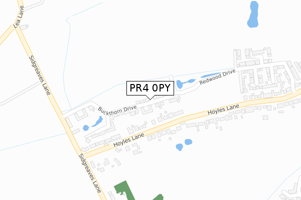
PR4 0PY is located in the Ingol & Cottam electoral ward, within the local authority district of Preston and the English Parliamentary constituency of Fylde. The Sub Integrated Care Board (ICB) Location is NHS Lancashire and South Cumbria ICB - 01E and the police force is Lancashire. This postcode has been in use since April 2019.


GetTheData
Source: OS Open Zoomstack (Ordnance Survey)
Licence: Open Government Licence (requires attribution)
Attribution: Contains OS data © Crown copyright and database right 2025
Source: Open Postcode Geo
Licence: Open Government Licence (requires attribution)
Attribution: Contains OS data © Crown copyright and database right 2025; Contains Royal Mail data © Royal Mail copyright and database right 2025; Source: Office for National Statistics licensed under the Open Government Licence v.3.0
| Easting | 349113 |
| Northing | 432382 |
| Latitude | 53.785275 |
| Longitude | -2.773806 |
GetTheData
Source: Open Postcode Geo
Licence: Open Government Licence
| Country | England |
| Postcode District | PR4 |
➜ See where PR4 is on a map ➜ Where is Cottam? | |
GetTheData
Source: Land Registry Price Paid Data
Licence: Open Government Licence
| Ward | Ingol & Cottam |
| Constituency | Fylde |
GetTheData
Source: ONS Postcode Database
Licence: Open Government Licence
| Hoyles Lane East (Hoyles Lane) | Cottam | 166m |
| Hoyles Lane East (Hoyles Lane) | Cottam | 213m |
| Sidgreaves Ln East (Hoyles Lane) | Cottam | 286m |
| Sidgreaves Ln West (Hoyles Lane) | Cottam | 292m |
| Sidgreaves Lane South (Sidgreaves Lane) | Cottam | 306m |
| Salwick Station | 2.9km |
| Preston Station | 5.4km |
GetTheData
Source: NaPTAN
Licence: Open Government Licence
| Percentage of properties with Next Generation Access | 100.0% |
| Percentage of properties with Superfast Broadband | 100.0% |
| Percentage of properties with Ultrafast Broadband | 100.0% |
| Percentage of properties with Full Fibre Broadband | 100.0% |
Superfast Broadband is between 30Mbps and 300Mbps
Ultrafast Broadband is > 300Mbps
| Percentage of properties unable to receive 2Mbps | 0.0% |
| Percentage of properties unable to receive 5Mbps | 0.0% |
| Percentage of properties unable to receive 10Mbps | 0.0% |
| Percentage of properties unable to receive 30Mbps | 0.0% |
GetTheData
Source: Ofcom
Licence: Ofcom Terms of Use (requires attribution)
GetTheData
Source: ONS Postcode Database
Licence: Open Government Licence


➜ Get more ratings from the Food Standards Agency
GetTheData
Source: Food Standards Agency
Licence: FSA terms & conditions
| Last Collection | |||
|---|---|---|---|
| Location | Mon-Fri | Sat | Distance |
| Lea School | 16:00 | 08:00 | 457m |
| Whitehouse | 16:00 | 08:30 | 624m |
| Nog Tow | 16:00 | 10:30 | 1,661m |
GetTheData
Source: Dracos
Licence: Creative Commons Attribution-ShareAlike
The below table lists the International Territorial Level (ITL) codes (formerly Nomenclature of Territorial Units for Statistics (NUTS) codes) and Local Administrative Units (LAU) codes for PR4 0PY:
| ITL 1 Code | Name |
|---|---|
| TLD | North West (England) |
| ITL 2 Code | Name |
| TLD4 | Lancashire |
| ITL 3 Code | Name |
| TLD45 | Mid Lancashire |
| LAU 1 Code | Name |
| E07000123 | Preston |
GetTheData
Source: ONS Postcode Directory
Licence: Open Government Licence
The below table lists the Census Output Area (OA), Lower Layer Super Output Area (LSOA), and Middle Layer Super Output Area (MSOA) for PR4 0PY:
| Code | Name | |
|---|---|---|
| OA | E00128257 | |
| LSOA | E01025272 | Preston 010B |
| MSOA | E02005262 | Preston 010 |
GetTheData
Source: ONS Postcode Directory
Licence: Open Government Licence
| PR4 0LD | Hoyles Lane | 175m |
| PR4 0RD | Sidgreaves Lane | 570m |
| PR4 0WF | Greenside | 580m |
| PR4 0WQ | Dacre Way | 601m |
| PR4 0RL | Lea Lane | 620m |
| PR4 0RT | Lea Lane | 621m |
| PR4 0WL | Bampton Drive | 630m |
| PR4 0NU | The Weald | 646m |
| PR4 0RA | Lea Road | 651m |
| PR4 0WP | Swinside | 666m |
GetTheData
Source: Open Postcode Geo; Land Registry Price Paid Data
Licence: Open Government Licence