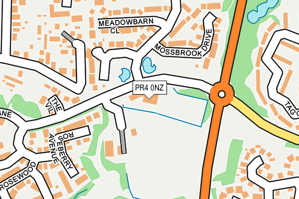
PR4 0NZ is located in the Ingol & Cottam electoral ward, within the local authority district of Preston and the English Parliamentary constituency of Fylde. The Sub Integrated Care Board (ICB) Location is NHS Lancashire and South Cumbria ICB - 01E and the police force is Lancashire. This postcode has been in use since June 1996.


GetTheData
Source: OS OpenMap – Local (Ordnance Survey)
Source: OS VectorMap District (Ordnance Survey)
Licence: Open Government Licence (requires attribution)
| Easting | 349957 |
| Northing | 432186 |
| Latitude | 53.783596 |
| Longitude | -2.760966 |
GetTheData
Source: Open Postcode Geo
Licence: Open Government Licence
| Country | England |
| Postcode District | PR4 |
➜ See where PR4 is on a map ➜ Where is Cottam? | |
GetTheData
Source: Land Registry Price Paid Data
Licence: Open Government Licence
Elevation or altitude of PR4 0NZ as distance above sea level:
| Metres | Feet | |
|---|---|---|
| Elevation | 30m | 98ft |
Elevation is measured from the approximate centre of the postcode, to the nearest point on an OS contour line from OS Terrain 50, which has contour spacing of ten vertical metres.
➜ How high above sea level am I? Find the elevation of your current position using your device's GPS.
GetTheData
Source: Open Postcode Elevation
Licence: Open Government Licence
| Ward | Ingol & Cottam |
| Constituency | Fylde |
GetTheData
Source: ONS Postcode Database
Licence: Open Government Licence
| Minster Park (Merry Trees Lane) | Cottam | 53m |
| Minster Park (Merry Trees Lane) | Cottam | 79m |
| Primary School (Haydocks Lane) | Cottam | 134m |
| Primary School (Haydocks Lane) | Cottam | 145m |
| Cottam Way | Cottam | 331m |
| Salwick Station | 3.7km |
| Preston Station | 4.6km |
GetTheData
Source: NaPTAN
Licence: Open Government Licence
GetTheData
Source: ONS Postcode Database
Licence: Open Government Licence


➜ Get more ratings from the Food Standards Agency
GetTheData
Source: Food Standards Agency
Licence: FSA terms & conditions
| Last Collection | |||
|---|---|---|---|
| Location | Mon-Fri | Sat | Distance |
| Lea School | 16:00 | 08:00 | 1,001m |
| Nog Tow | 16:00 | 10:30 | 1,097m |
| Whitehouse | 16:00 | 08:30 | 1,453m |
GetTheData
Source: Dracos
Licence: Creative Commons Attribution-ShareAlike
The below table lists the International Territorial Level (ITL) codes (formerly Nomenclature of Territorial Units for Statistics (NUTS) codes) and Local Administrative Units (LAU) codes for PR4 0NZ:
| ITL 1 Code | Name |
|---|---|
| TLD | North West (England) |
| ITL 2 Code | Name |
| TLD4 | Lancashire |
| ITL 3 Code | Name |
| TLD45 | Mid Lancashire |
| LAU 1 Code | Name |
| E07000123 | Preston |
GetTheData
Source: ONS Postcode Directory
Licence: Open Government Licence
The below table lists the Census Output Area (OA), Lower Layer Super Output Area (LSOA), and Middle Layer Super Output Area (MSOA) for PR4 0NZ:
| Code | Name | |
|---|---|---|
| OA | E00128260 | |
| LSOA | E01025272 | Preston 010B |
| MSOA | E02005262 | Preston 010 |
GetTheData
Source: ONS Postcode Directory
Licence: Open Government Licence
| PR4 0NP | Wiltshire Mews | 68m |
| PR4 0BZ | Spires Grove | 81m |
| PR4 0NR | Avon Gardens | 125m |
| PR4 0NQ | Worcester Gardens | 133m |
| PR4 0NS | Hereford Grove | 145m |
| PR4 0BY | Minster Park | 146m |
| PR4 0DE | Crosier Walk | 164m |
| PR4 0NT | The Chase | 181m |
| PR4 0LR | The Grange | 183m |
| PR4 0NG | Rosedene Close | 193m |
GetTheData
Source: Open Postcode Geo; Land Registry Price Paid Data
Licence: Open Government Licence