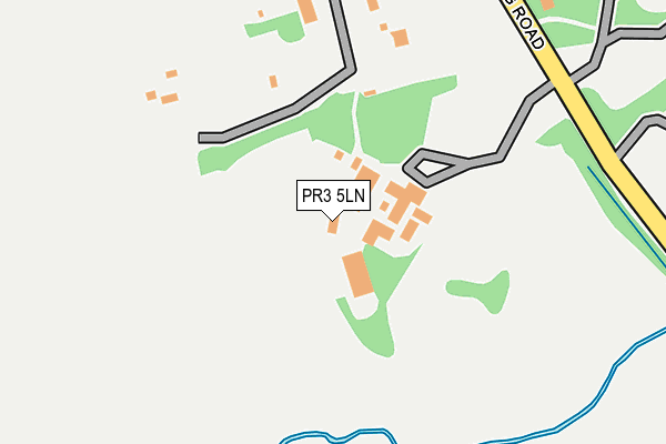
PR3 5LN is located in the Preston Rural East electoral ward, within the local authority district of Preston and the English Parliamentary constituency of Wyre and Preston North. The Sub Integrated Care Board (ICB) Location is NHS Lancashire and South Cumbria ICB - 01E and the police force is Lancashire. This postcode has been in use since January 1980.


GetTheData
Source: OS OpenMap – Local (Ordnance Survey)
Source: OS VectorMap District (Ordnance Survey)
Licence: Open Government Licence (requires attribution)
| Easting | 352529 |
| Northing | 434389 |
| Latitude | 53.803635 |
| Longitude | -2.722275 |
GetTheData
Source: Open Postcode Geo
Licence: Open Government Licence
| Country | England |
| Postcode District | PR3 |
➜ See where PR3 is on a map ➜ Where is Broughton? | |
GetTheData
Source: Land Registry Price Paid Data
Licence: Open Government Licence
Elevation or altitude of PR3 5LN as distance above sea level:
| Metres | Feet | |
|---|---|---|
| Elevation | 40m | 131ft |
Elevation is measured from the approximate centre of the postcode, to the nearest point on an OS contour line from OS Terrain 50, which has contour spacing of ten vertical metres.
➜ How high above sea level am I? Find the elevation of your current position using your device's GPS.
GetTheData
Source: Open Postcode Elevation
Licence: Open Government Licence
| Ward | Preston Rural East |
| Constituency | Wyre And Preston North |
GetTheData
Source: ONS Postcode Database
Licence: Open Government Licence
| Marriotts Hotel (Garstang Road) | Broughton | 179m |
| Marriotts Hotel (Garstang Road) | Broughton | 190m |
| St John The Baptist Church (Garstang Road) | Broughton | 245m |
| St John The Baptist Church (Garstang Road) | Broughton | 283m |
| Post Office (Garstang Road) | Broughton | 515m |
GetTheData
Source: NaPTAN
Licence: Open Government Licence
GetTheData
Source: ONS Postcode Database
Licence: Open Government Licence


➜ Get more ratings from the Food Standards Agency
GetTheData
Source: Food Standards Agency
Licence: FSA terms & conditions
| Last Collection | |||
|---|---|---|---|
| Location | Mon-Fri | Sat | Distance |
| Broughton Post Office | 17:15 | 12:30 | 502m |
| 8 South Drive, Fulwood | 17:45 | 11:30 | 910m |
| 1 Parklands Drive, Fulwood | 17:45 | 11:30 | 917m |
GetTheData
Source: Dracos
Licence: Creative Commons Attribution-ShareAlike
The below table lists the International Territorial Level (ITL) codes (formerly Nomenclature of Territorial Units for Statistics (NUTS) codes) and Local Administrative Units (LAU) codes for PR3 5LN:
| ITL 1 Code | Name |
|---|---|
| TLD | North West (England) |
| ITL 2 Code | Name |
| TLD4 | Lancashire |
| ITL 3 Code | Name |
| TLD45 | Mid Lancashire |
| LAU 1 Code | Name |
| E07000123 | Preston |
GetTheData
Source: ONS Postcode Directory
Licence: Open Government Licence
The below table lists the Census Output Area (OA), Lower Layer Super Output Area (LSOA), and Middle Layer Super Output Area (MSOA) for PR3 5LN:
| Code | Name | |
|---|---|---|
| OA | E00128293 | |
| LSOA | E01025277 | Preston 002B |
| MSOA | E02005254 | Preston 002 |
GetTheData
Source: ONS Postcode Directory
Licence: Open Government Licence
| PR3 5JA | Garstang Road | 180m |
| PR3 5JD | Garstang Road | 526m |
| PR3 5JB | Garstang Road | 589m |
| PR3 5JH | Arnside Road | 591m |
| PR2 3BF | St Edwards Chase | 604m |
| PR3 5JJ | Woodplumpton Lane | 634m |
| PR2 3LJ | Old Croft | 664m |
| PR3 5LA | Sandygate Lane | 665m |
| PR3 5LP | Moorcroft | 689m |
| PR2 3NJ | Lightfoot Close | 691m |
GetTheData
Source: Open Postcode Geo; Land Registry Price Paid Data
Licence: Open Government Licence