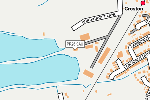
PR26 9AU is located in the Croston, Mawdesley & Euxton South electoral ward, within the local authority district of Chorley and the English Parliamentary constituency of South Ribble. The Sub Integrated Care Board (ICB) Location is NHS Lancashire and South Cumbria ICB - 00X and the police force is Lancashire. This postcode has been in use since March 2017.


GetTheData
Source: OS OpenMap – Local (Ordnance Survey)
Source: OS VectorMap District (Ordnance Survey)
Licence: Open Government Licence (requires attribution)
| Easting | 348426 |
| Northing | 419097 |
| Latitude | 53.665812 |
| Longitude | -2.782013 |
GetTheData
Source: Open Postcode Geo
Licence: Open Government Licence
| Country | England |
| Postcode District | PR26 |
➜ See where PR26 is on a map ➜ Where is Croston? | |
GetTheData
Source: Land Registry Price Paid Data
Licence: Open Government Licence
| Ward | Croston, Mawdesley & Euxton South |
| Constituency | South Ribble |
GetTheData
Source: ONS Postcode Database
Licence: Open Government Licence
| Railway Station (Station Road) | Croston | 370m |
| Railway Station (Station Road) | Croston | 374m |
| Station Road | Croston | 478m |
| Station Road | Croston | 542m |
| Town Road | Croston | 612m |
| Croston Station | 0.3km |
| Rufford Station | 3.9km |
GetTheData
Source: NaPTAN
Licence: Open Government Licence
GetTheData
Source: ONS Postcode Database
Licence: Open Government Licence


➜ Get more ratings from the Food Standards Agency
GetTheData
Source: Food Standards Agency
Licence: FSA terms & conditions
| Last Collection | |||
|---|---|---|---|
| Location | Mon-Fri | Sat | Distance |
| Old Bretherton Post Office | 16:45 | 11:00 | 1,459m |
| Lydiate Lane, Eccleston | 16:15 | 11:15 | 3,448m |
| Hesketh Lane Post Office | 17:30 | 12:00 | 4,156m |
GetTheData
Source: Dracos
Licence: Creative Commons Attribution-ShareAlike
The below table lists the International Territorial Level (ITL) codes (formerly Nomenclature of Territorial Units for Statistics (NUTS) codes) and Local Administrative Units (LAU) codes for PR26 9AU:
| ITL 1 Code | Name |
|---|---|
| TLD | North West (England) |
| ITL 2 Code | Name |
| TLD4 | Lancashire |
| ITL 3 Code | Name |
| TLD47 | Chorley and West Lancashire |
| LAU 1 Code | Name |
| E07000118 | Chorley |
GetTheData
Source: ONS Postcode Directory
Licence: Open Government Licence
The below table lists the Census Output Area (OA), Lower Layer Super Output Area (LSOA), and Middle Layer Super Output Area (MSOA) for PR26 9AU:
| Code | Name | |
|---|---|---|
| OA | E00126764 | |
| LSOA | E01024976 | Chorley 007D |
| MSOA | E02005195 | Chorley 007 |
GetTheData
Source: ONS Postcode Directory
Licence: Open Government Licence
| PR26 9SB | Lonsdale Drive | 213m |
| PR26 9RY | Railway View | 247m |
| PR26 9SE | Langdale Avenue | 268m |
| PR26 9RZ | De Trafford Place | 283m |
| PR26 9SA | Lonsdale Drive | 320m |
| PR26 9QY | Meadowside | 321m |
| PR26 9SD | Coniston Way | 322m |
| PR26 9RT | Westfields | 327m |
| PR26 9RJ | Station Road | 363m |
| PR26 9HL | Station Road | 382m |
GetTheData
Source: Open Postcode Geo; Land Registry Price Paid Data
Licence: Open Government Licence